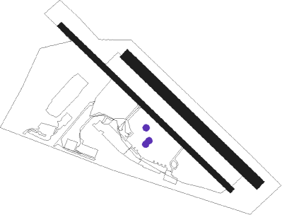
Wanaka
Airport details
| Country | New Zealand |
| State | Otago |
| Region | NZ |
| Municipality | Queenstown-Lakes District |
| Elevation | 1142ft (348m) |
| Timezone | GMT +12 |
| Coordinates | -44.72342, 169.24553 |
| Magnetic var | |
| Type | land |
| Available since | X-Plane v10.40 |
| ICAO code | NZWF |
| IATA code | WKA |
| FAA code | n/a |
Communication
| WANAKA Unicom | 119.100 |
Nearby Points of Interest:
Arrow Kilwinning Lodge
-Arrowtown Chinese Settlement
Nearby beacons
| code | identifier | dist | bearing | frequency |
|---|---|---|---|---|
| QN | QUEENSTOWN VOR/DME | 25.1 | 241° | 113.60 |
| LX | ALEXANDRA NDB | 28.3 | 152° | 386 |
Departure and arrival routes
| Transition altitude | 13000ft |
| Transition level | 15000ft |
| SID end points | distance | outbound heading | |
|---|---|---|---|
| ALL | |||
| TIMJ1R | 26mi | 61° | |
| RW11 | |||
| TIMJ1Q | 26mi | 61° | |
| PORU1Q | 28mi | 152° | |
| RW29 | |||
| TIMJ1P | 26mi | 61° | |
| PORU1P | 28mi | 152° | |
| STAR starting points | distance | inbound heading | |
|---|---|---|---|
| RW29 | |||
| QN1E | 25.1 | 61° | |
| ELRU1E | 25.8 | 260° | |
| PORU1E | 28.3 | 332° | |
Instrument approach procedures
| runway | airway (heading) | route (dist, bearing) |
|---|---|---|
| RW29 | ARIGU (289°) | ARIGU KAKVA (5mi, 237°) 4900ft |
| RW29 | PASMU (343°) | PASMU KAKVA (7mi, 58°) 4900ft |
| RW29 | SUPIM (313°) | SUPIM KAKVA (3mi, 337°) 4900ft |
| RNAV | KAKVA 4900ft PILAD (3mi, 308°) 3970ft SAGEM (6mi, 309°) 1972ft VIKOB (5mi, 294°) NINID (8mi, 118°) KAKVA (7mi, 128°) PASMU (7mi, 238°) 5800ft PASMU (turn) 7600ft |
Holding patterns
| STAR name | hold at | type | turn | heading* | altitude | leg | speed limit |
|---|---|---|---|---|---|---|---|
| QN1E | PASMU | VHF | left | 174 (354)° | > 7600ft | 1.0min timed | 170 |
| *) magnetic outbound (inbound) holding course | |||||||
Disclaimer
The information on this website is not for real aviation. Use this data with the X-Plane flight simulator only! Data taken with kind consent from X-Plane 12 source code and data files. Content is subject to change without notice.

