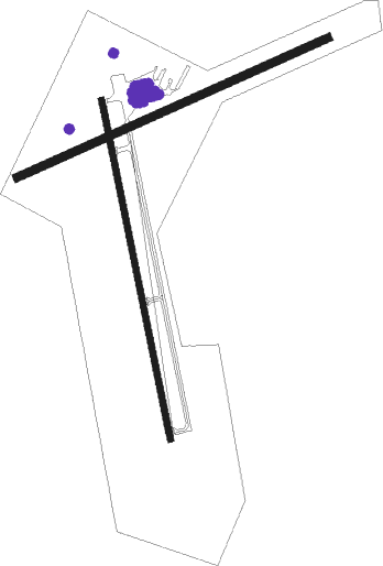
Chester - Rogers Fld
Airport details
| Country | United States of America |
| State | California |
| Region | K2 |
| Airspace | Oakland Ctr |
| Municipality | Chester |
| Elevation | 4526ft (1380m) |
| Timezone | GMT -8 |
| Coordinates | 40.28236, -121.24117 |
| Magnetic var | |
| Type | land |
| Available since | X-Plane v10.40 |
| ICAO code | O05 |
| IATA code | n/a |
| FAA code | n/a |
Communication
| Rogers Fld CTAF/UNICOM | 122.800 |
Nearby Points of Interest:
Warner Valley Ranger Station
-Horseshoe Lake Ranger Station
-Drakesbad Guest Ranch
-Summit Lake Ranger Station
-Park Headquarters, Lassen Volcanic National Park
-Nobles Emigrant Trail
-Lassen Volcanic National Park Highway Historic District
-Loomis Ranger Station
-Discovery Center
-Lassen County Court House
-Roop's Fort
Nearby beacons
| code | identifier | dist | bearing | frequency |
|---|---|---|---|---|
| RBL | RED BLUFF VORTAC | 46.9 | 260° | 115.70 |
Departure and arrival routes
| Transition altitude | 18000ft |
| Transition level | 18000ft |
| SID end points | distance | outbound heading | |
|---|---|---|---|
| RW16 | |||
| CHOTT1 | 19mi | 139° | |
| RW34 | |||
| CHOTT1 | 19mi | 139° | |
Instrument approach procedures
| runway | airway (heading) | route (dist, bearing) |
|---|---|---|
| RW34-M | FTHER (23°) | FTHER ALMNR (20mi, 49°) 10500ft SONDY (7mi, 31°) 8200ft |
| RW34-M | MRGGO (2°) | MRGGO PADDA (42mi, 34°) 10500ft CHOTT (13mi, 318°) 10500ft SONDY (7mi, 304°) 8200ft |
| RNAV | SONDY 8200ft GDBOY (5mi, 304°) 7100ft RDCHF (3mi, 332°) 6500ft O05 (5mi, 351°) 4560ft (6805mi, 108°) 5200ft CHOTT (6801mi, 288°) 10500ft CHOTT (turn) |
Disclaimer
The information on this website is not for real aviation. Use this data with the X-Plane flight simulator only! Data taken with kind consent from X-Plane 12 source code and data files. Content is subject to change without notice.

