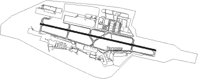
Kabul - Hamid Karzai Intl
Airport details
| Country | Afghanistan |
| State | Kabul Province |
| Region | OA |
| Airspace | Kabul Ctr |
| Municipality | Kabul |
| Elevation | 5875ft (1791m) |
| Timezone | GMT +4.5 |
| Coordinates | 34.56669, 69.21610 |
| Magnetic var | |
| Type | land |
| Available since | X-Plane v10.40 |
| ICAO code | OAKB |
| IATA code | KBL |
| FAA code | n/a |
Communication
| Hamid Karzai Intl ATIS | 130.150 |
| Hamid Karzai Intl CLD | 128.100 |
| Hamid Karzai Intl Ground Control | 125.400 |
| Hamid Karzai Intl Tower | 120.600 |
| Hamid Karzai Intl APR | 131.600 |
| Hamid Karzai Intl Departure | 132.500 |
Approach frequencies
| ILS-cat-I | RW29 | 110.5 | 18.00mi |
| 3.5° GS | RW29 | 110.5 | 18.00mi |
Runway info
| Runway 11 / 29 | ||
| length | 3500m (11483ft) | |
| bearing | 104° / 284° | |
| width | 45m (148ft) | |
| surface | asphalt | |
| blast zone | 47m (154ft) / 53m (174ft) | |
Nearby beacons
| code | identifier | dist | bearing | frequency |
|---|---|---|---|---|
| OKB | KABUL TACAN | 0.5 | 266° | 133.80 |
| KBL | KABUL VOR/DME | 3.8 | 106° | 112 |
| BGM | BAGRAM VORTAC | 23.2 | 8° | 112.70 |
| PC | PARACHINAR NDB | 58.1 | 128° | 273 |
Departure and arrival routes
| Transition altitude | 14000ft |
| Transition level | 16000ft |
| SID end points | distance | outbound heading | |
|---|---|---|---|
| RW11 | |||
| KABUL4 | 21mi | 187° | |
| TAPIS2 | 50mi | 219° | |
| RW29 | |||
| KABUL4 | 21mi | 187° | |
| LOGAR3 | 50mi | 248° | |
Instrument approach procedures
| runway | airway (heading) | route (dist, bearing) |
|---|---|---|
| RW29 | HURCK (277°) | HURCK 12500ft FAMUG (5mi, 273°) 12500ft OKUKA (6mi, 272°) 10600ft KOVME (2mi, 272°) 10200ft NAKOE (2mi, 272°) 9600ft |
| RNAV | NAKOE 9600ft HURAL (3mi, 283°) 7900ft OAKB (8mi, 284°) 5928ft SIXER (8mi, 286°) ILONN (8mi, 358°) HURCK (36mi, 110°) 12500ft HURCK (turn) 12500ft |
Disclaimer
The information on this website is not for real aviation. Use this data with the X-Plane flight simulator only! Data taken with kind consent from X-Plane 12 source code and data files. Content is subject to change without notice.