Abadan
Airport details
| Country | Iran |
| State | Khuzestan Province |
| Region | OI |
| Airspace | Tehran Ctr |
| Municipality | Abadan |
| Elevation | 19ft (6m) |
| Timezone | GMT +3.5 |
| Coordinates | 30.37111, 48.22833 |
| Magnetic var | |
| Type | land |
| Available since | X-Plane v10.30 |
| ICAO code | OIAA |
| IATA code | ABD |
| FAA code | n/a |
Communication
| Abadan ATIS | 126.850 |
| Abadan Tower | 121.800 |
| Abadan Tower | 118.100 |
| Abadan Departure | 121.800 |
Approach frequencies
| ILS-cat-I | RW32L | 109.9 | 18.00mi |
| 3° GS | RW32L | 109.9 | 18.00mi |
Nearby Points of Interest:
Abadan-2 Water Tower
-Abadan-1 Water Tower
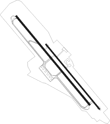
Runway info
Runway 14R / 32L  | ||
| length | 3107m (10194ft) | |
| bearing | 141° / 321° | |
| width | 45m (148ft) | |
| surface | asphalt | |
| blast zone | 60m (197ft) / 60m (197ft) | |
| Runway 14L / 32R | ||
| length | 2266m (7434ft) | |
| bearing | 141° / 321° | |
| width | 35m (115ft) | |
| surface | asphalt | |
Nearby beacons
| code | identifier | dist | bearing | frequency |
|---|---|---|---|---|
| ABD | ABADAN NDB | 0.4 | 266° | 210 |
| BSR | BASRAH VOR/DME | 29.5 | 286° | 112.30 |
| MAH | BANDAR MAHSHAHR VOR/DME | 48.9 | 79° | 115.80 |
| AWZ | AHWAZ NDB | 64.2 | 28° | 415 |
Departure and arrival routes
| Transition altitude | 3000ft |
| SID end points | distance | outbound heading | |
|---|---|---|---|
| RW14R | |||
| GABS2L, GABS2H | 34mi | 29° | |
| BOPI1L, BOPI2H | 26mi | 78° | |
| DEMP2L, DEMP2H | 26mi | 99° | |
| IBSA1L, IBSA2H | 31mi | 117° | |
| RW32L | |||
| GABS2K, GABS2G | 34mi | 29° | |
| BOPI1K, BOPI2G | 26mi | 78° | |
| DEMP2K, DEMP2G | 26mi | 99° | |
| IBSA1K, IBSA2G | 31mi | 117° | |
| STAR starting points | distance | inbound heading | |
|---|---|---|---|
| RW14R | |||
| GABS2T, GABS2P, GABS2N | 34.3 | 209° | |
| BOPI2T, BOPI1N, BOPI1Q, BOPI2P | 25.8 | 258° | |
| DEMP1Q, DEMP2T, DEMP2P, DEMP1N | 26.2 | 279° | |
| IBSA1N, IBSA1Q | 30.6 | 297° | |
| RW32L | |||
| GABS2T, GABS2P, GABS2N | 34.3 | 209° | |
| BOPI2T, BOPI1N, BOPI1Q, BOPI2P | 25.8 | 258° | |
| DEMP1N, DEMP2T, DEMP2P, DEMP1Q | 26.2 | 279° | |
| IBSA1N, IBSA1Q | 30.6 | 297° | |
Holding patterns
| STAR name | hold at | type | turn | heading* | altitude | leg | speed limit |
|---|---|---|---|---|---|---|---|
| BOPI1Q | D138O | VHF | right | 138 (318)° | 3000ft - 10000ft | 1.0min timed | 220 |
| BOPI2P | D022O | VHF | left | 22 (202)° | 3000ft - 20000ft | 1.0min timed | 220 |
| BOPI2T | D022O | VHF | left | 22 (202)° | 3000ft - 20000ft | 1.0min timed | 220 |
| DEMP1Q | D138O | VHF | right | 138 (318)° | 3000ft - 10000ft | 1.0min timed | 220 |
| DEMP2P | D022O | VHF | left | 22 (202)° | 3000ft - 20000ft | 1.0min timed | 220 |
| DEMP2T | D022O | VHF | left | 22 (202)° | 3000ft - 20000ft | 1.0min timed | 220 |
| GABS2P | D022O | VHF | left | 22 (202)° | 3000ft - 20000ft | 1.0min timed | 220 |
| GABS2T | D022O | VHF | left | 22 (202)° | 3000ft - 20000ft | 1.0min timed | 220 |
| IBSA1Q | D138O | VHF | right | 138 (318)° | 3000ft - 10000ft | 1.0min timed | 220 |
| *) magnetic outbound (inbound) holding course | |||||||
Disclaimer
The information on this website is not for real aviation. Use this data with the X-Plane flight simulator only! Data taken with kind consent from X-Plane 12 source code and data files. Content is subject to change without notice.