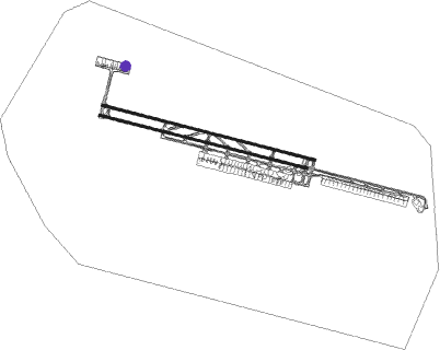
Tehran - Imam Khomeini Intl
Airport details
| Country | Iran |
| State | Tehran Province |
| Region | OI |
| Airspace | Tehran Ctr |
| Municipality | Hasanabad RD |
| Elevation | 3305ft (1007m) |
| Timezone | GMT +3.5 |
| Coordinates | 35.41611, 51.15222 |
| Magnetic var | |
| Type | land |
| Available since | X-Plane v10.40 |
| ICAO code | OIIE |
| IATA code | IKA |
| FAA code | n/a |
Communication
| Imam Khomeini Intl ATIS | 127.200 |
| Imam Khomeini Intl Ground Control | 121.825 |
| Imam Khomeini Intl Ground Control | 121.600 |
| Imam Khomeini Intl Tower | 118.700 |
| Imam Khomeini Intl Approach Mehrabad | 119.700 |
| Imam Khomeini Intl Approach Mehrabad | 125.100 |
Approach frequencies
| ILS-cat-II | RW29R | 110.3 | 18.00mi |
| 3° GS | RW29R | 110.3 | 18.00mi |
Runway info
Nearby beacons
| code | identifier | dist | bearing | frequency |
|---|---|---|---|---|
| IKA | IMAM KHOMAINI VOR/DME | 1.3 | 104° | 114.30 |
| IKA | IMAM KHOMAINI NDB | 1.6 | 104° | 201 |
| KAZ | KAHRIZAK NDB | 12.1 | 65° | 358 |
| RUS | RUDESHUR VOR/DME | 12.2 | 277° | 116.95 |
| THR | TEHRAN TACAN | 18 | 24° | 113.30 |
| TRN | TEHRAN VOR/DME | 18 | 25° | 115.30 |
| VR | VARAMIN NDB | 24.1 | 99° | 373 |
| PIM | PAYAM NDB | 25.4 | 319° | 306 |
| SAV | SAVEH NDB | 45.1 | 243° | 408 |
Departure and arrival routes
| Transition altitude | 9000ft |
| Transition level | 11000ft |
| SID end points | distance | outbound heading | |
|---|---|---|---|
| RW11 (ALL) | |||
| KAZ1D | 12mi | 65° | |
| DHN1L, DHN1M | 77mi | 96° | |
| OBRI2L | 63mi | 123° | |
| EGVE3L | 53mi | 223° | |
| SAV1L | 45mi | 243° | |
| DAXI1L | 84mi | 250° | |
| PAVE1L | 62mi | 271° | |
| RUS3D | 12mi | 277° | |
| PARO3L | 74mi | 303° | |
| PAXI2L | 65mi | 317° | |
| NABA1L | 48mi | 335° | |
| RW29 (ALL) | |||
| KAZ2C | 12mi | 65° | |
| DHN2J | 77mi | 96° | |
| OBRI2G | 63mi | 123° | |
| EGVE3G | 53mi | 223° | |
| SAV1G, SAV1H | 45mi | 243° | |
| DAXI1G | 84mi | 250° | |
| PAVE1G | 62mi | 271° | |
| RUS3C | 12mi | 277° | |
| PARO3G, PARO3H | 74mi | 303° | |
| PAXI2G | 65mi | 317° | |
| NABA1G | 48mi | 335° | |
| STAR starting points | distance | inbound heading | |
|---|---|---|---|
| ALL | |||
| SAV1R | 45.1 | 63° | |
| PAVE2R | 62.1 | 91° | |
| MIVA2R | 70.4 | 114° | |
| PAXI2R | 65.4 | 137° | |
| NAGM1V, NAGM2R | 38.5 | 198° | |
| MUXO1V | 75.6 | 267° | |
| RADA2V, RADA2R, RADA2Q | 65.8 | 293° | |
| BOXA1Q, BOXA2V, BOXA1Z, BOXA1R | 58.7 | 318° | |
| RW29R | |||
| SAV2X | 45.1 | 63° | |
| MIVA2X | 70.4 | 114° | |
| PAXI2X | 65.4 | 137° | |
| RADA3X | 65.8 | 293° | |
| BOXA2X | 58.7 | 318° | |
Instrument approach procedures
| runway | airway (heading) | route (dist, bearing) |
|---|---|---|
| RW29R | ITKOB (282°) | ITKOB 7000ft IE402 (5mi, 274°) 5500ft |
| RW29R | OXAVA (298°) | OXAVA 7000ft IE402 (5mi, 329°) 5500ft |
| RNAV | IE402 5500ft IE403 (5mi, 286°) 5100ft OIIE (6mi, 285°) 3306ft IE404 (2mi, 287°) 3710ft IE405 (9mi, 198°) OXAVA (16mi, 90°) OXAVA (turn) 7000ft |
Holding patterns
| STAR name | hold at | type | turn | heading* | altitude | leg | speed limit |
|---|---|---|---|---|---|---|---|
| BOXA1Q | D140O | VHF | right | 140 (320)° | > 8000ft | 1.0min timed | 220 |
| BOXA1Z | KAZ | FIX | right | 276 (96)° | > 8000ft | 1.0min timed | 220 |
| BOXA2V | VR | FIX | right | 181 (1)° | > 9000ft | 1.0min timed | 220 |
| NAGM1V | VR | FIX | right | 181 (1)° | > 9000ft | 1.0min timed | 220 |
| RADA2Q | D140O | VHF | right | 140 (320)° | > 8000ft | 1.0min timed | 220 |
| RADA2V | VR | FIX | right | 181 (1)° | > 9000ft | 1.0min timed | 220 |
| VR1R | VR | FIX | right | 181 (1)° | > 9000ft | 1.0min timed | 220 |
| VR1Z | KAZ | FIX | right | 276 (96)° | > 8000ft | 1.0min timed | 220 |
| VR1Z | VR | FIX | right | 181 (1)° | > 9000ft | 1.0min timed | 220 |
| *) magnetic outbound (inbound) holding course | |||||||
Disclaimer
The information on this website is not for real aviation. Use this data with the X-Plane flight simulator only! Data taken with kind consent from X-Plane 12 source code and data files. Content is subject to change without notice.

