Bandar Abbas - Bandar Abbas Intl
Airport details
| Country | Iran |
| State | Hormozgan Province |
| Region | OI |
| Airspace | Tehran Ctr |
| Municipality | Bandar Abbas |
| Elevation | 20ft (6m) |
| Timezone | GMT +3.5 |
| Coordinates | 27.21861, 56.37778 |
| Magnetic var | |
| Type | land |
| Available since | X-Plane v10.40 |
| ICAO code | OIKB |
| IATA code | BND |
| FAA code | n/a |
Communication
| Bandar Abbas Intl ATIS | 128.650 |
| Bandar Abbas Intl Tower | 121.900 |
| Bandar Abbas Intl Tower | 118.100 |
| Bandar Abbas Intl Approach | 124.200 |
Approach frequencies
| ILS-cat-I | RW21L | 109.9 | 18.00mi |
| 2.9° GS | RW21L | 109.9 | 18.00mi |
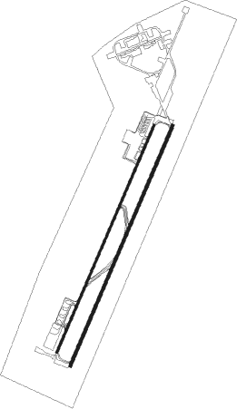
Runway info
Runway 03R / 21L  | ||
| length | 3670m (12041ft) | |
| bearing | 30° / 210° | |
| width | 45m (148ft) | |
| surface | asphalt | |
| blast zone | 255m (837ft) / 255m (837ft) | |
| Runway 03L / 21R | ||
| length | 3466m (11371ft) | |
| bearing | 30° / 210° | |
| width | 30m (98ft) | |
| surface | asphalt | |
| blast zone | 255m (837ft) / 0m (0ft) | |
Nearby beacons
| code | identifier | dist | bearing | frequency |
|---|---|---|---|---|
| BND | BANDAR ABBAS NDB | 0.9 | 263° | 250 |
| BND | BANDAR ABBAS VOR/DME | 1.4 | 207° | 117.20 |
| KHM | GHESHM ISLAND NDB | 37.1 | 226° | 335 |
Departure and arrival routes
| Transition altitude | 4000ft |
| SID end points | distance | outbound heading | |
|---|---|---|---|
| RW03R | |||
| TAVN1H, TAVN1G, TAVN1D, TAVN1C | 59mi | 10° | |
| DAVE1C, DAVE1G | 59mi | 63° | |
| MELM1G, MELM1C | 60mi | 114° | |
| KHM1L | 37mi | 226° | |
| MOBO1D, MOBO1H | 60mi | 298° | |
| ASMU1H, ASMU1G, ASMU1D, ASMU1C | 59mi | 343° | |
| RW21L | |||
| TAVN1B, TAVN1F | 59mi | 10° | |
| DAVE1A, DAVE1E | 59mi | 63° | |
| MELM1A, MELM1E | 60mi | 114° | |
| KHM1K | 37mi | 226° | |
| MOBO1F, MOBO1E, MOBO1B, MOBO1A | 60mi | 298° | |
| ASMU1B, ASMU1A, ASMU1F | 59mi | 343° | |
| STAR starting points | distance | inbound heading | |
|---|---|---|---|
| ALL | |||
| KHM1X | 37.1 | 46° | |
| MOBO1X | 59.7 | 118° | |
| ASMU1X | 58.9 | 163° | |
| TAVN1X | 58.8 | 190° | |
| DAVE1X | 58.8 | 243° | |
| MELM1X | 60.0 | 294° | |
| RW03R | |||
| KHM1S | 37.1 | 46° | |
| MOBO1S | 59.7 | 118° | |
| ASMU1S | 58.9 | 163° | |
| RW21L | |||
| MOBO1P | 59.7 | 118° | |
| ASMU1P | 58.9 | 163° | |
| TAVN1P | 58.8 | 190° | |
| DAVE1P | 58.8 | 243° | |
| MELM1P | 60.0 | 294° | |
Holding patterns
| STAR name | hold at | type | turn | heading* | altitude | leg | speed limit |
|---|---|---|---|---|---|---|---|
| ASMU1P | D055M | VHF | left | 55 (235)° | > 4000ft | 1.0min timed | 220 |
| ASMU1S | CD03R | VHF | right | 206 (26)° | > 3000ft | 1.0min timed | ICAO rules |
| DAVE1P | D055M | VHF | left | 55 (235)° | > 4000ft | 1.0min timed | 220 |
| KHM1S | CD03R | VHF | right | 206 (26)° | > 3000ft | 1.0min timed | ICAO rules |
| MELM1P | D055M | VHF | left | 55 (235)° | > 4000ft | 1.0min timed | 220 |
| MOBO1P | D055M | VHF | left | 55 (235)° | > 4000ft | 1.0min timed | 220 |
| MOBO1S | CD03R | VHF | right | 206 (26)° | > 3000ft | 1.0min timed | ICAO rules |
| TAVN1P | D055M | VHF | left | 55 (235)° | > 4000ft | 1.0min timed | 220 |
| *) magnetic outbound (inbound) holding course | |||||||
Disclaimer
The information on this website is not for real aviation. Use this data with the X-Plane flight simulator only! Data taken with kind consent from X-Plane 12 source code and data files. Content is subject to change without notice.