Zahedan - Zahedan Intl
Airport details
| Country | Iran |
| State | Sistan and Baluchestan Province |
| Region | OI |
| Airspace | Tehran Ctr |
| Municipality | Zahedan |
| Elevation | 4562ft (1390m) |
| Timezone | GMT +3.5 |
| Coordinates | 29.47333, 60.90333 |
| Magnetic var | |
| Type | land |
| Available since | X-Plane v10.40 |
| ICAO code | OIZH |
| IATA code | ZAH |
| FAA code | n/a |
Communication
| Zahedan Intl ATIS | 128.450 |
| Zahedan Intl Tower | 119.400 |
| Zahedan Intl Tower | 118.100 |
| Zahedan Intl Tower | 121.900 |
Approach frequencies
| ILS-cat-I | RW35L | 108.7 | 18.00mi |
| 3.2° GS | RW35L | 108.7 | 18.00mi |
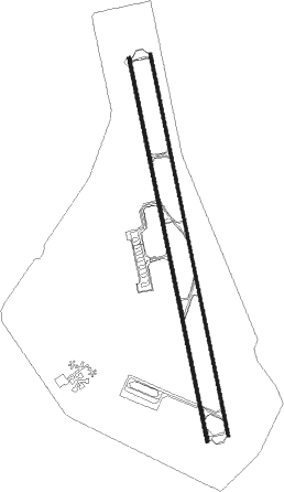
Runway info
Runway 17R / 35L  | ||
| length | 4279m (14039ft) | |
| bearing | 172° / 352° | |
| width | 45m (148ft) | |
| surface | asphalt | |
| displ threshold | 0m (0ft) / 274m (899ft) | |
| blast zone | 255m (837ft) / 255m (837ft) | |
| Runway 17L / 35R | ||
| length | 4266m (13996ft) | |
| bearing | 172° / 352° | |
| width | 30m (98ft) | |
| surface | asphalt | |
| displ threshold | 0m (0ft) / 224m (735ft) | |
| blast zone | 255m (837ft) / 255m (837ft) | |
Nearby beacons
| code | identifier | dist | bearing | frequency |
|---|---|---|---|---|
| ZD | ZAHEDAN NDB | 0.4 | 252° | 224 |
| ZAH | ZAHEDAN TACAN | 0.5 | 173° | 112.90 |
| ZDN | ZAHEDAN VOR/DME | 0.8 | 353° | 116 |
Departure and arrival routes
| Transition altitude | 11000ft |
| SID end points | distance | outbound heading | |
|---|---|---|---|
| RW17R | |||
| PIRA1H, PIRA1E | 13mi | 68° | |
| DERB2E, DERB1H | 20mi | 97° | |
| DANB1H, DANB2E | 29mi | 133° | |
| DANX1H, DANX2E | 29mi | 185° | |
| DANO2E, DANO1H | 30mi | 246° | |
| DANU1E, DANU1H | 30mi | 283° | |
| DAPA1H, DAPA2E | 31mi | 303° | |
| LUDA1H, LUDA2E | 31mi | 335° | |
| RW35L | |||
| PIRA1J | 13mi | 68° | |
| DERB2D, DERB1J | 20mi | 97° | |
| DANB1J, DANB2D | 29mi | 133° | |
| DANX1J, DANX2D | 29mi | 185° | |
| DANO1J, DANO2D | 30mi | 246° | |
| DANU1J, DANU1D | 30mi | 283° | |
| DAPA1J, DAPA2D | 31mi | 303° | |
| LUDA1J, LUDA2D | 31mi | 335° | |
| STAR starting points | distance | inbound heading | |
|---|---|---|---|
| RW17R | |||
| DANX1Z | 29.2 | 5° | |
| DANO1Z | 29.7 | 66° | |
| DANU2Z | 30.4 | 103° | |
| DAPA1Z | 30.5 | 123° | |
| LUDA1Z | 30.8 | 155° | |
| PIRA1Z | 13.4 | 248° | |
| DERB1Z | 20.0 | 277° | |
| DANB1Z | 29.3 | 313° | |
| RW35L | |||
| DANX2P, DANX2N, DANX1U, DANX1Q | 29.2 | 5° | |
| DANO2P, DANO1T, DANO1Q, DANO1N | 29.7 | 66° | |
| DANU2N, DANU2P, DANU1T, DANU1Q | 30.4 | 103° | |
| DAPA2P, DAPA1T, DAPA1R, DAPA1N, DAPA2Q | 30.5 | 123° | |
| LUDA2P, LUDA1T, LUDA1Q, LUDA2N | 30.8 | 155° | |
| PIRA1S, PIRA2P, PIRA1Q, PIRA1N | 13.4 | 248° | |
| DERB1S, DERB1N, DERB1Q, DERB2P | 20.0 | 277° | |
| DANB2P, DANB1S, DANB1Q, DANB2N | 29.3 | 313° | |
Instrument approach procedures
| runway | airway (heading) | route (dist, bearing) |
|---|---|---|
| RW17R | ZH409 (154°) | ZH409 9500ft ZH410 (6mi, 142°) 7100ft |
| RNAV | ZH410 7100ft ZH411 (5mi, 142°) 6400ft OIZH (7mi, 173°) 4534ft ZH404 (turn) 5500ft ZH408 (5mi, 265°) 6000ft ZH409 (18mi, 352°) 9500ft ZH409 (turn) | |
| RW35L | ZH403 (13°) | ZH403 9500ft ZH402 (5mi, 84°) 8100ft |
| RW35L | ZH405 (352°) | ZH405 9500ft ZH402 (5mi, 352°) 8100ft |
| RW35L | ZH407 (331°) | ZH407 9500ft ZH402 (5mi, 264°) 8100ft |
| RNAV | ZH402 8100ft ZH401 (5mi, 352°) 7600ft OIZH (10mi, 351°) 4569ft ZH411 (7mi, 353°) 6000ft ZH414 (5mi, 84°) 6000ft ZH407 (22mi, 172°) 9500ft ZH407 (turn) |
Holding patterns
| STAR name | hold at | type | turn | heading* | altitude | leg | speed limit |
|---|---|---|---|---|---|---|---|
| DANB1Q | ZD | FIX | right | 341 (161)° | > 10500ft | 1.0min timed | ICAO rules |
| DANB1S | ZH407 | VHF | left | 80 (260)° | > 9500ft | 1.0min timed | 210 |
| DANB1Z | ZH409 | VHF | right | 323 (143)° | > 9500ft | 1.0min timed | 210 |
| DANB2P | D170P | VHF | left | 170 (350)° | > 9500ft | 1.0min timed | 230 |
| DANO1Q | ZD | FIX | right | 341 (161)° | > 10500ft | 1.0min timed | ICAO rules |
| DANO1T | ZH403 | VHF | right | 260 (80)° | > 9500ft | 1.0min timed | 210 |
| DANO1Z | ZH409 | VHF | right | 323 (143)° | > 9500ft | 1.0min timed | 210 |
| DANO2P | D170P | VHF | left | 170 (350)° | > 9500ft | 1.0min timed | 230 |
| DANU1Q | ZD | FIX | right | 341 (161)° | > 10500ft | 1.0min timed | ICAO rules |
| DANU1T | ZH403 | VHF | right | 260 (80)° | > 9500ft | 1.0min timed | 210 |
| DANU2P | D170P | VHF | left | 170 (350)° | > 9500ft | 1.0min timed | 230 |
| DANU2Z | ZH409 | VHF | right | 323 (143)° | > 9500ft | 1.0min timed | 210 |
| DANX1Q | ZD | FIX | right | 341 (161)° | > 10500ft | 1.0min timed | ICAO rules |
| DANX1U | ZH405 | VHF | right | 170 (350)° | > 9500ft | 1.0min timed | 210 |
| DANX1Z | ZH409 | VHF | right | 323 (143)° | > 9500ft | 1.0min timed | 210 |
| DANX2P | D170P | VHF | left | 170 (350)° | > 9500ft | 1.0min timed | 230 |
| DAPA1R | ZD | FIX | right | 341 (161)° | > 10500ft | 1.0min timed | ICAO rules |
| DAPA1T | ZH403 | VHF | right | 260 (80)° | > 9500ft | 1.0min timed | 210 |
| DAPA1Z | ZH409 | VHF | right | 323 (143)° | > 9500ft | 1.0min timed | 210 |
| DAPA2P | D170P | VHF | left | 170 (350)° | > 9500ft | 1.0min timed | 230 |
| DAPA2Q | D170P | VHF | left | 170 (350)° | > 9500ft | 1.0min timed | 230 |
| DERB1Q | ZD | FIX | right | 341 (161)° | > 10500ft | 1.0min timed | ICAO rules |
| DERB1S | ZH407 | VHF | left | 80 (260)° | > 9500ft | 1.0min timed | 210 |
| DERB1Z | ZH409 | VHF | right | 323 (143)° | > 9500ft | 1.0min timed | 210 |
| DERB2P | D170P | VHF | left | 170 (350)° | > 9500ft | 1.0min timed | 230 |
| LUDA1Q | ZD | FIX | right | 341 (161)° | > 10500ft | 1.0min timed | ICAO rules |
| LUDA1T | ZH403 | VHF | right | 260 (80)° | > 9500ft | 1.0min timed | 210 |
| LUDA1Z | ZH409 | VHF | right | 323 (143)° | > 9500ft | 1.0min timed | 210 |
| LUDA2P | D170P | VHF | left | 170 (350)° | > 9500ft | 1.0min timed | 230 |
| PIRA1Q | ZD | FIX | right | 341 (161)° | > 10500ft | 1.0min timed | ICAO rules |
| PIRA1S | ZH407 | VHF | left | 80 (260)° | > 9500ft | 1.0min timed | 210 |
| PIRA1Z | ZH409 | VHF | right | 323 (143)° | > 9500ft | 1.0min timed | 210 |
| PIRA2P | D170P | VHF | left | 170 (350)° | > 9500ft | 1.0min timed | 230 |
| *) magnetic outbound (inbound) holding course | |||||||
Disclaimer
The information on this website is not for real aviation. Use this data with the X-Plane flight simulator only! Data taken with kind consent from X-Plane 12 source code and data files. Content is subject to change without notice.