Iranshahr - Iran Shahr
Airport details
| Country | Iran |
| State | Sistan and Baluchestan Province |
| Region | OI |
| Airspace | Tehran Ctr |
| Municipality | Iranshahr |
| Elevation | 2040ft (622m) |
| Timezone | GMT +3.5 |
| Coordinates | 27.22889, 60.72111 |
| Magnetic var | |
| Type | land |
| Available since | X-Plane v10.40 |
| ICAO code | OIZI |
| IATA code | IHR |
| FAA code | n/a |
Communication
| Iran Shahr INFO | 121.700 |
| Iran Shahr INFO | 121.900 |
| Iran Shahr INFO | 122.700 |
Nearby Points of Interest:
Irandegan castle
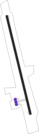
Runway info
| Runway 17 / 35 | ||
| length | 2349m (7707ft) | |
| bearing | 170° / 350° | |
| width | 46m (150ft) | |
| surface | asphalt | |
| displ threshold | 140m (459ft) / 0m (0ft) | |
| blast zone | 60m (197ft) / 76m (249ft) | |
Nearby beacons
| code | identifier | dist | bearing | frequency |
|---|---|---|---|---|
| ISR | IRAN SHAHR NDB | 0.3 | 318° | 309 |
Departure and arrival routes
| Transition altitude | 7500ft |
| Transition level | 9500ft |
| SID end points | distance | outbound heading | |
|---|---|---|---|
| RW17 | |||
| LOXO1B, LOXO1D | 32mi | 4° | |
| CBH1B | 108mi | 190° | |
| RW35 | |||
| LOXO1A, LOXO1C | 32mi | 4° | |
| CBH1A | 108mi | 190° | |
| STAR starting points | distance | inbound heading | |
|---|---|---|---|
| RW17 | |||
| LOXO1P | 32.2 | 184° | |
| RW35 | |||
| LOXO1N | 32.2 | 184° | |
Holding patterns
| STAR name | hold at | type | turn | heading* | altitude | leg | speed limit |
|---|---|---|---|---|---|---|---|
| LOXO1N | D172P | VHF | right | 172 (352)° | > 7500ft | 1.0min timed | ICAO rules |
| LOXO1P | D347O | VHF | right | 347 (167)° | > 7000ft | 1.0min timed | ICAO rules |
| *) magnetic outbound (inbound) holding course | |||||||
Disclaimer
The information on this website is not for real aviation. Use this data with the X-Plane flight simulator only! Data taken with kind consent from X-Plane 12 source code and data files. Content is subject to change without notice.