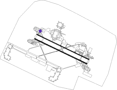
Jahra - Ali Al Salem Airbase
Airport details
| Country | Kuwait |
| State | Jahra |
| Region | OK |
| Airspace | Kuwait Ctr |
| Municipality | Al Mutla City |
| Elevation | 472ft (144m) |
| Timezone | GMT +3 |
| Coordinates | 29.35703, 47.52002 |
| Magnetic var | |
| Type | land |
| Available since | X-Plane v10.30 |
| ICAO code | OKAS |
| IATA code | KAS |
| FAA code | n/a |
Communication
| Ali Al Salem Airbase ATIS | 135.000 |
| Ali Al Salem Airbase Ali Al Salem Ground | 120.500 |
| Ali Al Salem Airbase Ali Al Salem Tower | 118.000 |
| Ali Al Salem Airbase Mohalab Control | 128.300 |
Approach frequencies
| ILS-cat-I | RW30L | 108.9 | 18.00mi |
| ILS-cat-I | RW12R | 108.1 | 18.00mi |
| 3° GS | RW30L | 108.9 | 18.00mi |
| 3° GS | RW12R | 108.1 | 18.00mi |
Nearby beacons
| code | identifier | dist | bearing | frequency |
|---|---|---|---|---|
| ASB | ALI AL SALEM VORTAC | 0.7 | 185° | 116 |
| PWR | PWR (ALI AL SALEM) TACAN | 0.7 | 185° | 135.40 |
| KUA | KUWAIT VOR/DME | 23.6 | 104° | 114.15 |
| KFR | WAFRA VOR/DME | 49.8 | 149° | 112 |
Departure and arrival routes
| Transition altitude | 13000ft |
| Transition level | 15000ft |
| SID end points | distance | outbound heading | |
|---|---|---|---|
| RW30L | |||
| ROSKE2 | 16mi | 132° | |
| RW30R | |||
| ROSKE2 | 16mi | 132° | |
Instrument approach procedures
| runway | airway (heading) | route (dist, bearing) |
|---|---|---|
| RW12R | SDNEE (82°) | SDNEE 3000ft METBE (11mi, 40°) 3000ft |
| RNAV | METBE 3000ft ASREP (7mi, 117°) 2300ft OKAS (6mi, 112°) 496ft (3240mi, 238°) 1000ft UMRUS (3229mi, 58°) 4000ft UMRUS (turn) 4000ft | |
| RW30L | ROSKE (312°) | ROSKE 3000ft BIBGE (6mi, 353°) 3000ft |
| RNAV | BIBGE 3000ft ZABAN (5mi, 293°) 2500ft OKAS (7mi, 298°) 533ft (3240mi, 238°) 2600ft UMRUS (3229mi, 58°) 4000ft UMRUS (turn) 4000ft |
Disclaimer
The information on this website is not for real aviation. Use this data with the X-Plane flight simulator only! Data taken with kind consent from X-Plane 12 source code and data files. Content is subject to change without notice.

