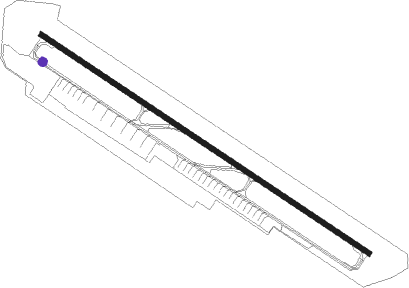
Bateen
Airport details
| Country | United Arab Emirates |
| State | Abu Dhabi Emirate |
| Region | OM |
| Airspace | Emirates Ctr |
| Municipality | Abu Dhabi |
| Elevation | 16ft (5m) |
| Timezone | GMT +4 |
| Coordinates | 24.42833, 54.45806 |
| Magnetic var | |
| Type | land |
| Available since | X-Plane v10.40 |
| ICAO code | OMAD |
| IATA code | AZI |
| FAA code | n/a |
Communication
| BATEEN Ground Control | 121.900 |
| BATEEN Tower | 119.900 |
| BATEEN ABU DHABI Approach | 124.400 |
| BATEEN ABU DHABI Approach | 128.100 |
Approach frequencies
| ILS-cat-I | RW31 | 110.7 | 18.00mi |
| 3.5° GS | RW31 | 110.7 | 18.00mi |
Nearby beacons
| code | identifier | dist | bearing | frequency |
|---|---|---|---|---|
| ALB | AL BATEEN (ABU DHABI) VOR/DME | 0.8 | 311° | 114 |
| ADV | ABU DHABI VOR/DME | 11.7 | 92° | 114.25 |
| MIN | MINHAD VOR/DME | 62.4 | 57° | 115.20 |
Departure and arrival routes
| Transition altitude | 13000ft |
| Transition level | 15000ft |
| SID end points | distance | outbound heading | |
|---|---|---|---|
| RW13 | |||
| LORI2R | 32mi | 21° | |
| TULO1R | 35mi | 34° | |
| KANI1R | 51mi | 106° | |
| ORNE1R | 53mi | 113° | |
| ATUD1R | 11mi | 141° | |
| MEKR1R | 30mi | 280° | |
| BOSE1R | 32mi | 317° | |
| DAXI2R | 34mi | 328° | |
| RW31 | |||
| LORI1Q | 32mi | 21° | |
| TULO1Q | 35mi | 34° | |
| KANI1Q | 51mi | 106° | |
| ORNE1Q | 53mi | 113° | |
| ATUD1Q | 11mi | 141° | |
| MEKR1Q | 30mi | 280° | |
| BOSE1Q | 32mi | 317° | |
| DAXI1Q | 34mi | 328° | |
| STAR starting points | distance | inbound heading | |
|---|---|---|---|
| RW13 | |||
| UKIL1F | 30.7 | 112° | |
| GIDO1F | 31.5 | 125° | |
| ELOV2F | 32.3 | 167° | |
| EMER1F, EMER2T | 39.5 | 237° | |
| ROVO1T, ROVO2F | 49.9 | 278° | |
| NOBT2F | 55.7 | 301° | |
| ATUD1F | 10.7 | 321° | |
| RW31 | |||
| UKIL1S | 30.7 | 112° | |
| GIDO1S | 31.5 | 125° | |
| ELOV1S | 32.3 | 167° | |
| EMER1S | 39.5 | 237° | |
| ROVO1S | 49.9 | 278° | |
| NOBT1S | 55.7 | 301° | |
| ATUD1S | 10.7 | 321° | |
Instrument approach procedures
| runway | airway (heading) | route (dist, bearing) |
|---|---|---|
| RW13-Z | ALKAD (103°) | ALKAD 3000ft ELAVU (6mi, 41°) 3000ft |
| RW13-Z | BORIM (125°) | BORIM 3000ft ELAVU (4mi, 123°) 3000ft |
| RW13-Z | DEBKI (150°) | DEBKI 3000ft ELAVU (6mi, 220°) 3000ft |
| RNAV | ELAVU 3000ft DELRI (4mi, 126°) 3000ft OMAD (9mi, 126°) 63ft GITPI (17mi, 126°) 3000ft | |
| RW31-Z | ALB (131°) | ALB 4000ft AD362 (11mi, 102°) ITENI (6mi, 125°) 4000ft KOBAV (5mi, 220°) 4000ft ALMEL (5mi, 305°) 3000ft |
| RW31-Z | ITENI (288°) | ITENI 4000ft KOBAV (5mi, 220°) 4000ft ALMEL (5mi, 305°) 3000ft |
| RW31-Z | MIPIP (306°) | MIPIP 3000ft KOBAV (4mi, 306°) 3000ft ALMEL (5mi, 305°) 3000ft |
| RNAV | ALMEL 3000ft OMAD (9mi, 306°) 63ft BORIM (18mi, 305°) 3000ft BORIM (turn) 3000ft |
Holding patterns
| STAR name | hold at | type | turn | heading* | altitude | leg | speed limit |
|---|---|---|---|---|---|---|---|
| ATUD1F | BORIM | VHF | right | 305 (125)° | 3000ft - 6000ft | 1.0min timed | 210 |
| ATUD1S | PARED | VHF | right | 120 (300)° | > 6000ft | 1.0min timed | 230 |
| ELOV1S | PARED | VHF | right | 120 (300)° | > 6000ft | 1.0min timed | 230 |
| ELOV2F | BORIM | VHF | right | 305 (125)° | 3000ft - 6000ft | 1.0min timed | 210 |
| EMER1F | BORIM | VHF | right | 305 (125)° | 3000ft - 6000ft | 1.0min timed | 210 |
| EMER1S | PARED | VHF | right | 120 (300)° | > 6000ft | 1.0min timed | 230 |
| GIDO1F | BORIM | VHF | right | 305 (125)° | 3000ft - 6000ft | 1.0min timed | 210 |
| NOBT1S | PARED | VHF | right | 120 (300)° | > 6000ft | 1.0min timed | 230 |
| ROVO1S | PARED | VHF | right | 120 (300)° | > 6000ft | 1.0min timed | 230 |
| ROVO2F | BORIM | VHF | right | 305 (125)° | 3000ft - 6000ft | 1.0min timed | 210 |
| UKIL1F | BORIM | VHF | right | 305 (125)° | 3000ft - 6000ft | 1.0min timed | 210 |
| *) magnetic outbound (inbound) holding course | |||||||
Disclaimer
The information on this website is not for real aviation. Use this data with the X-Plane flight simulator only! Data taken with kind consent from X-Plane 12 source code and data files. Content is subject to change without notice.
