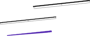
Hīt - Al Asad Ab
Airport details
| Country | Iraq |
| State | Al-Anbar Governorate |
| Region | OR |
| Airspace | Baghdad Ctr |
| Municipality | Al-Baghdadi Subdistrict |
| Elevation | 618ft (188m) |
| Timezone | GMT +3 |
| Coordinates | 33.78561, 42.44120 |
| Magnetic var | |
| Type | land |
| Available since | X-Plane v10.30 |
| ICAO code | ORAA |
| IATA code | IQA |
| FAA code | n/a |
Communication
| AL ASAD AB Ground Control | 121.175 |
| AL ASAD AB Tower | 131.225 |
| AL ASAD AB Approach | 118.600 |
| AL ASAD AB Approach | 127.875 |
Approach frequencies
| ILS-cat-I | RW09L | 108.9 | 18.00mi |
| ILS-cat-I | RW27R | 108.9 | 18.00mi |
| 3° GS | RW09L | 108.9 | 18.00mi |
| 3° GS | RW27R | 108.9 | 18.00mi |
Runway info
Nearby beacons
| code | identifier | dist | bearing | frequency |
|---|---|---|---|---|
| RAA | AL ASAD (AL-ANBAR) TACAN | 0.1 | 52° | 113.30 |
Instrument approach procedures
| runway | airway (heading) | route (dist, bearing) |
|---|---|---|
| RW09L | CEPOB (69°) | CEPOB 6200ft WILLZ (9mi, 34°) 3600ft |
| RNAV | WILLZ 3600ft ROLEE (6mi, 89°) 2800ft ORAA (6mi, 91°) 645ft (3133mi, 231°) 1020ft CEPOB (3115mi, 51°) 6200ft CEPOB (turn) 14000ft | |
| RW09R | CEPOB (69°) | CEPOB 6200ft DONAE (8mi, 32°) 3500ft |
| RNAV | DONAE 3500ft GRWLR (5mi, 88°) 2300ft ORAA (8mi, 87°) 668ft (3133mi, 231°) 1020ft CEPOB (3115mi, 51°) 6200ft CEPOB (turn) 14000ft | |
| RW27L | BLZRD (290°) | BLZRD 6200ft DRAXY (8mi, 327°) 3700ft |
| RNAV | DRAXY 3700ft NOTAE (6mi, 269°) 2300ft ORAA (6mi, 271°) 627ft (3133mi, 231°) 1020ft BLZRD (3143mi, 52°) 6200ft BLZRD (turn) 14000ft | |
| RW27R | FLOGR (287°) | FLOGR 6200ft MAZAM (8mi, 332°) 3900ft |
| RNAV | MAZAM 3900ft HAMMR (6mi, 269°) 2400ft ORAA (8mi, 267°) 607ft (3133mi, 231°) 1020ft FLOGR (3145mi, 52°) 6200ft FLOGR (turn) 14000ft |
Disclaimer
The information on this website is not for real aviation. Use this data with the X-Plane flight simulator only! Data taken with kind consent from X-Plane 12 source code and data files. Content is subject to change without notice.

