Arbil - Erbil Intl
Airport details
| Country | Iraq |
| State | Erbil Governorate |
| Region | OR |
| Airspace | Baghdad Ctr |
| Municipality | Ankawa Subdistrict |
| Elevation | 1339ft (408m) |
| Timezone | GMT +3 |
| Coordinates | 36.23806, 43.94667 |
| Magnetic var | |
| Type | land |
| Available since | X-Plane v10.40 |
| ICAO code | ORER |
| IATA code | EBL |
| FAA code | n/a |
Communication
| Erbil intl Tower | 128.800 |
| Erbil intl Approach | 127.700 |
Approach frequencies
| ILS-cat-I | RW18 | 109.1 | 18.00mi |
| ILS-cat-I | RW36 | 109.7 | 18.00mi |
| 3° GS | RW18 | 109.1 | 18.00mi |
| 3° GS | RW36 | 109.7 | 18.00mi |
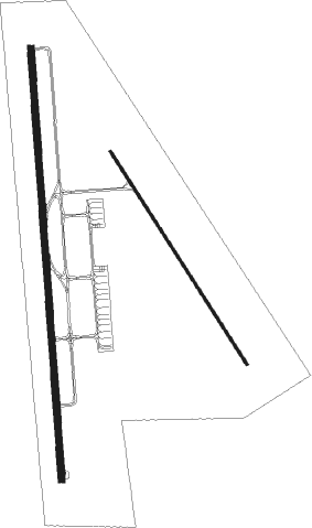
Runway info
Runway 18 / 36  | ||
| length | 4813m (15791ft) | |
| bearing | 180° / 0° | |
| width | 75m (246ft) | |
| surface | concrete | |
| blast zone | 241m (791ft) / 225m (738ft) | |
| Runway 15 / 33 | ||
| length | 2807m (9209ft) | |
| bearing | 146° / 326° | |
| width | 30m (98ft) | |
| surface | asphalt | |
| blast zone | 61m (200ft) / 59m (194ft) | |
Nearby beacons
| code | identifier | dist | bearing | frequency |
|---|---|---|---|---|
| RER | ERBIL VOR/DME | 1 | 76° | 116.30 |
| ORB | ORBR TACAN | 26 | 54° | 111 |
Instrument approach procedures
| runway | airway (heading) | route (dist, bearing) |
|---|---|---|
| RW18 | ARAZO (228°) | ARAZO 8500ft AFRAN (5mi, 270°) 6100ft ZANST (5mi, 270°) 3800ft |
| RW18 | NEZAR (180°) | NEZAR 5100ft ZANST (6mi, 180°) 3800ft |
| RW18 | SOZAN (147°) | SOZAN 5100ft ZANST (6mi, 90°) 3800ft |
| RNAV | ZANST 3800ft REZAN (5mi, 180°) 2900ft ORER (6mi, 180°) 1359ft RIBAZ (4mi, 181°) 2200ft DAXOG (26mi, 205°) 6000ft DAXOG (turn) | |
| RW36 | DIWAN (0°) | DIWAN 5100ft LIZAN (6mi, 0°) 3800ft |
| RW36 | SAFEN (327°) | SAFEN 5100ft LIZAN (6mi, 270°) 3800ft |
| RW36 | ZOZIK (51°) | ZOZIK 6100ft LIZAN (11mi, 90°) 3800ft |
| RNAV | LIZAN 3800ft VIYAN (5mi, 0°) 2900ft ORER (6mi, 0°) 1399ft LAWAN (4mi, 1°) 2400ft ROXOP (33mi, 319°) 9000ft ROXOP (turn) |
Disclaimer
The information on this website is not for real aviation. Use this data with the X-Plane flight simulator only! Data taken with kind consent from X-Plane 12 source code and data files. Content is subject to change without notice.