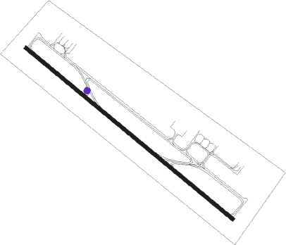
Sulaymaniyah - Sulaymaniyah Intl
Airport details
| Country | Iraq |
| State | Sulaymaniyah Governorate |
| Region | OR |
| Airspace | Baghdad Ctr |
| Municipality | Slemani |
| Elevation | 2494ft (760m) |
| Timezone | GMT +3 |
| Coordinates | 35.56055, 45.31445 |
| Magnetic var | |
| Type | land |
| Available since | X-Plane v10.40 |
| ICAO code | ORSU |
| IATA code | ISU |
| FAA code | n/a |
Communication
| Sulaymaniyah Intl Tower | 118.300 |
| Sulaymaniyah Intl Approach | 127.700 |
Approach frequencies
| ILS-cat-I | RW13 | 111.1 | 18.00mi |
| ILS-cat-I | RW31 | 111.7 | 18.00mi |
| 3° GS | RW13 | 111.1 | 18.00mi |
| 3° GS | RW31 | 111.7 | 18.00mi |
Nearby beacons
| code | identifier | dist | bearing | frequency |
|---|---|---|---|---|
| SUL | SULAIMANIYAH VOR/DME | 1.6 | 308° | 117 |
| ORB | ORBR TACAN | 74.9 | 315° | 111 |
Departure and arrival routes
| Transition altitude | 14000ft |
| SID end points | distance | outbound heading | |
|---|---|---|---|
| RW13 | |||
| KIRKK2 | 48mi | 265° | |
| ERBIL2 | 67mi | 291° | |
| RW31 | |||
| KIRKK1 | 48mi | 265° | |
| ERBIL1 | 67mi | 291° | |
| STAR starting points | distance | inbound heading | |
|---|---|---|---|
| RW13 | |||
| KIRKK2 | 47.5 | 85° | |
| ERBIL2 | 67.3 | 111° | |
| RW31 | |||
| KIRKK1 | 47.5 | 85° | |
| ERBIL1 | 67.3 | 111° | |
Instrument approach procedures
| runway | airway (heading) | route (dist, bearing) |
|---|---|---|
| RW13 | DESKU (127°) | DESKU 7550ft TOVEN (6mi, 127°) 6060ft |
| RW13 | TAKVA (105°) | TAKVA 7550ft TOVEN (6mi, 49°) 6060ft |
| RW13 | XADIL (154°) | XADIL 13000ft PARUN (5mi, 196°) 11000ft TOVEN (5mi, 195°) 6060ft |
| RNAV | TOVEN 6060ft TASRO (4mi, 127°) 5100ft ORMAM (7mi, 127°) 2834ft (3309mi, 232°) 6500ft TAKVA (3300mi, 52°) 7550ft TAKVA (turn) 7550ft | |
| RW31 | ALVEX (307°) | ALVEX 7550ft ORBET (6mi, 308°) 6060ft |
| RW31 | ASKOM (281°) | ASKOM 13000ft NOSKA (5mi, 248°) 11000ft ORBET (5mi, 247°) 6060ft |
| RW31 | KARUX (329°) | KARUX 8500ft ORBET (6mi, 27°) 6060ft |
| RNAV | ORBET 6060ft ORGOS (4mi, 307°) 5100ft RANKO (7mi, 307°) 2777ft (3310mi, 232°) 6500ft KARUX (3308mi, 52°) 8500ft KARUX (turn) 8500ft |
Holding patterns
| STAR name | hold at | type | turn | heading* | altitude | leg | speed limit |
|---|---|---|---|---|---|---|---|
| ERBIL1 | SUL | NDB | left | 130 (310)° | > 8000ft | 1.0min timed | ICAO rules |
| ERBIL2 | SUL | NDB | left | 130 (310)° | > 8000ft | 1.0min timed | ICAO rules |
| KIRKK1 | SUL | NDB | left | 130 (310)° | > 8000ft | 1.0min timed | ICAO rules |
| KIRKK2 | SUL | NDB | left | 130 (310)° | > 8000ft | 1.0min timed | ICAO rules |
| *) magnetic outbound (inbound) holding course | |||||||
Disclaimer
The information on this website is not for real aviation. Use this data with the X-Plane flight simulator only! Data taken with kind consent from X-Plane 12 source code and data files. Content is subject to change without notice.
