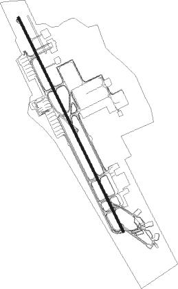
Doha - Doha Intl
Airport details
| Country | Qatar |
| State | Ad Dawhah Municipality |
| Region | OT |
| Airspace | Bahrain Ctr |
| Municipality | Doha |
| Elevation | 37ft (11m) |
| Timezone | GMT +3 |
| Coordinates | 25.27514, 51.56067 |
| Magnetic var | |
| Type | land |
| Available since | X-Plane v10.40 |
| ICAO code | OTBD |
| IATA code | DIA |
| FAA code | n/a |
Communication
| Doha Intl ATIS | 126.450 |
| Doha Intl Ground Control | 121.925 |
| Doha Intl Tower | 118.900 |
| Doha Intl DOHA Radar | 121.100 |
| Doha Intl DOHA Director | 119.400 |
| Doha Intl DOHA Approach | 119.725 |
| Doha Intl Departure | 118.900 |
Approach frequencies
| ILS-cat-III | RW33 | 109.5 | 18.00mi |
| ILS-cat-I | RW15 | 108.5 | 18.00mi |
| 3.5° GS | RW15 | 108.5 | 18.00mi |
| 3° GS | RW33 | 109.5 | 18.00mi |
Nearby beacons
| code | identifier | dist | bearing | frequency |
|---|---|---|---|---|
| DIA | DOHA INTL VOR/DME | 2.6 | 158° | 112.40 |
| DOH | DOHA/HAMAD INTL VOR/DME | 3 | 117° | 114.40 |
| WK | DOHA INTL NDB | 6 | 157° | 323 |
| ALD | AL UDEID VORTAC | 16.8 | 232° | 115.20 |
| SI | ISA AB (BAHRAIN) NDB | 63.7 | 303° | 343 |
| SIA | ISA AB (BAHRAIN) VORTAC | 65.3 | 304° | 117.60 |
Departure and arrival routes
| Transition altitude | 13000ft |
| Transition level | 15000ft |
| SID end points | distance | outbound heading | |
|---|---|---|---|
| RW15 | |||
| ALVE1S | 42mi | 27° | |
| VAXI1S | 50mi | 63° | |
| ALSE1S | 64mi | 81° | |
| NAML1S | 55mi | 100° | |
| BUND1S | 53mi | 106° | |
| SALW1S | 57mi | 269° | |
| PATO1S | 44mi | 340° | |
| RW33 | |||
| ALVE1N | 42mi | 27° | |
| VAXI1N | 50mi | 63° | |
| ALSE1N | 64mi | 81° | |
| NAML1N | 55mi | 100° | |
| BUND1N | 53mi | 106° | |
| SALW1N | 57mi | 269° | |
| PATO1N | 44mi | 340° | |
| STAR starting points | distance | inbound heading | |
|---|---|---|---|
| RW15 | |||
| GINT1A | 26.5 | 89° | |
| BAYA1A | 18.8 | 230° | |
| AFNA1A | 27.4 | 297° | |
| RW33 | |||
| GINT1D | 26.5 | 89° | |
| BAYA1D | 18.8 | 230° | |
| AFNA1D | 27.4 | 297° | |
Holding patterns
| STAR name | hold at | type | turn | heading* | altitude | leg | speed limit |
|---|---|---|---|---|---|---|---|
| AFNA1A | AFNAN | VHF | right | 88 (268)° | 15000ft - 22000ft | 1.5min timed | 240 |
| AFNA1D | AFNAN | VHF | right | 88 (268)° | 15000ft - 22000ft | 1.5min timed | 240 |
| BAYA1A | BAYAN | VHF | left | 49 (229)° | 15000ft - 24000ft | 1.5min timed | 240 |
| BAYA1D | BAYAN | VHF | left | 49 (229)° | 15000ft - 24000ft | 1.5min timed | 240 |
| GINT1A | GINTO | VHF | right | 267 (87)° | 15000ft - 21000ft | 1.5min timed | 240 |
| GINT1D | GINTO | VHF | right | 267 (87)° | 15000ft - 21000ft | 1.5min timed | 240 |
| *) magnetic outbound (inbound) holding course | |||||||
Disclaimer
The information on this website is not for real aviation. Use this data with the X-Plane flight simulator only! Data taken with kind consent from X-Plane 12 source code and data files. Content is subject to change without notice.