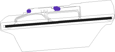
Utqiaġvik - Wiley Post-will Rogers Memorial
Airport details
| Country | United States of America |
| State | Alaska |
| Region | PA |
| Municipality | Utqiaġvik |
| Elevation | 47ft (14m) |
| Timezone | GMT -9 |
| Coordinates | 71.28486, -156.76859 |
| Magnetic var | |
| Type | land |
| Available since | X-Plane v10.40 |
| ICAO code | PABR |
| IATA code | BRW |
| FAA code | BRW |
Communication
| Wiley Post-Will Rogers Memorial ASOS | 132.150 |
| Wiley Post-Will Rogers Memorial CTAF | 123.600 |
Approach frequencies
| ILS-cat-I | RW08 | 110.5 | 18.00mi |
| 3° GS | RW08 | 110.5 | 18.00mi |
Nearby Points of Interest:
Birnirk Site
-Utqiaġvik Church Manse
-Rogers-Post Site
Nearby beacons
| code | identifier | dist | bearing | frequency |
|---|---|---|---|---|
| VIR | BROWERVILLE (UTQIAGVIK) NDB | 0.2 | 259° | 281 |
| BRW | BARROW (UTQIAGVIK) VOR/DME | 0.7 | 240° | 116.20 |
| ATK | ATQASUK NDB | 50.6 | 219° | 350 |
Instrument approach procedures
| runway | airway (heading) | route (dist, bearing) |
|---|---|---|
| RW08 | GUNNI (101°) | GUNNI OBCIN (7mi, 178°) 2000ft |
| RW08 | OBCIN (90°) | OBCIN 2000ft |
| RW08 | SICTO (79°) | SICTO OBCIN (7mi, 358°) 2000ft |
| RNAV | OBCIN 2000ft FRANY (6mi, 90°) 1700ft PABR (5mi, 90°) 106ft (6435mi, 114°) 249ft ASUKY (6430mi, 295°) 2000ft ASUKY (turn) | |
| RW26 | ASUKY (270°) | ASUKY 2000ft |
| RW26 | FINKE (259°) | FINKE ASUKY (7mi, 182°) 2000ft |
| RW26 | JOBVO (281°) | JOBVO ASUKY (7mi, 2°) 2000ft |
| RNAV | ASUKY 2000ft ZUMTU (6mi, 270°) 1700ft SEKTY (2mi, 270°) 1200ft PABR (4mi, 270°) 89ft (6435mi, 114°) 360ft OBCIN (6440mi, 294°) 2000ft OBCIN (turn) |
Disclaimer
The information on this website is not for real aviation. Use this data with the X-Plane flight simulator only! Data taken with kind consent from X-Plane 12 source code and data files. Content is subject to change without notice.
