Anchorage - Elmendorf Afb
Airport details
| Country | United States of America |
| State | Alaska |
| Region | PA |
| Municipality | Anchorage |
| Elevation | 211ft (64m) |
| Timezone | GMT -9 |
| Coordinates | 61.25851, -149.81595 |
| Magnetic var | |
| Type | land |
| Available since | X-Plane v10.40 |
| ICAO code | PAED |
| IATA code | EDF |
| FAA code | EDF |
Communication
| Elmendorf AFB ATIS | 124.300 |
| Elmendorf AFB Clearance DEL | 128.800 |
| Elmendorf AFB Ground Control | 121.800 |
| Elmendorf AFB Tower | 127.200 |
| Elmendorf AFB ANCHORAGE Approach | 118.600 |
| Elmendorf AFB ANCHORAGE Approach | 134.100 |
| Elmendorf AFB ANCHORAGE Departure | 118.600 |
Approach frequencies
| ILS-cat-I | RW06 | 110.3 | 18.00mi |
| 3° GS | RW06 | 110.3 | 18.00mi |
Nearby Points of Interest:
Wendler Building
-Civil Works Residential Dwellings
-Pioneer School House
-McKinley Tower Apartments
-Leopold David House
-Alaska Engineering Commission Cottage No. 25
-A. E. C. Cottage No. 23
-United States Federal Building and Courthouse
-Tony Knowles Coastal Trail
-Oscar Anderson House Museum
-Oscar Gill House
-Atwood Campus Center
-KENI Radio Building
-Pilgrim 100-B N709Y
-Site Summit
-Potter Section House
-Spring Creek Lodge
-Beluga Point Site
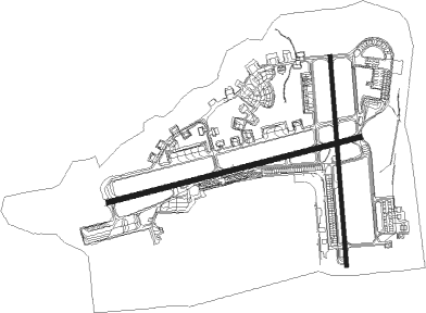
Runway info
Runway 6 / 24  | ||
| length | 3037m (9964ft) | |
| bearing | 85° / 265° | |
| width | 61m (200ft) | |
| surface | asphalt | |
| blast zone | 255m (837ft) / 255m (837ft) | |
| Runway 16 / 34 | ||
| length | 2449m (8035ft) | |
| bearing | 180° / 0° | |
| width | 46m (150ft) | |
| surface | asphalt | |
| displ threshold | 0m (0ft) / 171m (561ft) | |
| blast zone | 255m (837ft) / 46m (151ft) | |
Nearby beacons
| code | identifier | dist | bearing | frequency |
|---|---|---|---|---|
| EDF | ELMENDORF (ANCHORAGE) TACAN | 1.3 | 94° | 113.40 |
| TED | ANCHORAGE VOR/DME | 6.8 | 238° | 113.15 |
| BGQ | BIG LAKE VORTAC | 19.1 | 334° | 112.50 |
Departure and arrival routes
| Transition altitude | 18000ft |
| Transition level | 18000ft |
| SID end points | distance | outbound heading | |
|---|---|---|---|
| RW06 | |||
| MOTTI2 | 19mi | 334° | |
| EEEGL4 | 20mi | 358° | |
| RW16 | |||
| YUKLA2 | 20mi | 220° | |
| RW24 | |||
| EEEGL4 | 20mi | 358° | |
| RW34 | |||
| MOTTI2 | 19mi | 334° | |
| EEEGL4 | 20mi | 358° | |
| STAR starting points | distance | inbound heading | |
|---|---|---|---|
| RW06 | |||
| GRUUB1 | 33.5 | 97° | |
| JINXX1 | 22.4 | 235° | |
Instrument approach procedures
| runway | airway (heading) | route (dist, bearing) |
|---|---|---|
| RW06 | RNICH (92°) | RNICH 3000ft COSAS (6mi, 109°) 3000ft |
| RNAV | COSAS 3000ft DOYEG (6mi, 85°) 1600ft CETUX (2mi, 85°) 900ft PAED (3mi, 81°) 232ft (6880mi, 112°) 800ft BGQ (6867mi, 292°) 3000ft BGQ (turn) 6000ft |
Disclaimer
The information on this website is not for real aviation. Use this data with the X-Plane flight simulator only! Data taken with kind consent from X-Plane 12 source code and data files. Content is subject to change without notice.