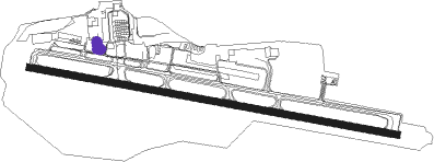
Juneau - Juneau Intl
Airport details
| Country | United States of America |
| State | Alaska |
| Region | PA |
| Municipality | Juneau |
| Elevation | 22ft (7m) |
| Timezone | GMT -9 |
| Coordinates | 58.35471, -134.57848 |
| Magnetic var | |
| Type | land |
| Available since | X-Plane v10.40 |
| ICAO code | PAJN |
| IATA code | JNU |
| FAA code | JNU |
Communication
| Juneau Intl ATIS | 135.200 |
| Juneau Intl Ground Control | 121.900 |
| Juneau Intl Tower | 118.700 |
| Juneau Intl Anchorage Center | 133.900 |
Approach frequencies
| LDA | RW08 | 109.9 | 18.00mi |
Nearby Points of Interest:
Rudy-Kodzoff House
-Alaska Governor's Mansion
-Wickersham House
-J. M. Davis House
-MacKinnon Apartments
-Frances House
-Fries Miners' Cabins
-Valentine Building
-Juneau Downtown Historic District
-Holy Trinity Church (Juneau, Alaska)
-Alaska Steam Laundry
-Last Chance Mining Museum
-Mayflower School
-Ernest Gruening Cabin
Nearby beacons
| code | identifier | dist | bearing | frequency |
|---|---|---|---|---|
| CGL | COGHLAN ISLAND NDB | 3.8 | 272° | 212 |
| SSR | SISTERS ISLAND VORTAC | 23.9 | 255° | 114 |
| EEF | ELEPHANT (SISTERS I.) NDB | 24.1 | 255° | 391 |
| HNS | HAINES NDB | 57.9 | 315° | 245 |
Departure and arrival routes
| Transition altitude | 18000ft |
| Transition level | 18000ft |
| SID end points | distance | outbound heading | |
|---|---|---|---|
| RW08 | |||
| JNU6 | 24mi | 255° | |
| ASORT2 | 39mi | 270° | |
| RW26 | |||
| JNU6 | 24mi | 255° | |
| ASORT2 | 39mi | 270° | |
Instrument approach procedures
| runway | airway (heading) | route (dist, bearing) |
|---|---|---|
| RW08-T | ASORT (90°) | ASORT DIBOL (19mi, 90°) 6300ft LYNNS (4mi, 90°) 5600ft |
| RW08-T | CHILL (109°) | CHILL CUSOV (10mi, 171°) 7500ft DIBOL (6mi, 130°) 6300ft LYNNS (4mi, 90°) 5600ft |
| RW08-T | SSR (75°) | SSR LYNNS (12mi, 44°) 5600ft |
| RNAV | LYNNS 5600ft BARLO (6mi, 90°) 3500ft ZULIL (6mi, 90°) 1273ft BARLO (6mi, 270°) 2800ft SSR (16mi, 244°) 5400ft SSR (turn) | |
| RW08-V | EEF (75°) | EEF CHILL (27mi, 351°) 7500ft GUMLE (9mi, 95°) 7500ft OGEME (14mi, 170°) 3400ft |
| RW08-V | SSR (75°) | SSR NIMLE (7mi, 77°) 3400ft OGEME (8mi, 18°) 3400ft |
| RNAV | OGEME 3400ft MENAE (5mi, 90°) 2700ft MOLRE (6mi, 90°) 792ft MUGGZ (15mi, 294°) CHILL (11mi, 287°) 9000ft CHILL (turn) |
Disclaimer
The information on this website is not for real aviation. Use this data with the X-Plane flight simulator only! Data taken with kind consent from X-Plane 12 source code and data files. Content is subject to change without notice.

