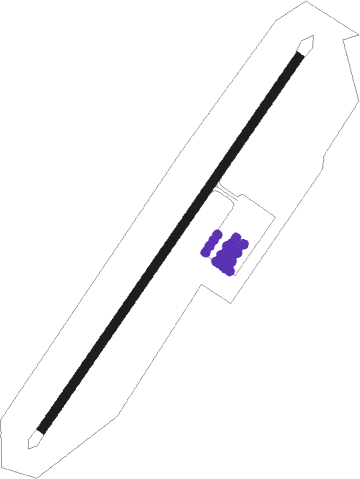
Klawock - Klawok
Airport details
| Country | United States of America |
| State | Alaska |
| Region | PA |
| Municipality | Unorganized Borough |
| Elevation | 79ft (24m) |
| Timezone | GMT -9 |
| Coordinates | 55.57924, -133.07600 |
| Magnetic var | |
| Type | land |
| Available since | X-Plane v10.40 |
| ICAO code | PAKW |
| IATA code | KLW |
| FAA code | AKW |
Communication
| Klawok ASOS | 135.450 |
| Klawok CTAF | 120.900 |
Nearby Points of Interest:
Chief Son-I-Hat's Whale House and Totems Historic District
Nearby beacons
| code | identifier | dist | bearing | frequency |
|---|---|---|---|---|
| AKW | KLAWOCK NDB | 0.6 | 207° | 229 |
| SQM | SUMNER STRAIT (LEVEL I.) NDB | 53.1 | 359° | 529 |
| LVD | LEVEL ISLAND VOR/DME | 53.3 | 360° | 116.50 |
| RGL | WRANGELL NDB | 59.2 | 37° | 206 |
Departure and arrival routes
| Transition altitude | 18000ft |
| Transition level | 18000ft |
| SID end points | distance | outbound heading | |
|---|---|---|---|
| RW02 | |||
| CAALM1 | 31mi | 103° | |
| RW20 | |||
| TURTY4 | 14mi | 342° | |
Instrument approach procedures
| runway | airway (heading) | route (dist, bearing) |
|---|---|---|
| RW02-M | HIPSA (55°) | HIPSA CHAWW (5mi, 55°) 3300ft |
| RW02-M | JIPEG (285°) | JIPEG JUGGG (44mi, 278°) 5200ft GTANY (8mi, 271°) 4600ft CHAWW (5mi, 295°) 3300ft |
| RW02-M | NESYI (107°) | NESYI PRDSE (10mi, 198°) 4600ft CHAWW (5mi, 114°) 3300ft |
| RW02-M | OWXUY (93°) | OWXUY PRDSE (8mi, 131°) 4600ft CHAWW (5mi, 114°) 3300ft |
| RW02-M | TURTY (162°) | TURTY PRDSE (21mi, 219°) 4600ft CHAWW (5mi, 114°) 3300ft |
| RW02-M | WIGUL (275°) | WIGUL JUGGG (31mi, 263°) 5200ft GTANY (8mi, 271°) 4600ft CHAWW (5mi, 295°) 3300ft |
| RNAV | CHAWW 3300ft VVANN (2mi, 55°) 2800ft SCOTV (3mi, 55°) 2000ft PAKW (6mi, 55°) 73ft (6769mi, 113°) 500ft NYALA (6777mi, 293°) HIPSA (9mi, 220°) 6000ft HIPSA (turn) 6000ft | |
| RW02-Y | UDENE (237°) | UDENE EXOFY (11mi, 238°) 4800ft BOHBI (12mi, 239°) 4500ft BOHBI (turn) 3800ft |
| RNAV | BOHBI 3800ft FOGMI (3mi, 60°) 3300ft ZETVU (3mi, 59°) 2160ft EXOFY (5mi, 59°) 483ft (6771mi, 113°) 483ft BOHBI (6782mi, 293°) 4200ft BOHBI (turn) 4200ft | |
| RW02-Z | HIDNA (76°) | HIDNA HIPSA (8mi, 115°) 4900ft |
| RW02-Z | HIPSA (55°) | HIPSA 4900ft |
| RW02-Z | HUSUV (21°) | HUSUV HIPSA (8mi, 295°) 4900ft |
| RNAV | HIPSA 4900ft WILIP (5mi, 55°) 3300ft JORAG (turn) 3000ft PAKW (9mi, 55°) 75ft (6769mi, 113°) 1520ft ZODMI (6781mi, 293°) HIPSA (6mi, 167°) 4900ft HIPSA (turn) 4900ft | |
| RW20 | WOMDO (252°) | WOMDO 4300ft |
| RNAV | WOMDO 4300ft ZETSA (7mi, 258°) 3400ft JOVAD (7mi, 249°) 323ft (6768mi, 113°) 480ft HIPSA (6784mi, 293°) 4900ft HIPSA (turn) |
Disclaimer
The information on this website is not for real aviation. Use this data with the X-Plane flight simulator only! Data taken with kind consent from X-Plane 12 source code and data files. Content is subject to change without notice.
