Nome
Airport details
| Country | United States of America |
| State | Alaska |
| Region | PA |
| Municipality | Nome |
| Elevation | 37ft (11m) |
| Timezone | GMT -9 |
| Coordinates | 64.51255, -165.44437 |
| Magnetic var | |
| Type | land |
| Available since | X-Plane v10.40 |
| ICAO code | PAOM |
| IATA code | OME |
| FAA code | OME |
Communication
| Nome ASOS | 119.925 |
| Nome CTAF | 123.600 |
| Nome Anchorage ARTCC | 133.300 |
Approach frequencies
| ILS-cat-I | RW28 | 108.7 | 18.00mi |
| 3° GS | RW28 | 108.7 | 18.00mi |
Nearby Points of Interest:
Discovery Saloon
-Swanberg Dredge
-Cape Nome Mining District Discovery Sites
-Cape Nome Roadhouse
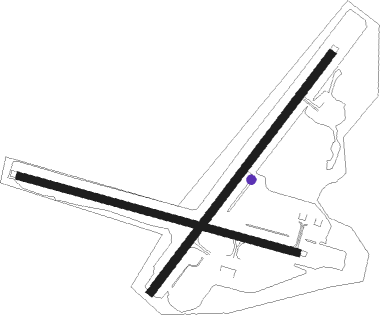
Runway info
Runway 3 / 21  | ||
| length | 1883m (6178ft) | |
| bearing | 64° / 244° | |
| width | 50m (164ft) | |
| surface | asphalt | |
| displ threshold | 191m (627ft) / 183m (600ft) | |
| blast zone | 0m (0ft) / 60m (197ft) | |
| Runway 10 / 28 | ||
| length | 1825m (5988ft) | |
| bearing | 99° / 279° | |
| width | 45m (148ft) | |
| surface | asphalt | |
| blast zone | 60m (197ft) / 63m (207ft) | |
Nearby beacons
| code | identifier | dist | bearing | frequency |
|---|---|---|---|---|
| OYN | (NOME) DME | 0.3 | 90° | 113.80 |
| FDV | FORT DAVIS (NOME) NDB | 3.5 | 98° | 529 |
| OME | NOME VOR/DME | 5.2 | 98° | 115 |
Instrument approach procedures
| runway | airway (heading) | route (dist, bearing) |
|---|---|---|
| RW03 | MAREE (64°) | MAREE 1700ft |
| RNAV | MAREE 1700ft GLOOP (6mi, 64°) 1600ft PAOM (5mi, 63°) 63ft (6883mi, 111°) 438ft MAREE (6893mi, 291°) 1700ft MAREE (turn) | |
| RW10 | SPYVY (98°) | SPYVY 3700ft |
| RNAV | SPYVY 3700ft HUFBU (4mi, 99°) 2600ft BOYUK (3mi, 99°) 2400ft URUPE (5mi, 99°) 960ft PAOM (3mi, 98°) 57ft (6883mi, 111°) 340ft EMMMO (6884mi, 291°) 3000ft EMMMO (turn) | |
| RW28 | EMMMO (279°) | EMMMO 3000ft |
| RNAV | EMMMO 3000ft MUKDE (7mi, 279°) 1700ft FOVAG (3mi, 279°) 800ft PAOM (3mi, 280°) 76ft (6883mi, 111°) 272ft SPYVY (6883mi, 291°) 3700ft SPYVY (turn) |
Disclaimer
The information on this website is not for real aviation. Use this data with the X-Plane flight simulator only! Data taken with kind consent from X-Plane 12 source code and data files. Content is subject to change without notice.