Andersen - Mariana Island - Andersen Afb
Airport details
| Country | United States of America |
| State | Guam |
| Region | PG |
| Municipality | Yigo Municipality |
| Elevation | 617ft (188m) |
| Timezone | GMT +10 |
| Coordinates | 13.58388, 144.93005 |
| Magnetic var | |
| Type | land |
| Available since | X-Plane v10.32 |
| ICAO code | PGUA |
| IATA code | UAM |
| FAA code | UAM |
Communication
| Andersen AFB ANDERSEN ATIS | 118.175 |
| Andersen AFB ANDERSEN Ground Control | 121.700 |
| Andersen AFB ANDERSEN Tower | 126.200 |
| Andersen AFB GUAM ApproachR | 119.800 |
| Andersen AFB GUAM Departure | 119.800 |
Approach frequencies
| ILS-cat-I | RW06L | 109.3 | 18.00mi |
| ILS-cat-I | RW24L | 110.1 | 18.00mi |
| ILS-cat-I | RW06R | 110.1 | 18.00mi |
| ILS-cat-I | RW24R | 109.3 | 18.00mi |
| 3° GS | RW06L | 109.3 | 18.00mi |
| 3° GS | RW24L | 110.1 | 18.00mi |
| 3° GS | RW06R | 110.1 | 18.00mi |
| 3° GS | RW24R | 109.3 | 18.00mi |
Nearby Points of Interest:
South Finegayan Latte Stone Park
-Ipao Pillbox I
-Guam Congress Building
-Plaza de España
-Asan Invasion Beach
-Piti Guns
-Aratama Maru
-Guam Cable Station
-Ha. 62-76 Japanese Midget Attack Submarine
-Agat Invasion Beach
-Cetti Bay
-Fort Nuestra Señora de la Soledad
-Merlyn G. Cooke School
-Nanyo Kohatsu Kabushiki Kaisha Sugar Mill
-Laulau Kattan Latte Site
Runway info
Runway 06L / 24R  | ||
| length | 3721m (12208ft) | |
| bearing | 66° / 246° | |
| width | 66m (215ft) | |
| surface | concrete | |
| displ threshold | 308m (1010ft) / 199m (653ft) | |
| blast zone | 0m (0ft) / 113m (371ft) | |
| Runway 06R / 24L | ||
| length | 3708m (12165ft) | |
| bearing | 66° / 246° | |
| width | 61m (200ft) | |
| surface | concrete | |
| displ threshold | 300m (984ft) / 0m (0ft) | |
| blast zone | 0m (0ft) / 255m (837ft) | |
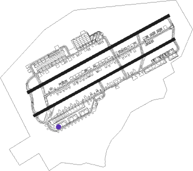
Airport layout - parking location S-04
Taxiway locations
Parking locations
Nearby beacons
| code | identifier | dist | bearing | frequency |
|---|---|---|---|---|
| UAM | ANDERSEN (YIGO) TACAN | 1 | 66° | 111.70 |
| AJA | MOUNT MACAJNA (GUAM) NDB | 13.7 | 236° | 385 |
| UNZ | NIMITZ VORTAC | 13.8 | 237° | 115.80 |
| GRO | ROTA NDB | 39.6 | 28° | 332 |
Instrument approach procedures
| runway | airway (heading) | route (dist, bearing) |
|---|---|---|
| RW06L | SNOYL (38°) | SNOYL 3000ft LOGLE (10mi, 346°) 2600ft |
| RW06L | WUVEN (134°) | WUVEN 10000ft BRTNE (28mi, 161°) 3000ft LOGLE (10mi, 145°) 2600ft |
| RNAV | LOGLE 2600ft JORUN (10mi, 66°) 2200ft PGUA (6mi, 68°) 585ft (8571mi, 265°) 1017ft ISLAA (8582mi, 85°) 3000ft ISLAA (turn) 10000ft | |
| RW06R | SNOYL (38°) | SNOYL 3000ft HILRI (10mi, 346°) 2700ft |
| RW06R | WUVEN (134°) | WUVEN 10000ft BRTNE (28mi, 161°) 3000ft HILRI (10mi, 146°) 2700ft |
| RNAV | HILRI 2700ft ANIKA (10mi, 66°) 2100ft PGUA (6mi, 65°) 601ft (8571mi, 265°) 1017ft OSKKR (8583mi, 85°) 3000ft OSKKR (turn) 10000ft | |
| RW24L | EDIAZ (217°) | EDIAZ 3000ft LUAAP (10mi, 166°) 2700ft |
| RW24L | FOKAI (275°) | FOKAI 3000ft LUAAP (10mi, 325°) 2700ft |
| RNAV | LUAAP 2700ft OWEND (10mi, 246°) 2300ft PGUA (6mi, 248°) 650ft (8571mi, 265°) 1200ft FOKAI (8591mi, 85°) 3000ft FOKAI (turn) 10000ft | |
| RW24R | EDIAZ (217°) | EDIAZ 3000ft ROUDY (10mi, 168°) 2700ft |
| RW24R | FOKAI (275°) | FOKAI 3000ft ROUDY (10mi, 323°) 2700ft |
| RNAV | ROUDY 2700ft JWILL (10mi, 246°) 2200ft PGUA (6mi, 245°) 676ft (8571mi, 265°) 1200ft FOKAI (8591mi, 85°) 3000ft FOKAI (turn) 10000ft |
Disclaimer
The information on this website is not for real aviation. Use this data with the X-Plane flight simulator only! Data taken with kind consent from X-Plane 12 source code and data files. Content is subject to change without notice.