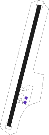
Qimei
Airport details
| Country | Taiwan |
| State | Penghu |
| Region | RC |
| Airspace | Taipei Ctr |
| Municipality | Qimei Township |
| Elevation | 62ft (19m) |
| Timezone | GMT +8 |
| Coordinates | 23.21110, 119.41714 |
| Magnetic var | |
| Type | land |
| Available since | X-Plane v10.40 |
| ICAO code | RCCM |
| IATA code | CMJ |
| FAA code | n/a |
Communication
Nearby Points of Interest:
Magong Office, Kaohsiung Customs
-Magong Beiji Temple
-Magong 1000-ton Water Tower
Nearby beacons
| code | identifier | dist | bearing | frequency |
|---|---|---|---|---|
| BM | MAGONG NDB | 26 | 30° | 290 |
| MKG | MAGONG (PENGHU I.) VOR/DME | 26 | 30° | 115.20 |
| NN | SIGANG (TAINAN) NDB | 43.6 | 96° | 375 |
| TNN | SIGANG (TAINAN) VOR/DME | 43.8 | 95° | 113.30 |
| MR | KUEIJEN NDB | 50.1 | 105° | 312 |
| AY | KANGSHAN NDB | 51.3 | 113° | 265 |
| KU | CHIAYI NDB | 58 | 69° | 525 |
| SK | KAOHSIUNG INTL NDB | 63 | 125° | 330 |
Departure and arrival routes
| Transition altitude | 11000ft |
| Transition level | 13000ft |
| STAR starting points | distance | inbound heading | |
|---|---|---|---|
| ALL | |||
| MA1R | 26.0 | 210° | |
| SA1R | 43.8 | 275° | |
Holding patterns
| STAR name | hold at | type | turn | heading* | altitude | leg | speed limit |
|---|---|---|---|---|---|---|---|
| MA1R | MALIC | VHF | left | 99 (279)° | > 1500ft | 1.0min timed | ICAO rules |
| SA1R | MALIC | VHF | left | 99 (279)° | > 1500ft | 1.0min timed | ICAO rules |
| *) magnetic outbound (inbound) holding course | |||||||
Disclaimer
The information on this website is not for real aviation. Use this data with the X-Plane flight simulator only! Data taken with kind consent from X-Plane 12 source code and data files. Content is subject to change without notice.
