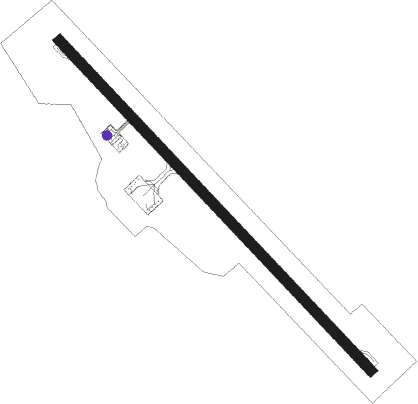
Shirahama - Nanki Shirahama
Airport details
| Country | Japan |
| State | Wakayama Prefecture |
| Region | RJ |
| Airspace | Fukuoka Ctr |
| Municipality | Shirahama |
| Elevation | 296ft (90m) |
| Timezone | GMT +9 |
| Coordinates | 33.66222, 135.36444 |
| Magnetic var | |
| Type | land |
| Available since | X-Plane v10.40 |
| ICAO code | RJBD |
| IATA code | SHM |
| FAA code | n/a |
Communication
| Nanki Shirahama Nanki RDO | 118.550 |
Approach frequencies
| LOC | RW15 | 108.55 | 18.00mi |
Nearby Points of Interest:
Nakahechi
-Sonaezaki Sutra Mounds
-Sacred Sites and Pilgrimage Routes in the Kii Mountain Range
-Okunoin
-Nachi Primeval Forest
-Doro-Hatchō
-Wakaura
Nearby beacons
| code | identifier | dist | bearing | frequency |
|---|---|---|---|---|
| NKE | NANKI VOR/DME | 0.2 | 259° | 109.05 |
| GBD | DME | 19.6 | 314° | 116.90 |
| KEC | KUSHIMOTO VORTAC | 25 | 117° | 112.90 |
| KJT | KOMATSUSHIMA TACAN | 42.1 | 295° | 113.55 |
| KIE | KANSAI VOR/DME | 46.5 | 348° | 111.60 |
| TSC | TOKUSHIMA VORTAC | 46.9 | 302° | 114.90 |
| TS | TOKUSHIMA NDB | 47 | 302° | 332 |
| AJD | DME | 48.8 | 313° | 115.60 |
| YOE | YAO VOR/DME | 57.3 | 14° | 114.60 |
| KCE | KOBE VOR/DME | 58.5 | 352° | 111.25 |
Departure and arrival routes
| Transition altitude | 14000ft |
| Transition level | 14000ft |
| SID end points | distance | outbound heading | |
|---|---|---|---|
| RW15 | |||
| KEC1 | 25mi | 117° | |
| RW33 | |||
| KEC1 | 25mi | 117° | |
| STAR starting points | distance | inbound heading | |
|---|---|---|---|
| RW15 | |||
| RAYJON | 40.3 | 258° | |
| RW33 | |||
| RAYJOS | 40.3 | 258° | |
Instrument approach procedures
| runway | airway (heading) | route (dist, bearing) |
|---|---|---|
| RW15 | YATAR (238°) | YATAR 7000ft BD550 (10mi, 269°) 3800ft BD551 (5mi, 268°) 2900ft BD552 (4mi, 236°) 2300ft |
| RNAV | BD552 2300ft GALAS (4mi, 136°) 1621ft BD553 (3mi, 136°) 667ft BD554 (4mi, 136°) KISEI (11mi, 200°) 4000ft KISEI (turn) 4000ft | |
| RW33 | MUROH (268°) | MUROH 7000ft BD350 (15mi, 245°) 3400ft BD351 (3mi, 245°) 2600ft |
| RNAV | BD351 2600ft PANDA (4mi, 301°) 2156ft BD352 (2mi, 332°) 1519ft BD353 (2mi, 332°) 1041ft BD354 (2mi, 332°) 567ft KISEI (11mi, 196°) 4000ft KISEI (turn) 4000ft |
Disclaimer
The information on this website is not for real aviation. Use this data with the X-Plane flight simulator only! Data taken with kind consent from X-Plane 12 source code and data files. Content is subject to change without notice.
