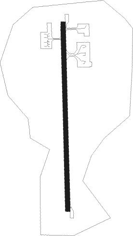
Tajima
Airport details
| Country | Japan |
| State | Hyōgo Prefecture |
| Region | RJ |
| Airspace | Fukuoka Ctr |
| Municipality | Toyooka |
| Elevation | 583ft (178m) |
| Timezone | GMT +9 |
| Coordinates | 35.51278, 134.78694 |
| Magnetic var | |
| Type | land |
| Available since | X-Plane v10.40 |
| ICAO code | RJBT |
| IATA code | TJH |
| FAA code | n/a |
Communication
| Tajima FLIGHT SVC | 130.800 |
Approach frequencies
| LOC | RW01 | 108.55 | 18.00mi |
Nearby Points of Interest:
Nagusa Shrine
-Gōmura Fault
Nearby beacons
| code | identifier | dist | bearing | frequency |
|---|---|---|---|---|
| YME | MIYAZU VOR/DME | 17.2 | 95° | 112.60 |
| TRE | TOTTORI VOR/DME | 30.4 | 271° | 110.20 |
| ITE | ITAMI VOR/DME | 52.1 | 139° | 114.75 |
| KCE | KOBE VOR/DME | 57.2 | 153° | 111.25 |
| OKT | OKAYAMA TACAN | 63.1 | 223° | 115.90 |
| OYE | KIBI VOR/DME | 65.4 | 231° | 111 |
| YOE | YAO VOR/DME | 67.7 | 139° | 114.60 |
Departure and arrival routes
| Transition altitude | 14000ft |
| Transition level | 14000ft |
| SID end points | distance | outbound heading | |
|---|---|---|---|
| RW01 | |||
| YME3 | 17mi | 95° | |
| ROKKO1 | 35mi | 128° | |
| RW19 | |||
| YME3 | 17mi | 95° | |
| ROKKO1 | 35mi | 128° | |
Instrument approach procedures
| runway | airway (heading) | route (dist, bearing) |
|---|---|---|
| RW01 | ASAGI (4°) | ASAGI 7000ft FOSTA (6mi, 5°) 7000ft BT150 (4mi, 5°) 4700ft BT151 (4mi, 5°) 3900ft |
| RW01 | OLSOP (221°) | OLSOP BT156 (11mi, 151°) BT157 (5mi, 184°) BT151 (5mi, 272°) 3900ft |
| RNAV | BT151 3900ft YABOO (5mi, 4°) 3400ft BT152 (4mi, 4°) 2034ft BT153 (2mi, 4°) 1556ft BT154 (2mi, 4°) 890ft BT155 (4mi, 4°) OLSOP (3mi, 179°) 5000ft OLSOP (turn) 5000ft | |
| RW19 | ASAGI (4°) | ASAGI 7000ft FOSTA (6mi, 5°) 7000ft BT950 (30mi, 11°) 4600ft BT951 (4mi, 4°) BT952 (3mi, 272°) AMARB (4mi, 184°) 2900ft |
| RW19 | OLSOP (221°) | OLSOP 5000ft BT950 (8mi, 30°) 4600ft BT951 (4mi, 4°) BT952 (3mi, 272°) AMARB (4mi, 184°) 2900ft |
| RNAV | AMARB 2900ft BT953 (2mi, 184°) 2310ft BT954 (3mi, 184°) 1418ft BT955 (2mi, 184°) 942ft BT956 (5mi, 184°) OLSOP (4mi, 7°) 5000ft OLSOP (turn) 5000ft |
Disclaimer
The information on this website is not for real aviation. Use this data with the X-Plane flight simulator only! Data taken with kind consent from X-Plane 12 source code and data files. Content is subject to change without notice.
