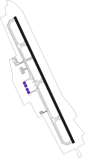
Obihiro
Airport details
| Country | Japan |
| State | Hokkaidō Prefecture |
| Region | RJ |
| Airspace | Fukuoka Ctr |
| Municipality | Obihiro |
| Elevation | 490ft (149m) |
| Timezone | GMT +9 |
| Coordinates | 42.73333, 143.21722 |
| Magnetic var | |
| Type | land |
| Available since | X-Plane v10.40 |
| ICAO code | RJCB |
| IATA code | OBO |
| FAA code | n/a |
Communication
| Obihiro Tower | 126.200 |
| Obihiro Tower | 118.700 |
| Obihiro Tower | 123.600 |
| Obihiro Sapporo Control | 134.250 |
| Obihiro Sapporo Control | 128.325 |
Approach frequencies
| ILS-cat-I | RW35 | 111.7 | 18.00mi |
| 3° GS | RW35 | 111.7 | 18.00mi |
Nearby beacons
| code | identifier | dist | bearing | frequency |
|---|---|---|---|---|
| OBE | OBIHIRO VOR/DME | 0.1 | 79° | 109.65 |
| TKT | TOKACHI TACAN | 9.8 | 342° | 111.80 |
| OH | TOKACHI NDB | 10.3 | 341° | 239 |
| KSE | KUSHIRO VOR/DME | 47 | 73° | 112.50 |
| AWE | ASAHIKAWA VOR/DME | 65.2 | 321° | 113.50 |
Departure and arrival routes
| Transition altitude | 14000ft |
| Transition level | 14000ft |
| SID end points | distance | outbound heading | |
|---|---|---|---|
| RW17 | |||
| EATAK1 | 24mi | 39° | |
| KSE4 | 47mi | 73° | |
| OTTER1, RACKO2 | 35mi | 154° | |
| NOTAK4 | 23mi | 330° | |
| RW35 | |||
| EATAK1 | 24mi | 39° | |
| KSE4 | 47mi | 73° | |
| OTTER1, RACKO2 | 35mi | 154° | |
| NOTAK4 | 23mi | 330° | |
Instrument approach procedures
| runway | airway (heading) | route (dist, bearing) |
|---|---|---|
| RW17 | TAIKI (333°) | TAIKI 5000ft CB750 (16mi, 319°) 4000ft |
| RNAV | CB750 4000ft HAPPY (3mi, 319°) 3800ft CB751 (1mi, 319°) 3345ft CB752 (4mi, 70°) 1020ft RJCB (2mi, 153°) 520ft TAIKI (18mi, 153°) 5000ft TAIKI (turn) 5000ft |
Disclaimer
The information on this website is not for real aviation. Use this data with the X-Plane flight simulator only! Data taken with kind consent from X-Plane 12 source code and data files. Content is subject to change without notice.
