Chitose / Tomakomai - Jasdf Airbase Chitose
Airport details
| Country | Japan |
| State | Hokkaidō Prefecture |
| Region | RJ |
| Airspace | Fukuoka Ctr |
| Municipality | Chitose |
| Elevation | 87ft (27m) |
| Timezone | GMT +9 |
| Coordinates | 42.79445, 141.66638 |
| Magnetic var | |
| Type | land |
| Available since | X-Plane v10.40 |
| ICAO code | RJCJ |
| IATA code | SPK |
| FAA code | n/a |
Communication
| JASDF Airbase Chitose Chitose Delivery | 121.900 |
| JASDF Airbase Chitose Chitose Ground | 121.700 |
| JASDF Airbase Chitose Chitose Tower | 118.200 |
| JASDF Airbase Chitose Chitose Tower | 126.200 |
| JASDF Airbase Chitose Chitose Approach | 120.100 |
| JASDF Airbase Chitose Chitose Departure | 124.700 |
Approach frequencies
| ILS-cat-I | RW36R | 110.3 | 18.00mi |
| 2.7° GS | RW36R | 110.3 | 18.00mi |
Nearby Points of Interest:
Kiusu Earthwork Burial Circles
-Sōsei Bridge
-Former Hokkaidō Government Office
-Batchelor Memorial Building
-Hokkaido Governor's Official Residence
-Furukawa Hall
-Sapporo Agricultural College Entomology and Sericulture Hall
-Hokkaido University Botanical Gardens
-Sapporo Agricultural College Farm No. 2
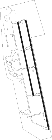
Runway info
Runway 18L / 36R  | ||
| length | 4008m (13150ft) | |
| bearing | 170° / 350° | |
| width | 45m (148ft) | |
| surface | concrete | |
| displ threshold | 1005m (3297ft) / 0m (0ft) | |
| blast zone | 255m (837ft) / 255m (837ft) | |
| Runway 18R / 36L | ||
| length | 2693m (8835ft) | |
| bearing | 170° / 350° | |
| width | 45m (148ft) | |
| surface | asphalt | |
| blast zone | 255m (837ft) / 255m (837ft) | |
Nearby beacons
| code | identifier | dist | bearing | frequency |
|---|---|---|---|---|
| ZYT | CHITOSE (SAPPORO) TACAN | 1.8 | 166° | 109.20 |
| CHE | CHITOSE VOR/DME | 5.7 | 168° | 116.90 |
| MKE | MUKAWA (SAPPORO) VOR/DME | 19.2 | 130° | 116.40 |
| SPE | SAPPORO VOR/DME | 27.8 | 316° | 113.90 |
| AWE | ASAHIKAWA VOR/DME | 62.8 | 42° | 113.50 |
Departure and arrival routes
| Transition altitude | 14000ft |
| Transition level | 14000ft |
| SID end points | distance | outbound heading | |
|---|---|---|---|
| RW18 (ALL) | |||
| KURIS4 | 22mi | 6° | |
| TO1BOK | 35mi | 89° | |
| TO1RAK | 36mi | 95° | |
| MKE5, TOBBY7 | 168mi | 187° | |
| HWE5 | 72mi | 219° | |
| SAVIT2, TEKKO9 | 67mi | 238° | |
| RW36 (ALL) | |||
| KURIS4 | 22mi | 6° | |
| TO1BOK | 35mi | 89° | |
| TO1RAK | 36mi | 95° | |
| MKE5, TOBBY7 | 168mi | 187° | |
| HWE5 | 72mi | 219° | |
| SAVIT2, TEKKO9 | 67mi | 238° | |
| STAR starting points | distance | inbound heading | |
|---|---|---|---|
| RW18L | |||
| WAKSAA | 40.4 | 12° | |
| RW36 (ALL) | |||
| KOMAIW | 40.4 | 12° | |
| KOMAIE | 19.2 | 310° | |
Holding patterns
| STAR name | hold at | type | turn | heading* | altitude | leg | speed limit |
|---|---|---|---|---|---|---|---|
| KOMAIE | MKE | NDB | left | 100 (280)° | 3000ft - 60000ft | 1.0min timed | ICAO rules |
| KOMAIW | NAVER | VHF | left | 201 (21)° | > 6000ft | DME 7.0mi | 230 |
| WAKSAA | MKE | NDB | left | 100 (280)° | 3000ft - 60000ft | 1.0min timed | ICAO rules |
| WAKSAA | NAVER | VHF | left | 201 (21)° | > 6000ft | DME 7.0mi | 230 |
| *) magnetic outbound (inbound) holding course | |||||||
Disclaimer
The information on this website is not for real aviation. Use this data with the X-Plane flight simulator only! Data taken with kind consent from X-Plane 12 source code and data files. Content is subject to change without notice.