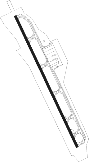
Kushiro
Airport details
| Country | Japan |
| State | Hokkaidō Prefecture |
| Region | RJ |
| Airspace | Fukuoka Ctr |
| Municipality | Kushiro |
| Elevation | 311ft (95m) |
| Timezone | GMT +9 |
| Coordinates | 43.04083, 144.19305 |
| Magnetic var | |
| Type | land |
| Available since | X-Plane v10.40 |
| ICAO code | RJCK |
| IATA code | KUH |
| FAA code | n/a |
Communication
| Kushiro Tower | 126.200 |
| Kushiro Tower | 118.050 |
Approach frequencies
| ILS-cat-III | RW17 | 108.9 | 18.00mi |
| 3° GS | RW17 | 108.9 | 18.00mi |
Nearby Points of Interest:
Kushiro Wetland
-Kushiro-shitsugen National Park
-Lake Akan
Nearby beacons
| code | identifier | dist | bearing | frequency |
|---|---|---|---|---|
| KSE | KUSHIRO VOR/DME | 0.6 | 122° | 112.50 |
| NSE | NAKASHIBETSU VOR/DME | 46.1 | 55° | 111.45 |
| OBE | OBIHIRO VOR/DME | 46.5 | 252° | 109.65 |
| TBE | MEMANBETSU VOR/DME | 50.7 | 358° | 110.85 |
Departure and arrival routes
| Transition altitude | 14000ft |
| Transition level | 14000ft |
| SID end points | distance | outbound heading | |
|---|---|---|---|
| RW17 | |||
| AKESI1 | 30mi | 194° | |
| ERIMO4 | 93mi | 194° | |
| ALICE3 | 140mi | 195° | |
| YUDOH2, TANCH1 | 38mi | 220° | |
| OBE3 | 47mi | 252° | |
| EATAK1, ASHOR1 | 31mi | 272° | |
| RW35 | |||
| AKESI1 | 30mi | 194° | |
| ERIMO4 | 93mi | 194° | |
| ALICE3 | 140mi | 195° | |
| TANCH1, YUDOH2 | 38mi | 220° | |
| OBE3 | 47mi | 252° | |
| ASHOR1, EATAK1 | 31mi | 272° | |
| STAR starting points | distance | inbound heading | |
|---|---|---|---|
| ALL | |||
| CRAARC | 13.3 | 12° | |
| KUSSY | 29.6 | 14° | |
| MENARC | 12.3 | 109° | |
| RW17 | |||
| MARNY | 13.3 | 12° | |
| MENOK | 29.6 | 14° | |
Instrument approach procedures
| runway | airway (heading) | route (dist, bearing) |
|---|---|---|
| RW17-Z | CRANE (12°) | CRANE 3600ft MARIM (7mi, 345°) 3300ft |
| RNAV | MARIM 3300ft MILKY (6mi, 345°) 3300ft CK752 (1mi, 345°) 2864ft CK751 (4mi, 78°) 901ft RJCK (2mi, 152°) 378ft CK753 (9mi, 152°) CRANE (7mi, 237°) 3600ft CRANE (turn) 3600ft | |
| RW35 | CRANE (12°) | CRANE 3600ft NOKKA (7mi, 67°) 1900ft |
| RNAV | NOKKA 1900ft NONNO (5mi, 332°) 1900ft RJCK (6mi, 332°) 340ft CK552 (2mi, 332°) NUPRI (12mi, 263°) 3600ft NUPRI (turn) 3600ft |
Holding patterns
| STAR name | hold at | type | turn | heading* | altitude | leg | speed limit |
|---|---|---|---|---|---|---|---|
| CRAARC | KOTAN | VHF | right | 269 (89)° | 3600ft - 60000ft | DME 6.0mi | 230 |
| CRAARC | MENOK | VHF | right | 306 (126)° | > 3600ft | DME 6.0mi | 230 |
| CRAARC | NUPRI | VHF | right | 283 (103)° | 3600ft - 60000ft | DME 6.0mi | 230 |
| CRAARC | SHORO | VHF | right | 256 (76)° | > 3600ft | DME 6.0mi | 230 |
| MENARC | CRANE | VHF | right | 200 (20)° | 3600ft - 60000ft | DME 6.0mi | 230 |
| MENARC | KOTAN | VHF | right | 269 (89)° | 3600ft - 60000ft | DME 6.0mi | 230 |
| MENARC | NUPRI | VHF | right | 283 (103)° | 3600ft - 60000ft | DME 6.0mi | 230 |
| MENARC | SHORO | VHF | right | 256 (76)° | > 3600ft | DME 6.0mi | 230 |
| *) magnetic outbound (inbound) holding course | |||||||
Disclaimer
The information on this website is not for real aviation. Use this data with the X-Plane flight simulator only! Data taken with kind consent from X-Plane 12 source code and data files. Content is subject to change without notice.