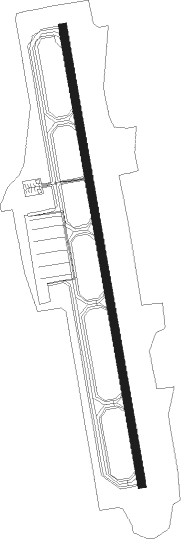
Ōzora - Memanbetsu
Airport details
| Country | Japan |
| State | Hokkaidō Prefecture |
| Region | RJ |
| Airspace | Fukuoka Ctr |
| Municipality | Ozora |
| Elevation | 106ft (32m) |
| Timezone | GMT +9 |
| Coordinates | 43.88055, 144.16417 |
| Magnetic var | |
| Type | land |
| Available since | X-Plane v10.40 |
| ICAO code | RJCM |
| IATA code | MMB |
| FAA code | n/a |
Communication
| Memanbetsu Tower | 126.200 |
| Memanbetsu Tower | 118.850 |
| Memanbetsu Sapporo Control | 128.325 |
Approach frequencies
| ILS-cat-I | RW36 | 110.3 | 18.00mi |
| ILS-cat-I | RW18 | 110.1 | 18.00mi |
| 3° GS | RW36 | 110.3 | 18.00mi |
| 3° GS | RW18 | 110.1 | 18.00mi |
Nearby Points of Interest:
Lake Mashū
-Lake Akan
Nearby beacons
| code | identifier | dist | bearing | frequency |
|---|---|---|---|---|
| TBE | MEMANBETSU VOR/DME | 0.2 | 25° | 110.85 |
| NSE | NAKASHIBETSU VOR/DME | 38.6 | 111° | 111.45 |
| MVE | MONBETSU VOR/DME | 41.8 | 299° | 112.90 |
| KSE | KUSHIRO VOR/DME | 50.8 | 177° | 112.50 |
| TKT | TOKACHI TACAN | 73.5 | 225° | 111.80 |
Departure and arrival routes
| Transition altitude | 14000ft |
| Transition level | 14000ft |
| SID end points | distance | outbound heading | |
|---|---|---|---|
| RW18 | |||
| KSE3 | 51mi | 177° | |
| EATAK3 | 57mi | 220° | |
| SHIBA1 | 69mi | 236° | |
| RW36 | |||
| KSE3 | 51mi | 177° | |
| EATAK3 | 57mi | 220° | |
| SHIBA1 | 69mi | 236° | |
| STAR starting points | distance | inbound heading | |
|---|---|---|---|
| ALL | |||
| QURARC | 13.1 | 124° | |
Instrument approach procedures
| runway | airway (heading) | route (dist, bearing) |
|---|---|---|
| RW18 | OZORA (355°) | OZORA 7000ft SHARO (14mi, 13°) 4300ft |
| RNAV | SHARO 4300ft CM850 (12mi, 13°) 3000ft TENTO (4mi, 317°) 2500ft CM851 (5mi, 238°) 675ft RJCM (2mi, 172°) 156ft RJCM (turn) 600ft RAUSU (13mi, 46°) 3100ft RAUSU (turn) 3100ft |
Holding patterns
| STAR name | hold at | type | turn | heading* | altitude | leg | speed limit |
|---|---|---|---|---|---|---|---|
| QURARC | GINGA | VHF | right | 220 (40)° | > 5400ft | DME 6.0mi | 230 |
| QURARC | QURIO | VHF | right | 322 (142)° | > 4000ft | DME 6.0mi | 230 |
| QURARC | TSUKA | VHF | right | 269 (89)° | > 5000ft | DME 6.0mi | 230 |
| *) magnetic outbound (inbound) holding course | |||||||
Disclaimer
The information on this website is not for real aviation. Use this data with the X-Plane flight simulator only! Data taken with kind consent from X-Plane 12 source code and data files. Content is subject to change without notice.