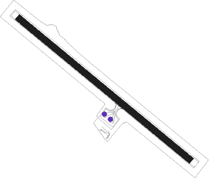
Yakushima
Airport details
| Country | Japan |
| State | Kagoshima Prefecture |
| Region | RJ |
| Airspace | Fukuoka Ctr |
| Municipality | Yakushima |
| Elevation | 122ft (37m) |
| Timezone | GMT +9 |
| Coordinates | 30.38556, 130.65916 |
| Magnetic var | |
| Type | land |
| Available since | X-Plane v10.40 |
| ICAO code | RJFC |
| IATA code | KUM |
| FAA code | n/a |
Communication
| Yakushima ATIS | 127.050 |
Runway info
| Runway 14 / 32 | ||
| length | 1502m (4928ft) | |
| bearing | 130° / 310° | |
| width | 45m (148ft) | |
| surface | asphalt | |
| blast zone | 60m (197ft) / 64m (210ft) | |
Nearby beacons
| code | identifier | dist | bearing | frequency |
|---|---|---|---|---|
| YKE | YAKUSHIMA VOR/DME | 0.4 | 150° | 117 |
| TGE | NAKATANE VOR/DME | 21.5 | 57° | 115.40 |
| JA | KANOYA NDB | 59 | 11° | 238 |
| JAT | KANOYA TACAN | 59.3 | 10° | 113.80 |
Departure and arrival routes
| Transition altitude | 14000ft |
| SID end points | distance | outbound heading | |
|---|---|---|---|
| RW14 | |||
| TGE3, SURF1 | 22mi | 57° | |
| HKC7, AMMON3 | 48mi | 357° | |
| RW32 | |||
| SURF1, TGE3 | 22mi | 57° | |
| AMMON3, HKC7 | 48mi | 357° | |
| STAR starting points | distance | inbound heading | |
|---|---|---|---|
| ALL | |||
| CEDAR, JOMON | 21.5 | 237° | |
Instrument approach procedures
| runway | airway (heading) | route (dist, bearing) |
|---|---|---|
| RW14 | ONSKE (177°) | ONSKE 2000ft MIYAN (9mi, 237°) 1800ft |
| RNAV | MIYAN 1800ft FR14 (6mi, 140°) 1800ft RJFC (6mi, 130°) 162ft (7459mi, 257°) 630ft ONSKE (7453mi, 77°) 2000ft ONSKE (turn) 2000ft |
Disclaimer
The information on this website is not for real aviation. Use this data with the X-Plane flight simulator only! Data taken with kind consent from X-Plane 12 source code and data files. Content is subject to change without notice.
