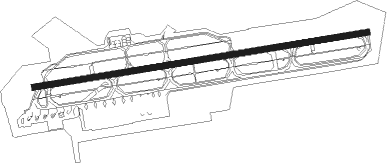
Miyazaki
Airport details
| Country | Japan |
| State | Miyazaki Prefecture |
| Region | RJ |
| Airspace | Fukuoka Ctr |
| Municipality | Miyazaki |
| Elevation | 20ft (6m) |
| Timezone | GMT +9 |
| Coordinates | 31.87722, 131.44861 |
| Magnetic var | |
| Type | land |
| Available since | X-Plane v10.40 |
| ICAO code | RJFM |
| IATA code | KMI |
| FAA code | n/a |
Communication
| Miyazaki ATIS | 126.800 |
| Miyazaki Ground Control | 121.900 |
| Miyazaki Tower | 118.300 |
| Miyazaki Approach | 121.400 |
| Miyazaki Approach | 120.900 |
| Miyazaki Departure | 120.900 |
| Miyazaki Departure | 121.400 |
Approach frequencies
| ILS-cat-I | RW27 | 108.9 | 18.00mi |
| 3° GS | RW27 | 108.9 | 18.00mi |
Nearby Points of Interest:
Saitobaru kofungun
Nearby beacons
| code | identifier | dist | bearing | frequency |
|---|---|---|---|---|
| MZE | MIYAZAKI VOR/DME | 0.5 | 278° | 112.40 |
| NHT | NYUTABARU TACAN | 12.1 | 1° | 115 |
| ZZT | NYUTABARU TACAN | 12.2 | 2° | 135.90 |
| KGE | KAJIKI (KAGOSHIMA) VOR/DME | 37.1 | 264° | 115.70 |
| JA | KANOYA NDB | 43.8 | 229° | 238 |
| JAT | KANOYA TACAN | 44.2 | 230° | 113.80 |
| HKC | KAGOSHIMA VORTAC | 45.4 | 258° | 113.30 |
| KUE | KUMAMOTO VOR/DME | 65.2 | 328° | 112.80 |
Departure and arrival routes
| Transition altitude | 14000ft |
| Transition level | 14000ft |
| SID end points | distance | outbound heading | |
|---|---|---|---|
| RW09 | |||
| SIIBA1 | 46mi | 9° | |
| KIZAK2 | 51mi | 75° | |
| JACKY1 | 29mi | 128° | |
| SASIK3, KIRIS1 | 54mi | 294° | |
| RW27 | |||
| SIIBA1 | 46mi | 9° | |
| KIZAK2 | 51mi | 75° | |
| JACKY1 | 29mi | 128° | |
| KIRIS1, SASIK3 | 54mi | 294° | |
| STAR starting points | distance | inbound heading | |
|---|---|---|---|
| ALL | |||
| KARAH, MELAR | 35.3 | 147° | |
| OTOHIM, RYUGU | 31.5 | 254° | |
Instrument approach procedures
| runway | airway (heading) | route (dist, bearing) |
|---|---|---|
| RW09-X | MELAR (146°) | MELAR 5200ft IKIME (7mi, 154°) 3100ft |
| RNAV | IKIME 3100ft FM955 (3mi, 181°) 2500ft FM956 (2mi, 181°) 1840ft FM952 (3mi, 128°) 684ft RJFM (3mi, 86°) 65ft OYODO (12mi, 86°) 4000ft OYODO (turn) | |
| RW09-Y | OYODO (266°) | OYODO 4000ft SURFU (10mi, 252°) 3500ft |
| RNAV | SURFU 3500ft FM953 (3mi, 252°) 3500ft FM954 (1mi, 252°) 3064ft FM952 (4mi, 345°) 684ft RJFM (3mi, 86°) 65ft OYODO (12mi, 86°) 4000ft OYODO (turn) | |
| RW09-Z | OYODO (266°) | OYODO 4000ft HIMKA (11mi, 287°) 3500ft |
| RNAV | HIMKA 3500ft FM950 (3mi, 266°) 3500ft FM951 (2mi, 266°) 2865ft FM952 (4mi, 174°) 684ft RJFM (3mi, 86°) 65ft OYODO (12mi, 86°) 4000ft OYODO (turn) | |
| RW27 | KARAH (242°) | KARAH 1800ft MENYA (3mi, 217°) |
| RNAV | MENYA FM750 (2mi, 217°) FM751 (1mi, 231°) 1800ft FM752 (turn) 1453ft RJFM (5mi, 266°) 75ft RJFM (turn) 500ft OYODO (12mi, 86°) 2000ft OYODO (turn) 2000ft |
Disclaimer
The information on this website is not for real aviation. Use this data with the X-Plane flight simulator only! Data taken with kind consent from X-Plane 12 source code and data files. Content is subject to change without notice.
