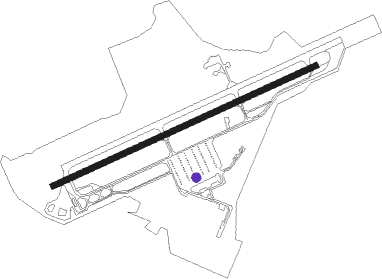
Tsuiki
Airport details
| Country | Japan |
| State | Toyama Prefecture |
| Region | RJ |
| Airspace | Fukuoka Ctr |
| Municipality | Yukuhashi |
| Elevation | 55ft (17m) |
| Timezone | GMT +9 |
| Coordinates | 33.68500, 131.04028 |
| Magnetic var | |
| Type | land |
| Available since | X-Plane v10.40 |
| ICAO code | RJFZ |
| IATA code | n/a |
| FAA code | n/a |
Communication
| Tsuiki Tower | 126.200 |
| Tsuiki TCA | 127.950 |
| Tsuiki Approach | 120.100 |
| Tsuiki Departure | 120.100 |
Nearby Points of Interest:
Kawachi Dam
-Former Moji Mitsui Club
-Kanmon Straits
-Shimonoseki Nabechō Post Office
-Kōzan-ji
-Usa Jingū
-Sumiyoshi Jinja
-Dazaifu Gakkōin
-Ōno Castle
-Dazaifu
-Imamura Church
-Mizuki
-Kashii-gū
-Kii Castle
-Hakozaki Shrine
-Institute for Geothermal Sciences, Graduate School of Sciences, Kyoto University
Runway info
| Runway 07 / 25 | ||
| length | 2250m (7382ft) | |
| bearing | 73° / 253° | |
| width | 46m (150ft) | |
| surface | concrete | |
| blast zone | 136m (446ft) / 111m (364ft) | |
Nearby beacons
| code | identifier | dist | bearing | frequency |
|---|---|---|---|---|
| TQT | TSUIKI TACAN | 0.2 | 306° | 110.40 |
| SWE | SUOH (KITAKYUSHU) VOR/DME | 10.3 | 356° | 113.85 |
| UBE | UBE (YAMAGUCHI) VOR/DME | 19.3 | 44° | 110.80 |
| OCT | OZUKI (SHIMONOSEKI) TACAN | 21.5 | 2° | 112.15 |
| AHT | ASHIYA TACAN | 22.9 | 297° | 108.60 |
| DGC | FUKUOKA VORTAC | 32.5 | 269° | 114.50 |
| FMT | HOFU TACAN | 32.9 | 55° | 113 |
| TFE | MUSASHI (OITA) VOR/DME | 36.3 | 106° | 117.70 |
| SGE | SAGA VOR/DME | 49.4 | 234° | 114.75 |
| KUE | KUMAMOTO VOR/DME | 52 | 193° | 112.80 |
| IME | IWAMI VOR/DME | 69.9 | 37° | 115.05 |
Departure and arrival routes
| Transition altitude | 14000ft |
| Transition level | 14000ft |
| SID end points | distance | outbound heading | |
|---|---|---|---|
| RW07 | |||
| MIT3 | 65mi | 5° | |
| IWT5 | 60mi | 70° | |
| HIMES3 | 36mi | 106° | |
| NAKA2R | 39mi | 236° | |
| RW25 | |||
| MIT3 | 65mi | 5° | |
| IWT5 | 60mi | 70° | |
| HIMES3 | 36mi | 106° | |
| NAKA2R | 39mi | 236° | |
| STAR starting points | distance | inbound heading | |
|---|---|---|---|
| RW07 | |||
| HIMEH | 28.8 | 265° | |
| RW25 | |||
| HIMEH | 28.8 | 265° | |
Disclaimer
The information on this website is not for real aviation. Use this data with the X-Plane flight simulator only! Data taken with kind consent from X-Plane 12 source code and data files. Content is subject to change without notice.