Nagoya
Airport details
| Country | Japan |
| State | Aichi Prefecture |
| Region | RJ |
| Airspace | Fukuoka Ctr |
| Municipality | Toyoyama |
| Elevation | 42ft (13m) |
| Timezone | GMT +9 |
| Coordinates | 35.24989, 136.92390 |
| Magnetic var | |
| Type | land |
| Available since | X-Plane v10.40 |
| ICAO code | RJNA |
| IATA code | NKM |
| FAA code | n/a |
Communication
| Nagoya Clearance DEL | 121.750 |
| Nagoya Ground Control | 121.700 |
| Nagoya Tower | 118.700 |
| Nagoya Tower | 122.700 |
| Nagoya Tower | 123.100 |
| Nagoya Approach | 119.250 |
| Nagoya Approach | 121.050 |
| Nagoya Approach | 121.175 |
| Nagoya Approach | 119.175 |
| Nagoya Approach | 125.550 |
| Nagoya Departure | 121.225 |
Approach frequencies
| ILS-cat-I | RW34 | 108.9 | 18.00mi |
| 3° GS | RW34 | 108.9 | 18.00mi |
Nearby Points of Interest:
Former Nagoya Court of Appeals Building
-Nagoya City Hall
-Kureha-za Theater
-Jo-an
-Nagatsuka Kofun
-Water Museum
-Water Experience learning Museum
-Ruins of Miroku-ji
-Okazaki City Kyodokan
-Hikone screen
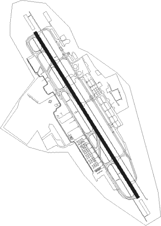
Runway info
| Runway 16 / 34 | ||
| length | 2742m (8996ft) | |
| bearing | 148° / 328° | |
| width | 45m (148ft) | |
| surface | asphalt | |
| blast zone | 77m (253ft) / 91m (299ft) | |
Nearby beacons
| code | identifier | dist | bearing | frequency |
|---|---|---|---|---|
| KCC | NAGOYA VORTAC | 1 | 330° | 114.20 |
| GFT | GIFU TACAN | 9.1 | 335° | 109.40 |
| CBE | CHUBU VOR/DME | 24.2 | 197° | 117.80 |
| CTE | CHITA VOR/DME | 25.1 | 195° | 115.35 |
| XMT | KOWA TACAN | 32.7 | 176° | 113.50 |
| AK | AKENO NDB | 44.7 | 197° | 380 |
| AKT | AKENO TACAN | 45 | 199° | 112.05 |
| WWT | HAMAMATSU TACAN | 48.8 | 123° | 135.90 |
| LHT | HAMAMATSU TACAN | 49 | 123° | 114.70 |
| MBE | MATSUMOTO VOR/DME | 72.9 | 48° | 117.60 |
Departure and arrival routes
| Transition altitude | 14000ft |
| Transition level | 14000ft |
| SID end points | distance | outbound heading | |
|---|---|---|---|
| RW16 | |||
| HOUBA4 | 87mi | 31° | |
| MORIZ5 | 49mi | 123° | |
| TALMI4 | 99mi | 264° | |
| IBUKI4 | 41mi | 336° | |
| RW34 | |||
| HOUBA4 | 87mi | 31° | |
| MORIZ5 | 49mi | 123° | |
| TALMI4 | 99mi | 264° | |
| IBUKI4 | 41mi | 336° | |
| STAR starting points | distance | inbound heading | |
|---|---|---|---|
| ALL | |||
| EXPOHS, ORIBES | 59.1 | 20° | |
| SHINO | 45.7 | 78° | |
| ORIBEE | 30.2 | 237° | |
| EXPOHN | 18.6 | 248° | |
Instrument approach procedures
| runway | airway (heading) | route (dist, bearing) |
|---|---|---|
| RW16 | DIMAC (148°) | DIMAC 5600ft MONET (3mi, 147°) 2900ft |
| RW16 | ORIBE (177°) | ORIBE 6000ft MONET (8mi, 240°) 2900ft |
| RW16 | SHINO (127°) | SHINO 5100ft MONET (6mi, 67°) 2900ft |
| RNAV | MONET 2900ft AQTOH (9mi, 147°) 2000ft RJNA (7mi, 149°) 102ft (7605mi, 256°) 550ft NA651 (7602mi, 76°) KCC (6mi, 49°) 3000ft KCC (turn) 3000ft |
Holding patterns
| STAR name | hold at | type | turn | heading* | altitude | leg | speed limit |
|---|---|---|---|---|---|---|---|
| ORIBES | RYUDO | VHF | right | 165 (345)° | > 6000ft | DME 6.3mi | 230 |
| *) magnetic outbound (inbound) holding course | |||||||
Disclaimer
The information on this website is not for real aviation. Use this data with the X-Plane flight simulator only! Data taken with kind consent from X-Plane 12 source code and data files. Content is subject to change without notice.