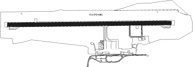
Tottori
Airport details
| Country | Japan |
| State | Tottori Prefecture |
| Region | RJ |
| Airspace | Fukuoka Ctr |
| Municipality | Tottori |
| Elevation | 62ft (19m) |
| Timezone | GMT +9 |
| Coordinates | 35.53000, 134.16499 |
| Magnetic var | |
| Type | land |
| Available since | X-Plane v10.40 |
| ICAO code | RJOR |
| IATA code | TTJ |
| FAA code | n/a |
Communication
| Tottori RJOR_Tower | 118.150 |
Approach frequencies
| ILS-cat-I | RW10 | 111.5 | 18.00mi |
| 3° GS | RW10 | 111.5 | 18.00mi |
Nearby Points of Interest:
Nagusa Shrine
-Teiko Shiotani Memorial Photo Gallery
Nearby beacons
| code | identifier | dist | bearing | frequency |
|---|---|---|---|---|
| TRE | TOTTORI VOR/DME | 0.1 | 182° | 110.20 |
| YGE | YONAGO VOR/DME | 44.4 | 268° | 117.30 |
| YME | MIYAZU VOR/DME | 47.6 | 93° | 112.60 |
| OYE | KIBI VOR/DME | 49.5 | 203° | 111 |
| OKT | OKAYAMA TACAN | 52 | 190° | 115.90 |
| OIE | OKI VOR/DME | 56.4 | 308° | 109.25 |
Departure and arrival routes
| Transition altitude | 14000ft |
| Transition level | 14000ft |
| SID end points | distance | outbound heading | |
|---|---|---|---|
| RW10 | |||
| AYABE3, YME1 | 48mi | 93° | |
| RW28 | |||
| AYABE3, YME1 | 48mi | 93° | |
Instrument approach procedures
| runway | airway (heading) | route (dist, bearing) |
|---|---|---|
| RW28 | KANNA (273°) | KANNA 7000ft ISASA (13mi, 319°) 6000ft |
| RNAV | ISASA 6000ft OR850 (6mi, 278°) OR851 (7mi, 250°) OR852 (5mi, 191°) 2100ft OR853 (1mi, 191°) 1661ft OR854 (3mi, 237°) 603ft RJOR (2mi, 273°) 115ft RJOR (turn) 700ft ISASA (20mi, 67°) 6000ft ISASA (turn) |
Disclaimer
The information on this website is not for real aviation. Use this data with the X-Plane flight simulator only! Data taken with kind consent from X-Plane 12 source code and data files. Content is subject to change without notice.
