Sendai
Airport details
| Country | Japan |
| State | Miyagi Prefecture |
| Region | RJ |
| Airspace | Fukuoka Ctr |
| Municipality | Natori |
| Elevation | 15ft (5m) |
| Timezone | GMT +9 |
| Coordinates | 38.13972, 140.91695 |
| Magnetic var | |
| Type | land |
| Available since | X-Plane v10.40 |
| ICAO code | RJSS |
| IATA code | SDJ |
| FAA code | n/a |
Communication
| SENDAI ATIS | 126.450 |
| SENDAI Ground Control | 121.700 |
| SENDAI Tower | 118.700 |
| SENDAI Tower | 126.200 |
| SENDAI Approach | 120.400 |
| SENDAI TCA | 121.025 |
| SENDAI Departure | 120.000 |
Approach frequencies
| ILS-cat-I | RW27 | 111.7 | 18.00mi |
| 3° GS | RW27 | 111.7 | 18.00mi |
Nearby Points of Interest:
Mutsu Kokubun-niji
-Shiogama Jinja
-Matsushima
-Entsū-in
-Former Kameoka Family Home
-Jōmon Goddess
-Motoki Stone Torii
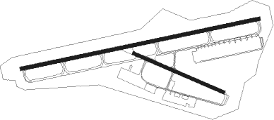
Runway info
Runway 09 / 27  | ||
| length | 2995m (9826ft) | |
| bearing | 84° / 264° | |
| width | 45m (148ft) | |
| surface | asphalt | |
| blast zone | 60m (197ft) / 67m (220ft) | |
| Runway 12 / 30 | ||
| length | 1200m (3937ft) | |
| bearing | 113° / 293° | |
| width | 45m (148ft) | |
| surface | asphalt | |
| blast zone | 59m (194ft) / 89m (292ft) | |
Nearby beacons
| code | identifier | dist | bearing | frequency |
|---|---|---|---|---|
| SDE | SENDAI VOR/DME | 0.2 | 104° | 116.30 |
| MXT | MATSUSHIMA TACAN | 21.5 | 49° | 114.30 |
| YTE | YAMAGATA VOR/DME | 30.3 | 294° | 113 |
| FKE | FUKUSHIMA VOR/DME | 59.5 | 208° | 113.45 |
| IXE | IWAKI VOR/DME | 59.5 | 177° | 117.70 |
Departure and arrival routes
| Transition altitude | 14000ft |
| Transition level | 14000ft |
| SID end points | distance | outbound heading | |
|---|---|---|---|
| RW09 | |||
| CUBIC4 | 123mi | 1° | |
| IXE8 | 60mi | 177° | |
| STEED4 | 41mi | 218° | |
| DERBY4 | 30mi | 294° | |
| RW12 | |||
| IXE8 | 60mi | 177° | |
| RW27 | |||
| CUBIC4 | 123mi | 1° | |
| IXE8 | 60mi | 177° | |
| STEED4 | 41mi | 218° | |
| DERBY4 | 30mi | 294° | |
| RW30 | |||
| IXE8 | 60mi | 177° | |
| STAR starting points | distance | inbound heading | |
|---|---|---|---|
| ALL | |||
| PERID | 12.2 | 301° | |
| RW09 | |||
| OWLETW | 30.7 | 51° | |
| LANCEW | 25.1 | 62° | |
| RW27 | |||
| OWLEEB, OWLEEA | 30.7 | 51° | |
| LANCEB, LANCEA | 25.1 | 62° | |
Instrument approach procedures
| runway | airway (heading) | route (dist, bearing) |
|---|---|---|
| RW09-Y | SHIPS (62°) | SHIPS 4000ft TILES (6mi, 16°) 2500ft |
| RNAV | TILES 2500ft SUGOH (5mi, 76°) 1700ft RJSS (6mi, 84°) 62ft SS901 (4mi, 83°) AOBAR (10mi, 135°) 3000ft AOBAR (turn) 3000ft | |
| RW09-Z | SHIPS (62°) | SHIPS 4000ft TILES (6mi, 16°) 2500ft |
| RNAV | TILES 2500ft SUGOH (5mi, 76°) 1700ft SDF1 (1mi, 84°) 1315ft SDF2 (turn) 962ft RJSS (4mi, 85°) 62ft SS901 (4mi, 83°) AOBAR (10mi, 135°) 3000ft AOBAR (turn) 3000ft |
Holding patterns
| STAR name | hold at | type | turn | heading* | altitude | leg | speed limit |
|---|---|---|---|---|---|---|---|
| LANCEA | LANCE | VHF | right | 287 (107)° | 11000ft - 14000ft | 1.0min timed | 230 |
| LANCEB | LANCE | VHF | right | 287 (107)° | 11000ft - 14000ft | 1.0min timed | 230 |
| LANCEW | LANCE | VHF | right | 287 (107)° | 11000ft - 14000ft | 1.0min timed | 230 |
| OWLEEA | OWLET | VHF | right | 260 (80)° | 13000ft - 14000ft | 1.0min timed | 230 |
| OWLEEB | OWLET | VHF | right | 260 (80)° | 13000ft - 14000ft | 1.0min timed | 230 |
| OWLETW | OWLET | VHF | right | 260 (80)° | 13000ft - 14000ft | 1.0min timed | 230 |
| PERID | AOBAR | VHF | left | 135 (315)° | 3000ft - 60000ft | DME 7.0mi | 230 |
| PERID | PERID | VHF | left | 89 (269)° | 1500ft - 60000ft | DME 6.0mi | 230 |
| *) magnetic outbound (inbound) holding course | |||||||
Disclaimer
The information on this website is not for real aviation. Use this data with the X-Plane flight simulator only! Data taken with kind consent from X-Plane 12 source code and data files. Content is subject to change without notice.