Izu Oshima - Oshima
Airport details
| Country | Japan |
| State | Tōkyō Prefecture |
| Region | RJ |
| Airspace | Fukuoka Ctr |
| Municipality | Tokyo |
| Elevation | 124ft (38m) |
| Timezone | GMT +9 |
| Coordinates | 34.78194, 139.36028 |
| Magnetic var | |
| Type | land |
| Available since | X-Plane v10.40 |
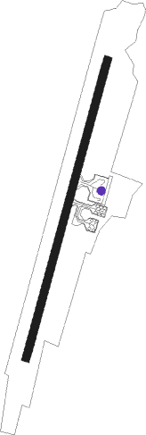
| ICAO code | RJTO |
| IATA code | OIM |
| FAA code | n/a |
Communication
| Oshima Oshima Radio | 118.600 |
| Oshima Oshima Radio | 126.200 |
Approach frequencies
| LOC | RW03 | 109.35 | 18.00mi |
Nearby Points of Interest:
Azusawakejinja-no-Okusu
-Yamagami no Jusō
-Nirayama Daikansho
-Mount Higane
-Jukkoku Pass
-Tateyama Bay
-Hayakawa no Biranju
-Numazu Imperial Villa Memorial Park
-Kakita River
-Kanrei Dōmon
-Hakone Tozan Line
-Moto-Hakone Stone Buddhas
-Fukara Irrigation Canal
Nearby beacons
| code | identifier | dist | bearing | frequency |
|---|---|---|---|---|
| OSE | MIHARA (OSHIMA) VOR/DME | 0.4 | 38° | 109.85 |
| XAC | OSHIMA VORTAC | 4.9 | 142° | 113.10 |
| TET | TATEYAMA TACAN | 26.1 | 68° | 108.80 |
| NJT | NIIJIMA TACAN | 26.4 | 192° | 116.50 |
| PQD | DME | 28.1 | 73° | 112.50 |
| HYD | DME | 30.5 | 26° | 116.20 |
| NJA | ATSUGI TACAN | 40.1 | 8° | 115.10 |
| MOE | OYAMA VOR/DME | 43.8 | 164° | 108.65 |
| KZT | KISARAZU TACAN | 45.6 | 42° | 110.05 |
| HME | HANEDA (TOKYO) VOR/DME | 50.8 | 27° | 112.20 |
| TNT | TACHIKAWA TACAN | 56.1 | 2° | 115.80 |
| TN | SHIN-TACHIKAWA NDB | 56.2 | 2° | 366 |
| YOK | YOKOTA (TOKYO) TACAN | 58 | 359° | 113.80 |
Departure and arrival routes
| Transition altitude | 14000ft |
| Transition level | 14000ft |
| SID end points | distance | outbound heading | |
|---|---|---|---|
| RW03 | |||
| HATSU4 | 14mi | 35° | |
| RW21 | |||
| HATSU4 | 14mi | 35° | |
Disclaimer
The information on this website is not for real aviation. Use this data with the X-Plane flight simulator only! Data taken with kind consent from X-Plane 12 source code and data files. Content is subject to change without notice.