Seoul - Gimpo
Airport details
| Country | South Korea |
| State | Seoul Teugbyeolsi |
| Region | RK |
| Airspace | Incheon Ctr |
| Municipality | Seoul |
| Elevation | 58ft (18m) |
| Timezone | GMT +9 |
| Coordinates | 37.55593, 126.78712 |
| Magnetic var | |
| Type | land |
| Available since | X-Plane v10.40 |
| ICAO code | RKSS |
| IATA code | GMP |
| FAA code | n/a |
Communication
| Gimpo ATIS | 126.400 |
| Gimpo Delivery | 121.975 |
| Gimpo Ground Control | 121.900 |
| Gimpo Ground Control | 121.950 |
| Gimpo Gimpo Tower | 118.050 |
| Gimpo GMP Tower | 118.100 |
| Gimpo SEOUL Approach | 119.900 |
| Gimpo SEOUL Approach | 119.050 |
| Gimpo SEOUL Approach | 120.800 |
| Gimpo SEOUL Approach | 119.100 |
| Gimpo SEOUL Approach | 121.350 |
| Gimpo SEOUL Approach | 119.750 |
| Gimpo SEOUL Approach | 124.200 |
| Gimpo Seoul Departure | 121.400 |
| Gimpo Seoul Departure | 124.800 |
| Gimpo Seoul Departure | 125.150 |
Approach frequencies
| ILS-cat-III | RW14R | 108.7 | 18.00mi |
| ILS-cat-I | RW32L | 108.3 | 18.00mi |
| ILS-cat-I | RW14L | 109.9 | 18.00mi |
| ILS-cat-I | RW32R | 110.7 | 18.00mi |
| 3° GS | RW32L | 108.3 | 18.00mi |
| 3° GS | RW14R | 108.7 | 18.00mi |
| 3° GS | RW14L | 109.9 | 18.00mi |
| 3° GS | RW32R | 110.7 | 18.00mi |
Nearby Points of Interest:
Injo Byeolseo Yugibi
-Seosamneung
-Yi Sangbeom's House and Atelier in Nuha-dong, Seoul
-Seoul municipal council
-Seoul City Hall
-Cheonggyecheon
-Myeonje baegab
Runway info
Runway 14L / 32R  | ||
| length | 3603m (11821ft) | |
| bearing | 129° / 309° | |
| width | 45m (148ft) | |
| surface | asphalt | |
| blast zone | 120m (394ft) / 120m (394ft) | |
| Runway 14R / 32L | ||
| length | 3198m (10492ft) | |
| bearing | 129° / 309° | |
| width | 60m (197ft) | |
| surface | asphalt | |
| blast zone | 119m (390ft) / 117m (384ft) | |
Airport layout
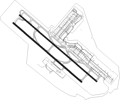
Taxiway locations
Parking locations
|
Nearby beacons
| code | identifier | dist | bearing | frequency |
|---|---|---|---|---|
| KIP | GIMPO (SEOUL) VOR/DME | 0.2 | 72° | 113.60 |
| SEL | ANYANG VORTAC | 10.8 | 135° | 115.50 |
| YJU | YANGJU VOR/DME | 15 | 47° | 114.90 |
| KSM | SEOUL VOR/DME | 16.7 | 108° | 109.80 |
| SOL | SEOUL TACAN | 16.7 | 108° | 111.20 |
| NCN | INCHEON VOR/DME | 17.3 | 260° | 113.80 |
| WNG | WANGSAN (SEOUL) VOR/DME | 17.6 | 250° | 112.90 |
| SWN | SUWON TACAN | 21.5 | 146° | 108.50 |
| SOT | SONGTAN VORTAC | 30 | 152° | 116.90 |
| PTK | PYONGTAEK VOR/DME | 36.6 | 159° | 108.20 |
| CJ | CHUCHON NDB | 48.7 | 71° | 360 |
| SAN | SEOSAN TACAN | 52.9 | 200° | 111.50 |
| CHO | CHEONGJU VOR/DME | 60.6 | 140° | 109 |
| CHJ | CHEONGJU TACAN | 61 | 140° | 110.50 |
Departure and arrival routes
| Transition altitude | 14000ft |
| Transition level | 14000ft |
| SID end points | distance | outbound heading | |
|---|---|---|---|
| RW14 (ALL) | |||
| SOT1E | 30mi | 152° | |
| RW14L | |||
| EGOB1U | 29mi | 97° | |
| OSPO1Z, OSPO1U | 51mi | 142° | |
| BULT1Z, BULT1U | 50mi | 177° | |
| NOPI1U | 55mi | 262° | |
| RW14R | |||
| EGOB1U | 29mi | 97° | |
| OSPO1U, OSPO1Z | 51mi | 142° | |
| BULT1Z, BULT1U | 50mi | 177° | |
| NOPI1U | 55mi | 262° | |
| RW32 (ALL) | |||
| KARB1W | 42mi | 91° | |
| SOT1W | 30mi | 152° | |
| RW32L | |||
| EGOB1Q, EGOB1T | 29mi | 97° | |
| OSPO1T, OSPO1Q | 51mi | 142° | |
| BULT1Q, BULT1T | 50mi | 177° | |
| NOPI1T, NOPI1Q | 55mi | 262° | |
| RW32R | |||
| EGOB1T, EGOB1Q | 29mi | 97° | |
| OSPO1Q, OSPO1T | 51mi | 142° | |
| BULT1T, BULT1Q | 50mi | 177° | |
| NOPI1Q, NOPI1T | 55mi | 262° | |
| STAR starting points | distance | inbound heading | |
|---|---|---|---|
| RW14 (ALL) | |||
| REBI1Z, REBI1U | 65.6 | 75° | |
| LEGA1U | 98.1 | 76° | |
| KARB1U | 41.7 | 271° | |
| GUKD1U | 51.9 | 302° | |
| OLME1U | 50.1 | 346° | |
| RW32 (ALL) | |||
| REBI1T, REBI1Q | 65.6 | 75° | |
| LEGA1T | 98.1 | 76° | |
| KARB1T | 41.7 | 271° | |
| GUKD1T | 51.9 | 302° | |
| OLME1T | 50.1 | 346° | |
Instrument approach procedures
| runway | airway (heading) | route (dist, bearing) |
|---|---|---|
| RW14L | DOKDO (102°) | DOKDO 4000ft GU009 (6mi, 51°) 2800ft |
| RNAV | GU009 2800ft GU004 (5mi, 128°) 1400ft GU002 (2mi, 128°) 840ft RKSS (3mi, 134°) 88ft DU994 (5mi, 126°) DU987 (7mi, 230°) DOKDO (15mi, 310°) 4000ft DOKDO (turn) 5000ft | |
| RW14R | DOKDO (102°) | DOKDO 4000ft DU009 (6mi, 51°) 2800ft |
| RNAV | DU009 2800ft DU004 (5mi, 128°) 1400ft DU002 (2mi, 128°) 840ft RKSS (3mi, 131°) 84ft DU994 (5mi, 126°) DU987 (7mi, 230°) DOKDO (15mi, 310°) 4000ft DOKDO (turn) 5000ft | |
| RW32L | BUMSI (308°) | BUMSI 8000ft PUDUB (7mi, 309°) 5500ft WONKO (5mi, 309°) 4000ft |
| RW32L | KT023 (284°) | KT023 7000ft KT018 (5mi, 254°) 5500ft WONKO (5mi, 255°) 4000ft |
| RW32L | PT022 (349°) | PT022 7000ft PT017 (5mi, 52°) 5500ft WONKO (5mi, 51°) 4000ft |
| RNAV | WONKO 4000ft DT009 (4mi, 309°) 2800ft DT007 (2mi, 309°) 2300ft DT006 (1mi, 309°) 2000ft RKSS (7mi, 307°) 91ft DT993 (7mi, 311°) CAVOI (9mi, 233°) 4000ft CAVOI (turn) 6000ft | |
| RW32R | BUMSI (308°) | BUMSI 8000ft PUDUB (7mi, 309°) 5500ft MOBAK (5mi, 311°) 4000ft |
| RW32R | KT023 (284°) | KT023 7000ft KT018 (5mi, 254°) 5500ft MOBAK (5mi, 254°) 4000ft |
| RW32R | PT022 (349°) | PT022 7000ft PT017 (5mi, 52°) 5500ft MOBAK (5mi, 52°) 4000ft |
| RNAV | MOBAK 4000ft GT009 (4mi, 309°) 2800ft GT007 (2mi, 309°) 2300ft GT006 (1mi, 309°) 2000ft RKSS (7mi, 306°) 92ft DT993 (7mi, 311°) CAVOI (9mi, 233°) 4000ft CAVOI (turn) 6000ft |
Holding patterns
| STAR name | hold at | type | turn | heading* | altitude | leg | speed limit |
|---|---|---|---|---|---|---|---|
| GUKD1T | BUMSI | VHF | right | 144 (324)° | > 8000ft | 1.0min timed | 230 |
| GUKD1U | DOKDO | VHF | right | 144 (324)° | 4000ft - 5000ft | 1.0min timed | 200 |
| GUKD1U | DU063 | VHF | left | 134 (314)° | > 13000ft | 1.0min timed | 230 |
| KARB1T | BUMSI | VHF | right | 144 (324)° | > 8000ft | 1.0min timed | 230 |
| KARB1U | DOKDO | VHF | right | 144 (324)° | 4000ft - 5000ft | 1.0min timed | 200 |
| KARB1U | EGOBA | VHF | right | 87 (267)° | 16000ft - 18000ft | DME 10.0mi | 230 |
| OLME1T | BUMSI | VHF | right | 144 (324)° | > 8000ft | 1.0min timed | 230 |
| OLME1U | DOKDO | VHF | right | 144 (324)° | 4000ft - 5000ft | 1.0min timed | 200 |
| OLME1U | DU063 | VHF | left | 134 (314)° | > 13000ft | 1.0min timed | 230 |
| REBI1Q | BUMSI | VHF | right | 144 (324)° | > 8000ft | 1.0min timed | 230 |
| REBI1Q | REBIT | VHF | right | 278 (98)° | > 13000ft | 1.5min timed | 250 |
| REBI1T | BUMSI | VHF | right | 144 (324)° | > 8000ft | 1.0min timed | 230 |
| REBI1T | REBIT | VHF | right | 278 (98)° | > 13000ft | 1.5min timed | 250 |
| REBI1U | DOKDO | VHF | right | 144 (324)° | 4000ft - 5000ft | 1.0min timed | 200 |
| REBI1U | REBIT | VHF | right | 278 (98)° | > 13000ft | 1.5min timed | 250 |
| REBI1Z | DOKDO | VHF | right | 144 (324)° | 4000ft - 5000ft | 1.0min timed | 200 |
| REBI1Z | REBIT | VHF | right | 278 (98)° | > 13000ft | 1.5min timed | 250 |
| *) magnetic outbound (inbound) holding course | |||||||
Disclaimer
The information on this website is not for real aviation. Use this data with the X-Plane flight simulator only! Data taken with kind consent from X-Plane 12 source code and data files. Content is subject to change without notice.