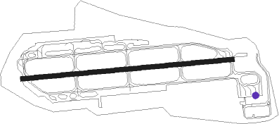
Pohang
Airport details
| Country | South Korea |
| State | Gyeongsangbukdo |
| Region | RK |
| Airspace | Incheon Ctr |
| Municipality | Pohang-si |
| Elevation | 75ft (23m) |
| Timezone | GMT +9 |
| Coordinates | 35.98778, 129.41861 |
| Magnetic var | |
| Type | land |
| Available since | X-Plane v10.40 |
| ICAO code | RKTH |
| IATA code | KPO |
| FAA code | n/a |
Communication
| Pohang ATIS | 127.400 |
| Pohang Ground Control | 126.200 |
| Pohang Tower | 118.050 |
| Pohang Approach | 124.250 |
| Pohang Approach | 120.200 |
Approach frequencies
| LOC | RW10 | 110.9 | 18.00mi |
Nearby Points of Interest:
Yangdong Folk Village
-Anapji
-Banwolseong
-Seokguram Grotto and Bulguksa Temple
-Gyeongju Historic Areas
-Namsan
-Cheonjeon-ri petroglyphs
-Bangudae Petroglyphs
-Eunhaesa
Nearby beacons
| code | identifier | dist | bearing | frequency |
|---|---|---|---|---|
| NPH | NAVY (POHANG) VORTAC | 0.4 | 262° | 109.60 |
| KPO | POHANG VORTAC | 2.7 | 101° | 112.50 |
| USN | ULSAN VOR/DME | 23.5 | 190° | 111.40 |
| US | ULSAN NDB | 24.9 | 189° | 335 |
| DOC | DONGCHON VOR/DME | 38.1 | 264° | 116.50 |
| TGU | DALSEONG VORTAC | 41.6 | 258° | 112.20 |
| UJN | ULJIN VORTAC | 47.4 | 3° | 115.30 |
| KMH | GIMHAE VOR/DME | 52.9 | 211° | 113.80 |
| KHE | KIMHAE (BUSAN) TACAN | 53.6 | 210° | 117 |
| PSN | BUSAN VORTAC | 55.8 | 206° | 114 |
Departure and arrival routes
| Transition altitude | 14000ft |
| Transition level | 14000ft |
| SID end points | distance | outbound heading | |
|---|---|---|---|
| RW10 | |||
| DORTI1, POHAN3 | 21mi | 2° | |
| RW28 | |||
| MARMI1, POHAN4 | 21mi | 2° | |
Instrument approach procedures
| runway | airway (heading) | route (dist, bearing) |
|---|---|---|
| RW10 | ELAPI (121°) | ELAPI IGASA (24mi, 115°) 5000ft TH501 (6mi, 237°) 4300ft RUNSA (6mi, 179°) 3600ft |
| RW10 | LOSTO (182°) | LOSTO IGASA (14mi, 218°) 5000ft TH501 (6mi, 237°) 4300ft RUNSA (6mi, 179°) 3600ft |
| RNAV | RUNSA 3600ft TH503 (3mi, 89°) 2600ft KADIL (3mi, 89°) 1800ft TH505 (2mi, 89°) 1180ft VISET (2mi, 89°) 598ft TH531 (6mi, 89°) RUTON (9mi, 11°) 6000ft RUTON (turn) 6000ft | |
| RW28 | APARU (24°) | APARU DOKPA (32mi, 42°) 5000ft TH702 (6mi, 62°) 4000ft SABUM (6mi, 359°) 3000ft |
| RW28 | BULGA (277°) | BULGA RUTON (19mi, 305°) 6000ft TH701 (6mi, 117°) 4500ft SABUM (6mi, 179°) 3000ft |
| RW28 | LOSTO (182°) | LOSTO RUTON (13mi, 153°) 6000ft TH701 (6mi, 117°) 4500ft SABUM (6mi, 179°) 3000ft |
| RW28 | RUTON (217°) | RUTON 6000ft TH701 (6mi, 117°) 4500ft SABUM (6mi, 179°) 3000ft |
| RNAV | SABUM 3000ft VELKI (5mi, 269°) 1800ft PAPTO (3mi, 269°) 594ft TH731 (5mi, 269°) IGASA (10mi, 333°) 5000ft IGASA (turn) 6000ft |
Holding patterns
| STAR name | hold at | type | turn | heading* | altitude | leg | speed limit |
|---|---|---|---|---|---|---|---|
| EMTIK1 | IGASA | VHF | right | 330 (150)° | 5000ft - 6000ft | DME 5.0mi | 230 |
| PUDEN1 | RUTON | VHF | left | 40 (220)° | 6000ft - 6000ft | DME 5.0mi | 230 |
| *) magnetic outbound (inbound) holding course | |||||||
Disclaimer
The information on this website is not for real aviation. Use this data with the X-Plane flight simulator only! Data taken with kind consent from X-Plane 12 source code and data files. Content is subject to change without notice.