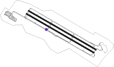
Daegu - Daegu Intl
Airport details
| Country | South Korea |
| State | Daegu Gwang'yeogsi |
| Region | RK |
| Airspace | Incheon Ctr |
| Municipality | Daegu |
| Elevation | 120ft (37m) |
| Timezone | GMT +9 |
| Coordinates | 35.89417, 128.65889 |
| Magnetic var | |
| Type | land |
| Available since | X-Plane v10.40 |
| ICAO code | RKTN |
| IATA code | TAE |
| FAA code | n/a |
Communication
| Daegu Intl ATIS | 127.650 |
| Daegu Intl Ground Control | 121.950 |
| Daegu Intl Tower | 126.200 |
| Daegu Intl Approach | 135.900 |
| Daegu Intl Departure | 120.250 |
| Daegu Intl Departure | 135.900 |
Approach frequencies
| LOC | RW31R | 111.9 | 18.00mi |
| ILS-cat-I | RW31L | 108.7 | 18.00mi |
| ILS-cat-I | RW13R | 108.7 | 18.00mi |
| 3.3° GS | RW13R | 108.7 | 18.00mi |
| 3° GS | RW31L | 108.7 | 18.00mi |
Nearby Points of Interest:
Eunhaesa
-Changnyeong Gyo-dong and Songhyeon-dong Tumuli
-Goryeong Jisan-dong Tumuli
-Hapcheon Okjeon Tumuli
-Banwolseong
-Tripitaka Koreana
-Haeinsa Temple Janggyeong Panjeon, the Depositories for the Tripitaka Koreana Woodblocks
-Anapji
-Gyeongju Historic Areas
-Namsan
-Yangdong Folk Village
-Cheonjeon-ri petroglyphs
-Bangudae Petroglyphs
Nearby beacons
| code | identifier | dist | bearing | frequency |
|---|---|---|---|---|
| DOC | DONGCHON VOR/DME | 1 | 299° | 116.50 |
| TGU | DALSEONG VORTAC | 6 | 219° | 112.20 |
| NPH | NAVY (POHANG) VORTAC | 36.8 | 83° | 109.60 |
| USN | ULSAN VOR/DME | 38.2 | 113° | 111.40 |
| US | ULSAN NDB | 38.8 | 115° | 335 |
| KPO | POHANG VORTAC | 39.9 | 84° | 112.50 |
| KMH | GIMHAE VOR/DME | 43.8 | 158° | 113.80 |
| KHE | KIMHAE (BUSAN) TACAN | 45.1 | 158° | 117 |
| YC | YECHON NDB | 46.3 | 339° | 367 |
| YCN | YECHEON TACAN | 46.6 | 338° | 108.90 |
| CUN | YECHEON VOR/DME | 47.1 | 336° | 114.80 |
| PSN | BUSAN VORTAC | 49.2 | 156° | 114 |
| SCN | SACHEON TACAN | 55.5 | 216° | 110 |
| SAC | SACHEON (CHINJU) VOR/DME | 55.6 | 216° | 115.10 |
| UJN | ULJIN VORTAC | 65.5 | 42° | 115.30 |
Departure and arrival routes
| Transition altitude | 14000ft |
| Transition level | 14000ft |
| SID end points | distance | outbound heading | |
|---|---|---|---|
| RW13 (ALL) | |||
| DOC13 | 51mi | 268° | |
| RW31 (ALL) | |||
| DOC31 | 51mi | 268° | |
Disclaimer
The information on this website is not for real aviation. Use this data with the X-Plane flight simulator only! Data taken with kind consent from X-Plane 12 source code and data files. Content is subject to change without notice.

