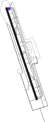
Shimojishima - Shimojijima
Airport details
| Country | Japan |
| State | Okinawa Prefecture |
| Region | RJ |
| Airspace | Fukuoka Ctr |
| Municipality | Miyakojima |
| Elevation | 0ft (0m) |
| Timezone | GMT +9 |
| Coordinates | 24.82667, 125.14472 |
| Magnetic var | |
| Type | land |
| Available since | X-Plane v10.40 |
| ICAO code | RORS |
| IATA code | SHI |
| FAA code | n/a |
Communication
| Shimojijima Shimojijima Ground | 121.700 |
| Shimojijima Shimojijima Tower | 118.300 |
| Shimojijima Shimojijima Tower | 126.200 |
| Shimojijima Sakishima Approach | 120.300 |
| Shimojijima Sakishima Approach | 121.200 |
| Shimojijima Sakishima Departure | 125.000 |
Approach frequencies
| ILS-cat-I | RW17 | 111.5 | 18.00mi |
| 3° GS | RW17 | 111.5 | 18.00mi |
Nearby Points of Interest:
Yonaha Bay
Nearby beacons
| code | identifier | dist | bearing | frequency |
|---|---|---|---|---|
| SJE | SHIMOJISHIMA VOR/DME | 0.2 | 191° | 117.10 |
| MJC | MIYAKOJIMA VORTAC | 8.6 | 108° | 113.45 |
| IGE | ISHIGAKIJIMA VOR/DME | 55.8 | 245° | 115.40 |
Departure and arrival routes
| Transition altitude | 14000ft |
| Transition level | 14000ft |
| SID end points | distance | outbound heading | |
|---|---|---|---|
| RW17 | |||
| FREED1 | 85mi | 65° | |
| BETTY5 | 38mi | 166° | |
| ANNIE5 | 30mi | 345° | |
| RW35 | |||
| FREED1 | 85mi | 65° | |
| BETTY5 | 38mi | 166° | |
| ANNIE5 | 30mi | 345° | |
| STAR starting points | distance | inbound heading | |
|---|---|---|---|
| RW17 | |||
| ANNIE | 29.8 | 165° | |
| RW35 | |||
| BETTY | 38.2 | 346° | |
Instrument approach procedures
| runway | airway (heading) | route (dist, bearing) |
|---|---|---|
| RW35 | DIANA (165°) | DIANA 1600ft TAIKO (11mi, 199°) NUUSI (11mi, 165°) CHIMI (6mi, 77°) 1600ft |
| RNAV | CHIMI 1600ft PINZA (5mi, 345°) 1581ft RS550 (4mi, 345°) 349ft RS551 (4mi, 345°) SJE (3mi, 167°) 2000ft SJE (turn) 2000ft |
Disclaimer
The information on this website is not for real aviation. Use this data with the X-Plane flight simulator only! Data taken with kind consent from X-Plane 12 source code and data files. Content is subject to change without notice.