Tarama
Airport details
| Country | Japan |
| State | Okinawa Prefecture |
| Region | RJ |
| Airspace | Fukuoka Ctr |
| Municipality | Tarama |
| Elevation | 36ft (11m) |
| Timezone | GMT +9 |
| Coordinates | 24.65389, 124.67528 |
| Magnetic var | |
| Type | land |
| Available since | X-Plane v10.40 |
| ICAO code | RORT |
| IATA code | TRA |
| FAA code | n/a |
Communication
| Tarama REMOTE | 118.600 |
Nearby Points of Interest:
Kabira Bay
-Yonaha Bay
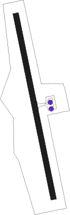
Runway info
| Runway 18 / 36 | ||
| length | 1502m (4928ft) | |
| bearing | 172° / 352° | |
| width | 45m (148ft) | |
| surface | asphalt | |
| blast zone | 60m (197ft) / 60m (197ft) | |
Nearby beacons
| code | identifier | dist | bearing | frequency |
|---|---|---|---|---|
| SJE | SHIMOJISHIMA VOR/DME | 27.4 | 70° | 117.10 |
| IGE | ISHIGAKIJIMA VOR/DME | 28.4 | 239° | 115.40 |
| MJC | MIYAKOJIMA VORTAC | 34.5 | 79° | 113.45 |
Departure and arrival routes
| Transition altitude | 14000ft |
| Transition level | 14000ft |
| SID end points | distance | outbound heading | |
|---|---|---|---|
| RW18 | |||
| GAHRA3 | 35mi | 79° | |
| RW36 | |||
| GAHRA3 | 35mi | 79° | |
Instrument approach procedures
| runway | airway (heading) | route (dist, bearing) |
|---|---|---|
| RW18 | UMAKI (280°) | UMAKI 2000ft KROWA (12mi, 322°) MINNA (4mi, 263°) 1200ft |
| RNAV | MINNA 1200ft RT851 (4mi, 172°) 1100ft RORT (4mi, 172°) 84ft RT852 (3mi, 172°) UMAKI (9mi, 86°) 2000ft UMAKI (turn) 2000ft | |
| RW36 | UMAKI (280°) | UMAKI 2000ft PANAP (7mi, 229°) YUGAP (4mi, 263°) 1200ft |
| RNAV | YUGAP 1200ft RT650 (4mi, 352°) 1100ft RORT (4mi, 352°) 86ft RT651 (3mi, 352°) UMAKI (11mi, 112°) 2000ft UMAKI (turn) 2000ft |
Disclaimer
The information on this website is not for real aviation. Use this data with the X-Plane flight simulator only! Data taken with kind consent from X-Plane 12 source code and data files. Content is subject to change without notice.