Angeles City - Clark Intl
Airport details
| Country | Philippines |
| State | Pampanga |
| Region | RP |
| Airspace | Manila Ctr |
| Municipality | Mabalacat |
| Elevation | 482ft (147m) |
| Timezone | GMT +8 |
| Coordinates | 15.18872, 120.54568 |
| Magnetic var | |
| Type | land |
| Available since | X-Plane v10.35 |
| ICAO code | RPLC |
| IATA code | CRK |
| FAA code | n/a |
Communication
| Clark Intl ATIS | 127.200 |
| Clark Intl Clearance DEL | 125.200 |
| Clark Intl Ground Control | 124.300 |
| Clark Intl Tower | 118.700 |
| Clark Intl Approach | 119.200 |
Approach frequencies
| ILS-cat-I | RW02 | 109.3 | 18.00mi |
| ILS-cat-I | RW20 | 110.1 | 18.00mi |
| 3.5° GS | RW02 | 109.3 | 18.00mi |
| 3° GS | RW20 | 110.1 | 18.00mi |
Nearby Points of Interest:
Henson-Hizon House
-Lazatin House
-Augusto P. Hizon House
-Lubao Church
-Abucay Church
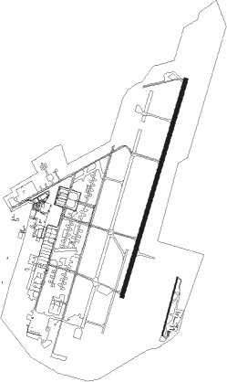
Runway info
Runway 02 / 20  | ||
| length | 3219m (10561ft) | |
| bearing | 22° / 202° | |
| width | 61m (200ft) | |
| surface | concrete | |
| blast zone | 255m (837ft) / 255m (837ft) | |
| Runway 02C / 20C | ||
| length | 855m (2805ft) | |
| bearing | 20° / 200° | |
| width | 14m (45ft) | |
| surface | asphalt | |
| displ threshold | 283m (928ft) / 214m (702ft) | |
Nearby beacons
| code | identifier | dist | bearing | frequency |
|---|---|---|---|---|
| CIA | CLARK VOR/DME | 0.8 | 97° | 113.10 |
| SBA | SUBIC BAY VOR/DME | 31.2 | 217° | 113.50 |
| CAB | CABANATUAN VOR/DME | 32.8 | 58° | 112.70 |
| MIA | MANILA VOR/DME | 49.3 | 145° | 114.40 |
Departure and arrival routes
| Transition altitude | 11000ft |
| Transition level | 13000ft |
| SID end points | distance | outbound heading | |
|---|---|---|---|
| RW02 | |||
| RIAN2A, RIAN4R | 19mi | 59° | |
| RAYA2A | 16mi | 105° | |
| OLIV2E | 18mi | 144° | |
| BAYA2A, BAYA4R | 22mi | 163° | |
| KIBO2C | 15mi | 216° | |
| MALI1A | 30mi | 354° | |
| RW20 | |||
| RIAN4N, RIAN2D, RIAN4P | 19mi | 59° | |
| RAYA2D | 16mi | 105° | |
| OLIV2F | 18mi | 144° | |
| BAYA4P, BAYA2D | 22mi | 163° | |
| KIBO2F | 15mi | 216° | |
| MALI1C | 30mi | 354° | |
| STAR starting points | distance | inbound heading | |
|---|---|---|---|
| RW02 | |||
| BABA5R, BABA7R | 19.9 | 168° | |
| MALI5R, MALI7R | 29.9 | 174° | |
| RAYA5R | 16.3 | 285° | |
| OLIV5R | 17.6 | 324° | |
| BAYA5R | 22.3 | 343° | |
| RW20 | |||
| KIBO3P, KIBO3N | 14.9 | 36° | |
| BABA3P | 19.9 | 168° | |
| MALI3P | 29.9 | 174° | |
| RAYA3P | 16.3 | 285° | |
| OLIV3P | 17.6 | 324° | |
Instrument approach procedures
| runway | airway (heading) | route (dist, bearing) |
|---|---|---|
| RW02 | EDLEX (347°) | EDLEX 5000ft LC02C (6mi, 291°) 3500ft |
| RW02 | SIRMO (206°) | SIRMO 5000ft MAMEN (19mi, 181°) EDLEX (7mi, 202°) 5000ft LC02C (6mi, 291°) 3500ft |
| RNAV | LC02C 3500ft LC02D (4mi, 22°) 3000ft 24THR (4mi, 22°) 1400ft RPLC (3mi, 3°) 515ft SIRMO (13mi, 26°) 5000ft SIRMO (turn) | |
| RW20 | DINOS (181°) | DINOS 5000ft SIRMO (6mi, 111°) 3500ft |
| RW20 | SIRMO (206°) | SIRMO 3500ft |
| RW20 | SUNGA (229°) | SUNGA 3500ft SIRMO (6mi, 291°) 3500ft |
| RNAV | SIRMO 3500ft LC20B (5mi, 202°) 2600ft RPLC (8mi, 209°) 442ft PATTY (3mi, 183°) EDUEL (10mi, 55°) SUNGA (7mi, 22°) SIRMO (6mi, 291°) 3500ft SIRMO (turn) 3500ft |
Holding patterns
| STAR name | hold at | type | turn | heading* | altitude | leg | speed limit |
|---|---|---|---|---|---|---|---|
| BABA7R | SIRMO | VHF | right | 23 (203)° | 3500ft - 11000ft | 1.0min timed | 230 |
| MALI7R | SIRMO | VHF | right | 23 (203)° | 3500ft - 11000ft | 1.0min timed | 230 |
| OLIV5R | OLIVA | VHF | left | 101 (281)° | 6000ft - 11000ft | 1.0min timed | 230 |
| *) magnetic outbound (inbound) holding course | |||||||
Disclaimer
The information on this website is not for real aviation. Use this data with the X-Plane flight simulator only! Data taken with kind consent from X-Plane 12 source code and data files. Content is subject to change without notice.