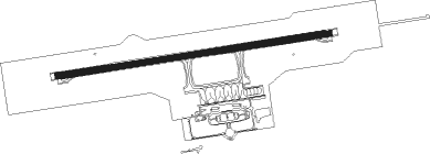
[ (cagayan De Oro) - Laguindingan Airport
Airport details
| Country | Philippines |
| State | Misamis Oriental |
| Region | RP |
| Airspace | Manila Ctr |
| Municipality | El Salvador |
| Elevation | 189ft (58m) |
| Timezone | GMT +8 |
| Coordinates | 8.61220, 124.45650 |
| Magnetic var | |
| Type | land |
| Available since | X-Plane v10.40 |
| ICAO code | RPMY |
| IATA code | CGY |
| FAA code | n/a |
Communication
| Laguindingan Airport Laguindingan Tower | 118.600 |
Approach frequencies
| ILS-cat-I | RW27 | 111.3 | 18.00mi |
| 3° GS | RW27 | 111.3 | 18.00mi |
Nearby beacons
| code | identifier | dist | bearing | frequency |
|---|---|---|---|---|
| LGD | LAGUINDINGAN VOR/DME | 0.2 | 288° | 116.10 |
| OZ | OZAMIS NDB | 45.4 | 235° | 267 |
| BHL | PANGLAO VOR/DME | 70.6 | 324° | 116.20 |
Departure and arrival routes
| Transition altitude | 11000ft |
| Transition level | 13000ft |
| SID end points | distance | outbound heading | |
|---|---|---|---|
| RW09 | |||
| ANKI5A | 49mi | 141° | |
| NADU5A | 41mi | 159° | |
| MAUR5A | 39mi | 179° | |
| SIKI5A | 33mi | 318° | |
| LIRY5A | 28mi | 334° | |
| RW27 | |||
| ANKI7A | 49mi | 141° | |
| NADU7A | 41mi | 159° | |
| MAUR7A | 39mi | 179° | |
| SIKI7A | 33mi | 318° | |
| LIRY7A | 28mi | 334° | |
| STAR starting points | distance | inbound heading | |
|---|---|---|---|
| RW09 | |||
| SIKI4A | 33.4 | 138° | |
| SAGO4A | 24.9 | 174° | |
| ANKI4A | 49.3 | 321° | |
| NADU4A | 41.3 | 339° | |
| MAUR4A | 38.6 | 359° | |
| RW27 | |||
| SIKI6A, SIK2C | 33.4 | 138° | |
| SGL2C, SAGO6A | 24.9 | 174° | |
| GON2C | 37.3 | 295° | |
| ANKI6A, ANK2C | 49.3 | 321° | |
| NAD2C, NADU6A | 41.3 | 339° | |
| MAUR6A, MAU2C | 38.6 | 359° | |
Instrument approach procedures
| runway | airway (heading) | route (dist, bearing) |
|---|---|---|
| RW09 | JONAS (113°) | JONAS 3300ft MY09A (6mi, 176°) 1900ft |
| RW09 | REBBY (57°) | REBBY 3900ft MY09A (8mi, 16°) 1900ft |
| RNAV | MY09A 1900ft MY09B (6mi, 86°) 1900ft RPMY (6mi, 86°) 239ft (7448mi, 266°) 1000ft GARED (7447mi, 86°) JONAS (13mi, 246°) 3300ft JONAS (turn) | |
| RW27 | LALAH (294°) | LALAH 3900ft MY27A (6mi, 356°) 1900ft |
| RW27 | MATTE (235°) | MATTE 3400ft MY27A (7mi, 176°) 1900ft |
| RNAV | MY27A 1900ft MY27B (5mi, 266°) 1900ft RPMY (6mi, 266°) 239ft (7448mi, 266°) 1000ft OLGAR (7447mi, 86°) MATTE (10mi, 96°) 3400ft MATTE (turn) |
Holding patterns
| STAR name | hold at | type | turn | heading* | altitude | leg | speed limit |
|---|---|---|---|---|---|---|---|
| ANKI4A | REBBY | VHF | left | 196 (16)° | 3900ft - 13000ft | 1.0min timed | 230 |
| ANKI6A | LALAH | VHF | left | 176 (356)° | 3900ft - 8000ft | 1.0min timed | 230 |
| MAUR4A | REBBY | VHF | left | 196 (16)° | 3900ft - 13000ft | 1.0min timed | 230 |
| MAUR6A | LALAH | VHF | left | 176 (356)° | 3900ft - 8000ft | 1.0min timed | 230 |
| NADU4A | REBBY | VHF | left | 196 (16)° | 3900ft - 13000ft | 1.0min timed | 230 |
| NADU6A | LALAH | VHF | left | 176 (356)° | 3900ft - 8000ft | 1.0min timed | 230 |
| SAGO4A | JONAS | VHF | right | 356 (176)° | 3300ft - 13000ft | 1.0min timed | 230 |
| SAGO4A | SAGOL | VHF | left | 342 (162)° | 13000ft - 19000ft | 1.5min timed | 250 |
| SAGO6A | MATTE | VHF | right | 324 (144)° | 3400ft - 13000ft | 1.0min timed | 230 |
| SAGO6A | SAGOL | VHF | left | 342 (162)° | 13000ft - 19000ft | 1.5min timed | 250 |
| SIKI4A | JONAS | VHF | right | 356 (176)° | 3300ft - 13000ft | 1.0min timed | 230 |
| SIKI6A | MATTE | VHF | right | 324 (144)° | 3400ft - 13000ft | 1.0min timed | 230 |
| *) magnetic outbound (inbound) holding course | |||||||
Disclaimer
The information on this website is not for real aviation. Use this data with the X-Plane flight simulator only! Data taken with kind consent from X-Plane 12 source code and data files. Content is subject to change without notice.
