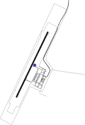
Tawala - Bohol-panglao Intl
Airport details
| Country | Philippines |
| State | Bohol |
| Region | |
| Airspace | Manila Ctr |
| Municipality | Panglao |
| Elevation | 41ft (12m) |
| Timezone | GMT +8 |
| Coordinates | 9.57393, 123.77066 |
| Magnetic var | |
| Type | land |
| Available since | X-Plane v11.40 |
| ICAO code | RPSP |
| IATA code | TAG |
| FAA code | n/a |
Communication
| Bohol-Panglao Intl ATIS | 126.500 |
| Bohol-Panglao Intl CTAF | 121.900 |
| Bohol-Panglao Intl Ground Control | 121.600 |
| Bohol-Panglao Intl Tower (P) | 124.500 |
| Bohol-Panglao Intl Tower (S) | 128.800 |
| Bohol-Panglao Intl MACTAN Approach (P) | 121.200 |
| Bohol-Panglao Intl MACTAN Approach (S) | 124.700 |
Approach frequencies
| IGS | RW21 | 111.1 | 18.00mi |
| 3° GS | RW21 | 111.1 | 18.00mi |
Nearby Points of Interest:
Santa Cruz Parish Church
-Loon Church
-Boljoon Church
-Chocolate Hills
-Mercado Mansion
Nearby beacons
| code | identifier | dist | bearing | frequency |
|---|---|---|---|---|
| BHL | PANGLAO VOR/DME | 0.1 | 248° | 116.20 |
| DGT | DUMAGUETE VOR | 31 | 243° | 114.10 |
| MCT | MACTAN (LAPU-LAPU) VOR/DME | 46.2 | 16° | 114.30 |
| DI | DIPOLOG NDB | 63.6 | 204° | 389 |
| LGD | LAGUINDINGAN VOR/DME | 70.4 | 145° | 116.10 |
Departure and arrival routes
| SID end points | distance | outbound heading | |
|---|---|---|---|
| RW03 | |||
| ZKY2C, ZENK2P, ZENK2B | 27mi | 155° | |
| LMK2C, LAMO2P | 20mi | 356° | |
| RW21 | |||
| ZENK2R, ZKY2D | 27mi | 155° | |
| LAMO2R, LMK2D | 20mi | 356° | |
| STAR starting points | distance | inbound heading | |
|---|---|---|---|
| RW03 | |||
| NANA1P, NAN1 | 48.2 | 105° | |
| BATA1P | 94.0 | 183° | |
| MCT1 | 46.2 | 196° | |
| FORT1P, FOR1C | 20.6 | 305° | |
| ZENK1P | 27.3 | 335° | |
| RW21 | |||
| NANA1R, NANA1N, NAN1 | 48.2 | 105° | |
| BATA1R | 94.0 | 183° | |
| MCT1 | 46.2 | 196° | |
| FORT1R, FOR1D | 20.6 | 305° | |
Instrument approach procedures
| runway | airway (heading) | route (dist, bearing) |
|---|---|---|
| RW03 | DEGRA (68°) | DEGRA 5000ft GELIC (7mi, 103°) SP03A (5mi, 103°) 2700ft |
| RW03 | KISES (3°) | KISES 4000ft SP03A (6mi, 300°) 2700ft |
| RNAV | SP03A 2700ft SP03B (5mi, 31°) 2000ft RPSP (7mi, 31°) 85ft (7401mi, 266°) 1000ft PINAT (7405mi, 86°) KISES (9mi, 207°) 4000ft KISES (turn) 4000ft | |
| RW21 | AURES (192°) | AURES 4000ft SP21A (6mi, 148°) 3000ft |
| RW21 | TARSI (236°) | TARSI 4000ft SP21A (6mi, 300°) 3000ft |
| RW21 | TUBIG (218°) | TUBIG 5000ft SP21A (12mi, 225°) 3000ft |
| RNAV | SP21A 3000ft SP21B (6mi, 211°) 2000ft RPSP (7mi, 211°) 93ft (7401mi, 266°) 1000ft PRUNI (7408mi, 86°) TARSI (10mi, 31°) 4000ft TARSI (turn) 4000ft |
Holding patterns
| STAR name | hold at | type | turn | heading* | altitude | leg | speed limit |
|---|---|---|---|---|---|---|---|
| BATA1P | KISES | VHF | left | 122 (302)° | 4000ft - 10000ft | 1.0min timed | 230 |
| BATA1R | TUBIG | VHF | right | 46 (226)° | 5000ft - 10000ft | 1.0min timed | 230 |
| FOR1C | BHL | NDB | left | 355 (175)° | 4000ft - 10000ft | 1.0min timed | 230 |
| FOR1D | BHL | NDB | left | 355 (175)° | 4000ft - 10000ft | 1.0min timed | 230 |
| FORT1P | KISES | VHF | left | 122 (302)° | 4000ft - 10000ft | 1.0min timed | 230 |
| FORT1R | TARSI | VHF | right | 122 (302)° | 4000ft - 10000ft | 1.0min timed | 230 |
| MCT1 | BHL | NDB | left | 355 (175)° | 4000ft - 10000ft | 1.0min timed | 230 |
| MCT1 | PERGA | VHF | left | 39 (219)° | 3000ft - 10000ft | DME 5.0mi | 230 |
| NAN1 | BHL | NDB | left | 355 (175)° | 4000ft - 10000ft | 1.0min timed | 230 |
| NANA1P | DEGRA | VHF | left | 284 (104)° | 5000ft - 10000ft | 1.0min timed | 230 |
| NANA1R | TARSI | VHF | right | 122 (302)° | 4000ft - 10000ft | 1.0min timed | 230 |
| ZENK1P | KISES | VHF | left | 122 (302)° | 4000ft - 10000ft | 1.0min timed | 230 |
| *) magnetic outbound (inbound) holding course | |||||||
Disclaimer
The information on this website is not for real aviation. Use this data with the X-Plane flight simulator only! Data taken with kind consent from X-Plane 12 source code and data files. Content is subject to change without notice.