Forks
Airport details
| Country | United States of America |
| State | Washington |
| Region | |
| Airspace | Seattle Ctr |
| Municipality | Forks |
| Elevation | 293ft (89m) |
| Timezone | GMT -8 |
| Coordinates | 47.94000, -124.40000 |
| Magnetic var | |
| Type | land |
| Available since | X-Plane v10.40 |
| ICAO code | S18 |
| IATA code | n/a |
| FAA code | S18 |
Communication
| Forks Forks | 122.900 |
Nearby Points of Interest:
Peter Roose Homestead
-Ozette Indian Village Archaeological Site
-Eagle Ranger Station
-Point of Arches
-Canyon Creek Shelter
-Olympic Mountains
-Pyramid Peak Aircraft Warning Service Lookout
-Storm King Ranger Station
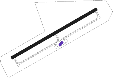
Runway info
| Runway 4 / 22 | ||
| length | 731m (2398ft) | |
| bearing | 72° / 252° | |
| width | 23m (75ft) | |
| surface | asphalt | |
Nearby beacons
| code | identifier | dist | bearing | frequency |
|---|---|---|---|---|
| TOU | TATOOSH (NEAH BAY) VORTAC | 23.4 | 328° | 112.20 |
| CL | ELWHA (PORT ANGELES) NDB | 31.9 | 74° | 515 |
| NOW | EDIZ HOOK (PORT ANGELES) NDB | 41.7 | 79° | 338 |
| MB | MILL BAY (VICTORIA) NDB | 55.8 | 50° | 293 |
| YYJ | VICTORIA VOR/DME | 59.7 | 49° | 113.70 |
| HQM | HOQUIAM VORTAC | 60.4 | 166° | 117.70 |
Disclaimer
The information on this website is not for real aviation. Use this data with the X-Plane flight simulator only! Data taken with kind consent from X-Plane 12 source code and data files. Content is subject to change without notice.