Snohomish - Harvey Field
Airport details
| Country | United States of America |
| State | Washington |
| Region | |
| Airspace | Seattle Ctr |
| Municipality | Snohomish County |
| Elevation | 16ft (5m) |
| Timezone | GMT -8 |
| Coordinates | 47.90619, -122.10032 |
| Magnetic var | |
| Type | land |
| Available since | X-Plane v10.40 |
| ICAO code | S43 |
| IATA code | n/a |
| FAA code | S43 |
Communication
| Harvey Field CTAF | 123.000 |
Nearby Points of Interest:
Snohomish County Centennial Trail
-McCabe Building
-Swalwell Cottage
-Everett Carnegie Library
-Snohomish County Courthouse
-Everett City Hall
-Commerce Building
-Hewitt Avenue Historic District
-U.S. Post Office and Customshouse
-Community Center and War Memorial Building
-Rucker House
-Roland Hartley House
-Weyerhaeuser Office Building
-North Coast Casket Company Building
-North Creek School
-Lilly Kirk House
-Marysville Opera House
-Dr. Reuben Chase House
-Indian Shaker Church
-Sorenson House
-Horatio and Laura Allen Farm
-Harry Vanderbilt Wurdemann House
-St. Anne's Roman Catholic Church
-St. Edward Seminary
-Andrew Carnegie Library
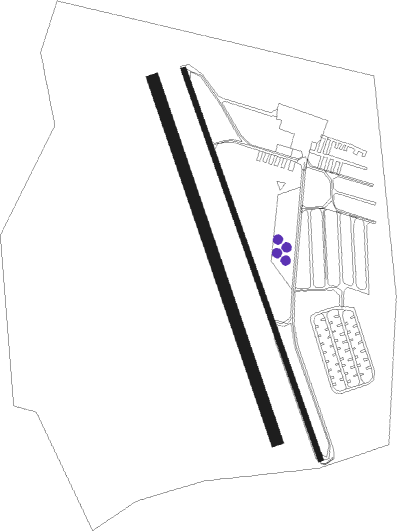
Runway info
Runway 15L / 33R  | ||
| length | 800m (2625ft) | |
| bearing | 158° / 338° | |
| width | 11m (36ft) | |
| surface | asphalt | |
| displ threshold | 137m (449ft) / 68m (223ft) | |
| Runway 15R / 33L | ||
| length | 737m (2418ft) | |
| bearing | 159° / 339° | |
| width | 23m (75ft) | |
| surface | grass | |
Nearby beacons
| code | identifier | dist | bearing | frequency |
|---|---|---|---|---|
| PAE | PAINE (EVERETT) VOR/DME | 7.1 | 274° | 110.60 |
| AW | WATON (ARLINGTON) NDB | 10.4 | 342° | 382 |
| SEA | SEATTLE VORTAC | 29.5 | 204° | 116.80 |
| CVV | PENN COVE VOR/DME | 32.2 | 298° | 117.20 |
| NUW | WHIDBEY ISLAND (OAK HARBO TACAN | 35.1 | 309° | 113.80 |
| BVS | SKAGIT/BAY VIEW (BURLINGTON) NDB | 36 | 331° | 240 |
| TCM | MC CHORD (TACOMA) TACAN | 48 | 206° | 109.60 |
| FHR | FRIDAY HARBOR NDB | 51.8 | 303° | 284 |
| OLM | OLYMPIA VORTAC | 64.8 | 221° | 113.40 |
Instrument approach procedures
| runway | airway (heading) | route (dist, bearing) |
|---|---|---|
| RWNVA | PAE (94°) | PAE HAVHO (16mi, 143°) 3100ft HAVHO (turn) 3100ft |
| RNAV | HAVHO 3100ft DEDBE (9mi, 10°) 2000ft S43 (5mi, 340°) 63ft USUXY (3mi, 336°) WATON (8mi, 345°) 2000ft WATON (turn) |
Disclaimer
The information on this website is not for real aviation. Use this data with the X-Plane flight simulator only! Data taken with kind consent from X-Plane 12 source code and data files. Content is subject to change without notice.