Kellogg - Shoshone County
Airport details
| Country | United States of America |
| State | Idaho |
| Region | K1 |
| Airspace | Seattle Ctr |
| Municipality | Shoshone County |
| Elevation | 2227ft (679m) |
| Timezone | GMT -8 |
| Coordinates | 47.54726, -116.18906 |
| Magnetic var | |
| Type | land |
| Available since | X-Plane v10.30 |
| ICAO code | S83 |
| IATA code | n/a |
| FAA code | n/a |
Communication
| Shoshone County AWOS | 135.475 |
| Shoshone County CTAF/UNICOM | 122.800 |
Nearby Points of Interest:
Wallace Historic District
-Wallace 1910 Fire Memorial
-Mineral Ridge National Recreation Trail, Idaho
-Cedar Snags
-Benewah County Courthouse
-St. Maries Masonic Temple No. 63
-St. Maries 1910 Fire Memorial
-Avery Depot
-Chicago, Milwaukee, St. Paul and Pacific Railroad Company Historic District
-John P. and Stella Gray House
-First United Methodist Church (Coeur d'Alene, Idaho)
-Coeur d'Alene Masonic Temple
-Coeur d'Alene City Hall
-Clark House
-Coeur d'Alene Federal Building
-Harvey M. Davey House
-Kootenai County Courthouse
-Fort Sherman
-John A. Finch Caretaker's House
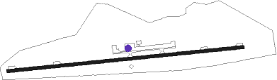
Runway info
| Runway 7 / 25 | ||
| length | 1622m (5322ft) | |
| bearing | 89° / 269° | |
| width | 23m (75ft) | |
| surface | asphalt | |
| displ threshold | 0m (0ft) / 102m (335ft) | |
Nearby beacons
| code | identifier | dist | bearing | frequency |
|---|---|---|---|---|
| MLP | MULLAN PASS VOR/DME | 22.6 | 99° | 117.80 |
| COE | COEUR D'ALENE VOR/DME | 28.9 | 290° | 108.80 |
| SZT | SANDPOE (SANDPOINT) NDB | 47.1 | 333° | 264 |
Disclaimer
The information on this website is not for real aviation. Use this data with the X-Plane flight simulator only! Data taken with kind consent from X-Plane 12 source code and data files. Content is subject to change without notice.