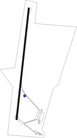
Rosario - Rosario (islas Malvinas)
Airport details
| Country | Argentina |
| State | Santa Fe |
| Region | SA |
| Airspace | Ezeiza Ctr |
| Municipality | Municipio de Rosario |
| Elevation | 83ft (25m) |
| Timezone | GMT -3 |
| Coordinates | -32.90361, -60.78444 |
| Magnetic var | |
| Type | land |
| Available since | X-Plane v10.40 |
| ICAO code | SAAR |
| IATA code | ROS |
| FAA code | n/a |
Communication
| Rosario (Islas Malvinas) Tower | 118.700 |
| Rosario (Islas Malvinas) Approach | 118.700 |
Approach frequencies
| ILS-cat-I | RW20 | 109.9 | 18.00mi |
| 3° GS | RW20 | 109.9 | 18.00mi |
Nearby beacons
| code | identifier | dist | bearing | frequency |
|---|---|---|---|---|
| ROS | ROSARIO VOR/DME | 0.1 | 115° | 117.30 |
| F | ISLAS MALVINAS (ROSARIO) NDB | 1.2 | 12° | 305 |
Departure and arrival routes
| Transition altitude | 3000ft |
| SID end points | distance | outbound heading | |
|---|---|---|---|
| RW02 | |||
| DABO1C | 30mi | 15° | |
| TINT1C | 30mi | 93° | |
| VASA1C | 30mi | 145° | |
| VUMK1C | 19mi | 221° | |
| GEDU1C | 30mi | 279° | |
| TOLU2C | 30mi | 296° | |
| VUKS1C | 30mi | 339° | |
| MUPI1C | 30mi | 359° | |
| RW20 | |||
| DABO1G | 30mi | 15° | |
| TINT1G | 30mi | 93° | |
| VASA1G | 30mi | 145° | |
| VUMK1G | 19mi | 221° | |
| GEDU1G | 30mi | 279° | |
| TOLU2G | 30mi | 296° | |
| VUKS1G | 30mi | 339° | |
| MUPI1G | 30mi | 359° | |
| STAR starting points | distance | inbound heading | |
|---|---|---|---|
| RW02 | |||
| VUMK1Q | 19.1 | 41° | |
| GEDU1Q | 29.8 | 99° | |
| ROKE1Q | 72.6 | 143° | |
| VUKS1Q | 30.0 | 159° | |
| MUPI1Q | 29.9 | 179° | |
| DABO1Q | 29.9 | 195° | |
| TINT1Q | 30.2 | 273° | |
| ESKO1Q | 30.2 | 306° | |
| RW20 | |||
| VUMK1U | 19.1 | 41° | |
| GEDU1U | 29.8 | 99° | |
| ROKE1U | 72.6 | 143° | |
| VUKS1U | 30.0 | 159° | |
| MUPI1U | 29.9 | 179° | |
| DABO1U | 29.9 | 195° | |
| TINT1U | 30.2 | 273° | |
| ESKO1U | 30.2 | 306° | |
Instrument approach procedures
| runway | airway (heading) | route (dist, bearing) |
|---|---|---|
| RW02 | IMDAD (342°) | IMDAD 3000ft SINIV (5mi, 289°) 2000ft |
| RW02 | REGUD (46°) | REGUD 3000ft SINIV (6mi, 95°) 2000ft |
| RNAV | SINIV 2000ft DOKMU (3mi, 13°) 2000ft AR056 (3mi, 13°) 890ft SAAR (3mi, 13°) 133ft ATAGU (16mi, 13°) 2800ft ATAGU (turn) 3000ft | |
| RW20 | ATAGU (193°) | ATAGU 3000ft VUSPO (5mi, 193°) 2000ft |
| RW20 | NIBGO (164°) | NIBGO 3000ft VUSPO (5mi, 99°) 2000ft |
| RW20 | UTNUM (220°) | UTNUM 3000ft VUSPO (5mi, 278°) 2000ft |
| RNAV | VUSPO 2000ft ESMOK (4mi, 193°) 2000ft SAAR (7mi, 193°) 129ft EDMEL (9mi, 193°) 1800ft EDMEL (turn) 3000ft |
Disclaimer
The information on this website is not for real aviation. Use this data with the X-Plane flight simulator only! Data taken with kind consent from X-Plane 12 source code and data files. Content is subject to change without notice.
