Buenos Aires - Jorge Newbery Aeroparque
Airport details
| Country | Argentina |
| State | Capital federal |
| Region | SA |
| Airspace | Ezeiza Ctr |
| Municipality | Autonomous City of Buenos Aires |
| Elevation | 18ft (5m) |
| Timezone | GMT -3 |
| Coordinates | -34.55889, -58.41639 |
| Magnetic var | |
| Type | land |
| Available since | X-Plane v10.40 |
| ICAO code | SABE |
| IATA code | AEP |
| FAA code | n/a |
Communication
| Jorge Newbery Aeroparque SABE ATIS | 127.600 |
| Jorge Newbery Aeroparque AEROPARQUE CLR | 118.250 |
| Jorge Newbery Aeroparque AEROPARQUE Ground Control | 121.900 |
| Jorge Newbery Aeroparque AEROPARQUE Tower | 118.850 |
| Jorge Newbery Aeroparque AEROPARQUE Approach | 120.600 |
| Jorge Newbery Aeroparque AEROPARQUE Departure | 120.600 |
Approach frequencies
| ILS-cat-I | RW13 | 109.5 | 18.00mi |
| 3° GS | RW13 | 109.5 | 18.00mi |
Nearby Points of Interest:
Buenos Aires Cricket Club Ground
-Central Military Hospital
-Palacio Errázuriz
-Café La Biela
-Fernández Anchorena Palace
-Navy Petty-Officers School of Mechanics
-Café San Bernardo
-Hotel de Inmigrantes
-Paz Palace
-Plaza San Martín
-Palacio Haedo
-El Gato Negro
-Petit Colón
-Galerías Pacífico
-Café de los Angelitos
-Confitería Ideal
-Mariano Acosta school
-Confitería Richmond
-Congressional Plaza
-YPF building
-Palacio Dassen
-Confederación General Económica
-Numismatics Museum "Héctor Carlos Janson"
-Avenida de Mayo
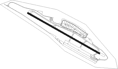
Runway info
| Runway 13 / 31 | ||
| length | 2091m (6860ft) | |
| bearing | 119° / 299° | |
| width | 40m (131ft) | |
| surface | concrete | |
| displ threshold | 0m (0ft) / 127m (417ft) | |
| blast zone | 0m (0ft) / 158m (518ft) | |
Nearby beacons
| code | identifier | dist | bearing | frequency |
|---|---|---|---|---|
| P | JORGE NEWBERY AEROPARQUE(BUENO NDB | 1.3 | 298° | 280 |
| N | JORGE NEWBERY AEROPARQUE(BUENO NDB | 2.8 | 119° | 375 |
| PAL | EL PALOMAR (BUENOS AIRES) VOR/DME | 10.2 | 255° | 115.20 |
| FDO | SAN FERNANDO VOR/DME | 10.5 | 303° | 114.40 |
| ILM | QUILMES NDB | 12.6 | 131° | 210 |
| EZE | EZEIZA VOR/DME | 16.9 | 204° | 116.50 |
| C | EZEIZA INTL MINISTRO PISTARINI NDB | 17.1 | 210° | 305 |
| OC | EZEIZA INTL MINISTRO PISTARINI NDB | 18.2 | 221° | 330 |
| ENO | MARIANO MORENO VOR/DME | 18.5 | 269° | 112.90 |
| OA | EZEIZA INTL MINISTRO PISTARINI NDB | 20.3 | 195° | 270 |
| PTA | LA PLATA NDB | 35.4 | 128° | 250 |
| PTA | LA PLATA VOR | 35.7 | 129° | 113.70 |
Departure and arrival routes
| Transition altitude | 3000ft |
| SID end points | distance | outbound heading | |
|---|---|---|---|
| RW13 | |||
| KUKEN7 | 25mi | 28° | |
| SURBO7 | 23mi | 76° | |
| DORVO7 | 45mi | 100° | |
| PTA7 | 64mi | 142° | |
| PAL8 | 70mi | 232° | |
| EZE8 | 61mi | 263° | |
| ATOV3B | 47mi | 304° | |
| BIVA3B | 44mi | 318° | |
| LAND3B | 40mi | 346° | |
| RW31 | |||
| KUKEN7 | 25mi | 28° | |
| SURBO7 | 23mi | 76° | |
| DORVO7 | 45mi | 100° | |
| PTA7 | 64mi | 142° | |
| PAL8 | 70mi | 232° | |
| EZE8 | 61mi | 263° | |
| ATOV3B | 47mi | 304° | |
| BIVA3B | 44mi | 318° | |
| LAND3B | 40mi | 346° | |
| STAR starting points | distance | inbound heading | |
|---|---|---|---|
| RW13 | |||
| GBE7C | 71.6 | 2° | |
| VALO8C | 70.8 | 46° | |
| ASAD7C | 65.9 | 69° | |
| SNT7C | 54.6 | 108° | |
| PAGO7C | 41.1 | 155° | |
| KUKE1C | 24.6 | 208° | |
| PAPI1C | 22.2 | 251° | |
| SURB7A | 23.4 | 256° | |
| UGIM7C | 79.7 | 285° | |
| KOVU7C | 58.5 | 306° | |
| TENI7C | 65.5 | 329° | |
| RW31 | |||
| GBE7R, GBE7D | 71.6 | 2° | |
| VALO7D, VALO8R | 70.8 | 46° | |
| ASAD8R, ASAD7D | 65.9 | 69° | |
| SNT8R, SNT7D | 54.6 | 108° | |
| PAGO8R, PAGO7D | 41.1 | 155° | |
| PAPI1R | 22.2 | 251° | |
| SURB2B | 23.4 | 256° | |
| UGIM7D, UGIM7R | 79.7 | 285° | |
| KOVU7D | 58.5 | 306° | |
| TENI7R, TENI7D | 65.5 | 329° | |
Instrument approach procedures
| runway | airway (heading) | route (dist, bearing) |
|---|---|---|
| RW13-Z | VANAR (124°) | VANAR MUPER (12mi, 129°) 2500ft |
| RNAV | MUPER 2500ft KABIS (5mi, 119°) 1700ft SABE (6mi, 119°) 69ft BE076 (2mi, 119°) VERAS (10mi, 94°) 2200ft VERAS (turn) 3000ft | |
| RW31-Z | ENPID (299°) | ENPID 3000ft FUSCA (5mi, 299°) 2500ft |
| RW31-Z | ILM (311°) | ILM 3000ft FUSCA (3mi, 2°) 2500ft |
| RW31-Z | VERAS (278°) | VERAS 3000ft FUSCA (5mi, 224°) 2500ft |
| RNAV | FUSCA 2500ft SIKED (5mi, 299°) 1700ft SABE (6mi, 299°) 67ft BE920 (1mi, 299°) VERAS (14mi, 100°) 2200ft VERAS (turn) 3000ft |
Holding patterns
| STAR name | hold at | type | turn | heading* | altitude | leg | speed limit |
|---|---|---|---|---|---|---|---|
| ASAD7C | VANAR | VHF | right | 319 (139)° | > 5000ft | 1.0min timed | 210 |
| ASAD7D | PTA | NDB | right | 97 (277)° | > 12000ft | 1.0min timed | ICAO rules |
| GBE7C | VANAR | VHF | right | 319 (139)° | > 5000ft | 1.0min timed | 210 |
| GBE7D | PTA | NDB | right | 97 (277)° | > 12000ft | 1.0min timed | ICAO rules |
| KOVU7C | PTA | NDB | right | 97 (277)° | > 12000ft | 1.0min timed | ICAO rules |
| KOVU7C | VANAR | VHF | right | 319 (139)° | > 5000ft | 1.0min timed | 210 |
| KOVU7D | PTA | NDB | right | 97 (277)° | > 12000ft | 1.0min timed | ICAO rules |
| KUKE1C | KUKEN | VHF | right | 44 (224)° | < 60000ft | 1.0min timed | ICAO rules |
| KUKE1C | VANAR | VHF | right | 319 (139)° | > 5000ft | 1.0min timed | 210 |
| PAGO7C | VANAR | VHF | right | 319 (139)° | > 5000ft | 1.0min timed | 210 |
| PAPI1C | VANAR | VHF | right | 319 (139)° | > 5000ft | 1.0min timed | 210 |
| SNT7C | VANAR | VHF | right | 319 (139)° | > 5000ft | 1.0min timed | 210 |
| SURB7A | FDO | NDB | left | 317 (137)° | > 4000ft | 1.0min timed | ICAO rules |
| TENI7C | PTA | NDB | right | 97 (277)° | > 12000ft | 1.0min timed | ICAO rules |
| TENI7C | VANAR | VHF | right | 319 (139)° | > 5000ft | 1.0min timed | 210 |
| TENI7D | PTA | NDB | right | 97 (277)° | > 12000ft | 1.0min timed | ICAO rules |
| UGIM7C | PTA | NDB | right | 97 (277)° | > 12000ft | 1.0min timed | ICAO rules |
| UGIM7C | VANAR | VHF | right | 319 (139)° | > 5000ft | 1.0min timed | 210 |
| UGIM7D | PTA | NDB | right | 97 (277)° | > 12000ft | 1.0min timed | ICAO rules |
| VALO7D | PTA | NDB | right | 97 (277)° | > 12000ft | 1.0min timed | ICAO rules |
| VALO8C | VANAR | VHF | right | 319 (139)° | > 5000ft | 1.0min timed | 210 |
| *) magnetic outbound (inbound) holding course | |||||||
Disclaimer
The information on this website is not for real aviation. Use this data with the X-Plane flight simulator only! Data taken with kind consent from X-Plane 12 source code and data files. Content is subject to change without notice.