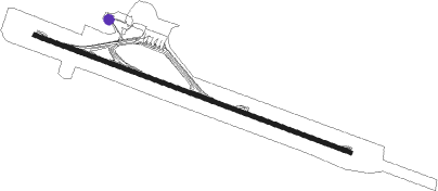
Puerto Iguazu - Cataratus Del Iguazu
Airport details
| Country | Argentina |
| State | Misiones |
| Region | SA |
| Airspace | Resistencia Ctr |
| Municipality | Puerto Iguazú |
| Elevation | 916ft (279m) |
| Timezone | GMT -3 |
| Coordinates | -25.73722, -54.47333 |
| Magnetic var | |
| Type | land |
| Available since | X-Plane v10.40 |
| ICAO code | SARI |
| IATA code | IGR |
| FAA code | n/a |
Communication
| Cataratus del Iguazu ATIS | 127.700 |
| Cataratus del Iguazu Tower | 118.300 |
| Cataratus del Iguazu Approach | 120.700 |
Approach frequencies
| ILS-cat-I | RW31 | 110.9 | 18.00mi |
| 3° GS | RW31 | 110.9 | 18.00mi |
Nearby beacons
| code | identifier | dist | bearing | frequency |
|---|---|---|---|---|
| IGU | CATARATAS DEL IGUAZU VOR/DME | 0.6 | 282° | 114.10 |
| Z | MAYOR D CARLOS EDUARDO KRAUSE NDB | 1.5 | 113° | 310 |
| FOZ | FOZ (FOZ DO IGUACU) VOR/DME | 9.3 | 349° | 112.10 |
| ITU | ITAIPU NDB | 21.3 | 336° | 225 |
| CDE | CIUDAD DEL ESTE NDB | 26.3 | 303° | 200 |
| VES | MINGA GUAZU VOR/DME | 26.3 | 306° | 116.30 |
| ALG | CIUDAD DEL ESTE NDB | 27.1 | 322° | 293 |
| CAV | CASCAVEL NDB | 68.6 | 53° | 220 |
Departure and arrival routes
| Transition altitude | 3000ft |
| SID end points | distance | outbound heading | |
|---|---|---|---|
| RW13 | |||
| MATE1C | 44mi | 49° | |
| CRAN1C | 40mi | 65° | |
| KAMI1C | 39mi | 78° | |
| KOLN1C | 32mi | 137° | |
| ELAM1C | 151mi | 202° | |
| NAID1C | 128mi | 211° | |
| POS1C | 127mi | 222° | |
| UDEN2C | 34mi | 230° | |
| ALGE2C | 39mi | 259° | |
| COST2C | 43mi | 286° | |
| RW31 | |||
| MATE1G | 44mi | 49° | |
| CRAN1G | 40mi | 65° | |
| KAMI1G | 39mi | 78° | |
| ALDO1G | 32mi | 204° | |
| UDEN2G | 34mi | 230° | |
| ALGE2G | 39mi | 259° | |
| COST2G, COST2H | 43mi | 286° | |
| STAR starting points | distance | inbound heading | |
|---|---|---|---|
| RW13 | |||
| DOKB2M | 53.3 | 22° | |
| UDEN2M | 34.1 | 50° | |
| ALGE2M | 38.5 | 79° | |
| COST2M | 43.4 | 106° | |
| MATE1M | 44.4 | 229° | |
| ILMI1M | 99.7 | 233° | |
| DIDO1M | 74.6 | 251° | |
| KAMI1M | 39.3 | 258° | |
| RW31 | |||
| ELAM1Q | 151.3 | 22° | |
| NAID1Q | 127.5 | 31° | |
| POS1Q | 127.4 | 42° | |
| UDEN2Q | 34.1 | 50° | |
| ALGE2Q | 38.5 | 79° | |
| COST2Q | 43.4 | 106° | |
| KOVS1Q | 28.9 | 240° | |
| VUGL1Q | 77.6 | 264° | |
| KOLN1Q | 31.6 | 317° | |
Instrument approach procedures
| runway | airway (heading) | route (dist, bearing) |
|---|---|---|
| RW13 | PUNBU (99°) | PUNBU 3000ft KOVRA (5mi, 69°) 3000ft |
| RNAV | KOVRA 3000ft MALDI (5mi, 113°) 2550ft SARI (6mi, 113°) 958ft ROCAR (4mi, 113°) ISUBA (9mi, 148°) 3000ft ISUBA (turn) 3000ft | |
| RW31 | ISUBA (316°) | ISUBA 3000ft ESABI (5mi, 27°) 3000ft |
| RW31 | JOALI (293°) | JOALI 3000ft ESABI (5mi, 293°) 3000ft |
| RNAV | ESABI 3000ft SEDIA (5mi, 293°) 2500ft SARI (6mi, 293°) 966ft RI555 (3mi, 293°) 2000ft OBLET (10mi, 164°) 3000ft OBLET (turn) 3000ft |
Holding patterns
| STAR name | hold at | type | turn | heading* | altitude | leg | speed limit |
|---|---|---|---|---|---|---|---|
| ELAM1Q | LANUB | VHF | right | 200 (20)° | > 10000ft | DME 4.0mi | 220 |
| NAID1Q | LANUB | VHF | right | 200 (20)° | > 10000ft | DME 4.0mi | 220 |
| POS1Q | LANUB | VHF | right | 200 (20)° | > 10000ft | DME 4.0mi | 220 |
| *) magnetic outbound (inbound) holding course | |||||||
Disclaimer
The information on this website is not for real aviation. Use this data with the X-Plane flight simulator only! Data taken with kind consent from X-Plane 12 source code and data files. Content is subject to change without notice.
