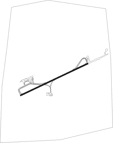
Rawson - Almirante Zar
Airport details
| Country | Argentina |
| State | Chubut Province |
| Region | SA |
| Airspace | Comodoro Rivadavia Ctr |
| Municipality | Trelew |
| Elevation | 141ft (43m) |
| Timezone | GMT -3 |
| Coordinates | -43.21056, -65.27028 |
| Magnetic var | |
| Type | land |
| Available since | X-Plane v10.40 |
| ICAO code | SAVT |
| IATA code | REL |
| FAA code | n/a |
Communication
| Almirante Zar Tower/Approach | 118.700 |
| Almirante Zar Tower/Approach | 120.650 |
Approach frequencies
| ILS-cat-I | RW25 | 109.5 | 18.00mi |
| 3° GS | RW25 | 109.5 | 18.00mi |
Nearby Points of Interest:
Trelew train station
-Capel Seion
Nearby beacons
| code | identifier | dist | bearing | frequency |
|---|---|---|---|---|
| TRE | TRELEW VOR/DME | 1.1 | 71° | 115.10 |
| T | TRELEW NDB | 1.5 | 74° | 280 |
| DRY | MADRYN (PUERTO MADRYN) VOR/DME | 28 | 21° | 116.10 |
| Y | EL TEHUELCHE (PUERTO MADRYN) NDB | 29.1 | 23° | 300 |
Departure and arrival routes
| Transition altitude | 3000ft |
| SID end points | distance | outbound heading | |
|---|---|---|---|
| RW07 | |||
| ORAM2K | 57mi | 10° | |
| LOMU1K | 156mi | 35° | |
| OPSI1K | 55mi | 190° | |
| GATU2K | 54mi | 218° | |
| EKAT2K | 54mi | 272° | |
| SILA2K | 54mi | 288° | |
| RW25 | |||
| ORAM2C | 57mi | 10° | |
| LOMU1C | 156mi | 35° | |
| OPSI1C | 55mi | 190° | |
| GATU2C | 54mi | 218° | |
| EKAT2C | 54mi | 272° | |
| SILA2C | 54mi | 288° | |
| STAR starting points | distance | inbound heading | |
|---|---|---|---|
| RW07 | |||
| OPSI1U | 55.0 | 10° | |
| GATU2U | 54.1 | 38° | |
| EKAT2U | 54.0 | 92° | |
| SILA2U | 54.3 | 108° | |
| ORAM2U | 56.6 | 190° | |
| LOMU1U | 155.6 | 215° | |
| KIGI2U | 143.2 | 224° | |
| RW25 | |||
| OPSI1Q | 55.0 | 10° | |
| GATU2Q | 54.1 | 38° | |
| EKAT2Q | 54.0 | 92° | |
| SILA2Q | 54.3 | 108° | |
| ORAM2Q | 56.6 | 190° | |
| LOMU1Q | 155.6 | 215° | |
| KIGI2Q | 143.2 | 224° | |
Instrument approach procedures
| runway | airway (heading) | route (dist, bearing) |
|---|---|---|
| RW07 | KAKOG (75°) | KAKOG 3000ft GUVUM (5mi, 75°) 1800ft |
| RW07 | ROKAB (93°) | ROKAB 3000ft GUVUM (5mi, 153°) 1800ft |
| RW07 | VURPI (53°) | VURPI 3000ft GUVUM (5mi, 333°) 1800ft |
| RNAV | GUVUM 1800ft MAMGO (5mi, 75°) 1760ft SAVT (6mi, 75°) 164ft VT620 (4mi, 74°) ROKAB (16mi, 268°) 3000ft ROKAB (turn) 3000ft | |
| RW25 | BOBIM (254°) | BOBIM 3000ft GILNA (5mi, 254°) 1760ft |
| RW25 | MATMU (273°) | MATMU 3000ft GILNA (5mi, 332°) 1760ft |
| RW25 | PUMUG (233°) | PUMUG 3000ft GILNA (5mi, 152°) 1760ft |
| RNAV | GILNA 1760ft VULEB (5mi, 254°) 1760ft SAVT (6mi, 254°) 160ft VT610 (2mi, 255°) MATMU (14mi, 90°) 3000ft MATMU (turn) 3000ft |
Disclaimer
The information on this website is not for real aviation. Use this data with the X-Plane flight simulator only! Data taken with kind consent from X-Plane 12 source code and data files. Content is subject to change without notice.