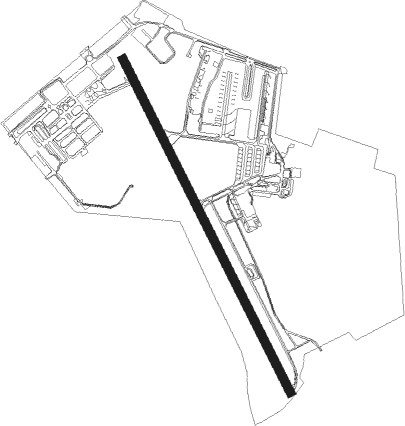
Curitiba - Curitiba Bacacheri
Airport details
| Country | Brazil |
| State | Paraná |
| Region | SB |
| Airspace | Curitiba Ctr |
| Municipality | Curitiba |
| Elevation | 3057ft (932m) |
| Timezone | GMT -3 |
| Coordinates | -25.40333, -49.23361 |
| Magnetic var | |
| Type | land |
| Available since | X-Plane v10.40 |
| ICAO code | SBBI |
| IATA code | BFH |
| FAA code | n/a |
Communication
| Curitiba Bacacheri Ground Control | 121.800 |
| Curitiba Bacacheri Tower | 118.900 |
| Curitiba Bacacheri CURITIBA Approach | 129.550 |
Nearby Points of Interest:
Jockey Club do Paraná
-Casa Barão do Serro Azul
-Paço da Liberdade
-Palácio da Liberdade (Curitiba)
-Antigo Palácio Wolff
-Palácio Garibaldi
-Paraná Public Library
-Casa Emílio Romani
-Antigo Engenho de Mate da Rondinha
-Graciosa State Park
-Ponte do Rio dos Papagaios
-Sede da Fazenda Cancela
Nearby beacons
| code | identifier | dist | bearing | frequency |
|---|---|---|---|---|
| BCH | BACACHERI NDB | 0.2 | 82° | 300 |
| CTB | CURITIBA VOR/DME | 8.5 | 153° | 116.50 |
| LAA | DME | 36.4 | 235° | 117.70 |
| PGA | DME | 39 | 101° | 114.10 |
| PGR | GROSSA NDB | 51.3 | 284° | 275 |
| JNV | JOINVILLE VOR/DME | 54.5 | 152° | 115.10 |
Departure and arrival routes
| Transition altitude | 6000ft |
| SID end points | distance | outbound heading | |
|---|---|---|---|
| RW18 | |||
| PAGI2A | 34mi | 7° | |
| OMNI | 14mi | 75° | |
| TINS2C | 35mi | 137° | |
| AKPI1C | 35mi | 281° | |
| RW36 | |||
| OMNI | 14mi | 75° | |
| PAGI1D | 35mi | 137° | |
| LOME1D | 35mi | 281° | |
| STAR starting points | distance | inbound heading | |
|---|---|---|---|
| RW18 | |||
| MATK2C | 46.7 | 159° | |
| RAXI1C | 102.6 | 237° | |
| RW36 | |||
| MATK1D | 36.7 | 160° | |
| RAXI1D | 102.6 | 237° | |
Instrument approach procedures
| runway | airway (heading) | route (dist, bearing) |
|---|---|---|
| RW36-Y | BI063 (244°) | BI063 6500ft BI058 (3mi, 196°) 5500ft BI062 (7mi, 206°) 4500ft |
| RNAV | BI062 4500ft BI079 (2mi, 291°) 4500ft BI061 (1mi, 291°) 4080ft BI059 (3mi, 305°) 3329ft (3234mi, 63°) 4000ft BI063 (3224mi, 243°) 6500ft BI063 (turn) 6500ft | |
| RW36-Z | ALGUD (339°) | ALGUD 7000ft OPVIS (6mi, 47°) 5500ft BUVBA (5mi, 312°) 5400ft CTB (5mi, 314°) 4900ft |
| RW36-Z | EDSUR (303°) | EDSUR 7000ft OPVIS (6mi, 227°) 5500ft BUVBA (5mi, 312°) 5400ft CTB (5mi, 314°) 4900ft |
| RNAV | CTB 4900ft BI002 (3mi, 326°) 4700ft SBBI (6mi, 336°) 3109ft GIMSO (19mi, 331°) 6000ft GIMSO (turn) 6000ft | |
| RWNVA | EPGAV (225°) | EPGAV 7000ft BI018 (5mi, 278°) 5000ft |
| RWNVA | ILRIT (191°) | ILRIT 7000ft BI018 (6mi, 190°) 5000ft |
| RNAV | BI018 5000ft BI019 (3mi, 190°) 4680ft BI034 (3mi, 190°) 3720ft EPGAV (8mi, 52°) 7000ft EPGAV (turn) 7000ft | |
| RWNVB | EPGAV (225°) | EPGAV 7000ft BI018 (5mi, 278°) 5000ft |
| RWNVB | ILRIT (191°) | ILRIT 7000ft BI018 (6mi, 190°) 5000ft |
| RNAV | BI018 5000ft BI019 (3mi, 190°) 4680ft BI034 (3mi, 190°) 3720ft EPGAV (8mi, 52°) 7000ft EPGAV (turn) 7000ft |
Disclaimer
The information on this website is not for real aviation. Use this data with the X-Plane flight simulator only! Data taken with kind consent from X-Plane 12 source code and data files. Content is subject to change without notice.